

The use of a spatial information system in the management of HIV/AIDS in South Africa
- PMID: 15239839
- PMCID: PMC471560
- DOI: 10.1186/1476-072X-3-13
The use of a spatial information system in the management of HIV/AIDS in South Africa
Abstract
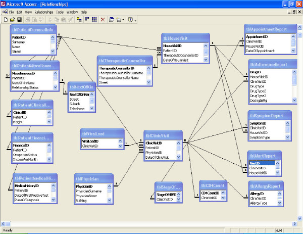
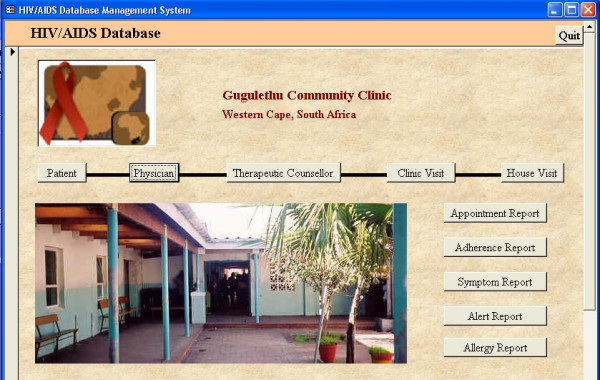
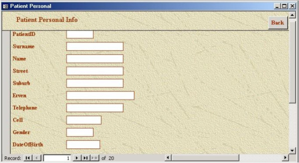
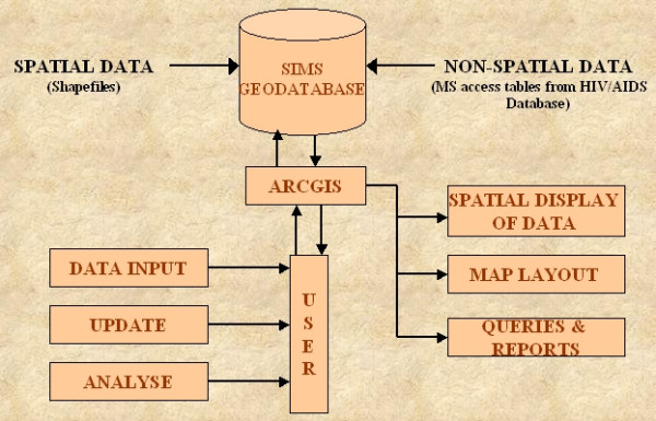
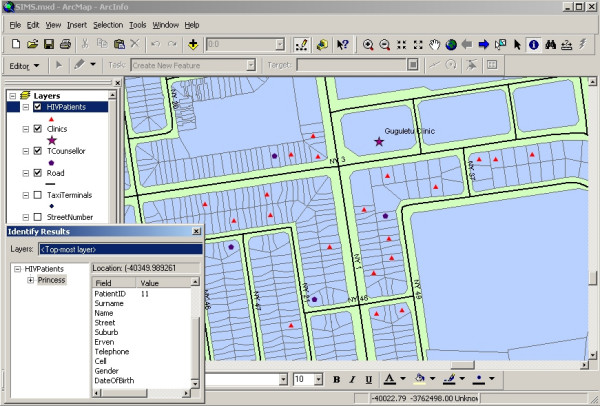
BACKGROUND: South Africa is experiencing an HIV/AIDS pandemic of shattering dimensions. The availability and provision of antiretroviral (ARV) drugs could bring relief to the situation, but the treatment is unfortunately complex with each patient being assigned a different antiretroviral therapy varying in diet-medication regiment. The context of South Africa, its variety of urban and rural settings adds to the challenge of administering and monitoring the HIV+ person throughout the treatment, which will last for the rest of their lives. The lack of physical infrastructure, reliable statistics and adequate resources hinder the efficient management of HIV/AIDS. RESULTS: The collection of reliable data will be a first step to assess the status of HIV/AIDS in communities. A number of hospitals have started this process using the conventional approach to collect information about their patients using a paper-based system. Since time is of essence in the fight against the pandemic, data exchange between various hospitals, municipalities and decision-making bodies is becoming more and more important. The logical response to such a need is a computerised system, which will collect and administer HIV/AIDS related information within the local context and allow a monitored access to the data from a number of stakeholders. CONCLUSIONS: The purpose of this study was to design and develop an HIV/AIDS database, which is embedded in a Spatial Information Management System. The pilot study area is the Gugulethu township in Cape Town where more than 27% of the 325 000 residents are HIV+. It is shown that the implementation of the HIV/AIDS database and the Spatial Information Management System can play a critical role in determining where and when to intervene, improving the quality of care for HIV+ patients, increasing accessibility of service and delivering a cost-effective mode of information.
Figures
References
-
- Medical Research Council of South Africa Annual Report: 2000 – 2001. Research highlights: Health Systems and Policy http://web.archive.org/web/20020220014516/http://www.mrc.ac.za/annualrep...
-
- McDonald D. Immigration and Homelessness in the New South Africa (2000) http://www.queensu.ca/msp/pages/Project_Publications/Papers/Immigrat.pdf
-
- Longley PA, Goodchild MF, Rhind DW, (Editors) Geographical Information Systems Principles and Technical Issues. 2. 1 & 2. New York: John Wiley & Sons; 1999.
-
- Sadiq Z, Ramalingam M, Venugopal L. GIS for public health management http://www.gisdevelopment.net/application/health/overview/healtho0006.htm
LinkOut - more resources
Full Text Sources
