

Spatial analysis and mapping of malaria risk in Malawi using point-referenced prevalence of infection data
- PMID: 16987415
- PMCID: PMC1584224
- DOI: 10.1186/1476-072X-5-41
Spatial analysis and mapping of malaria risk in Malawi using point-referenced prevalence of infection data
Abstract
Background: Current malaria control initiatives aim at reducing malaria burden by half by the year 2010. Effective control requires evidence-based utilisation of resources. Characterizing spatial patterns of risk, through maps, is an important tool to guide control programmes. To this end an analysis was carried out to predict and map malaria risk in Malawi using empirical data with the aim of identifying areas where greatest effort should be focussed.
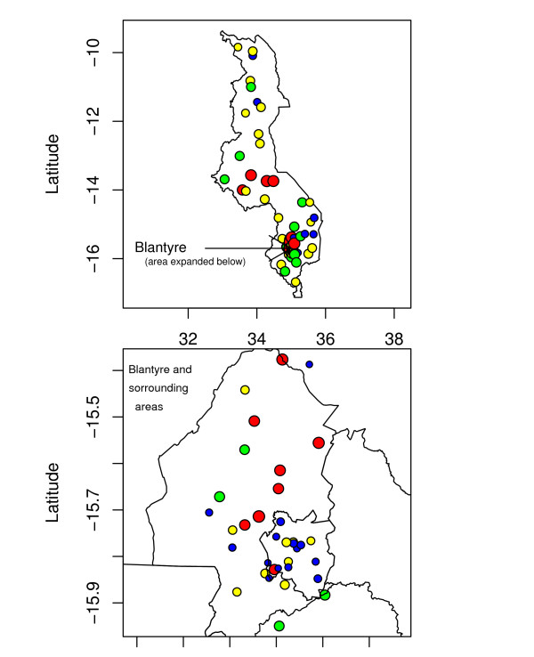
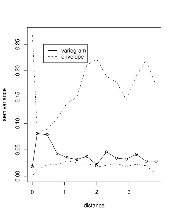
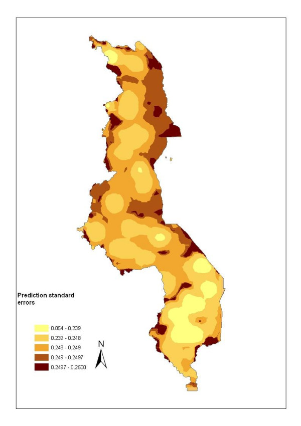
Methods: Point-referenced prevalence of infection data for children aged 1-10 years were collected from published and grey literature and geo-referenced. The model-based geostatistical methods were applied to analyze and predict malaria risk in areas where data were not observed. Topographical and climatic covariates were added in the model for risk assessment and improved prediction. A Bayesian approach was used for model fitting and prediction.
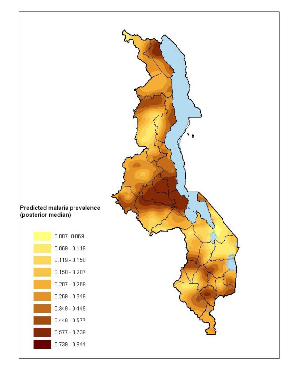
Results: Bivariate models showed a significant association of malaria risk with elevation, annual maximum temperature, rainfall and potential evapotranspiration (PET). However in the prediction model, the spatial distribution of malaria risk was associated with elevation, and marginally with maximum temperature and PET. The resulting map broadly agreed with expert opinion about the variation of risk in the country, and further showed marked variation even at local level. High risk areas were in the low-lying lake shore regions, while low risk was along the highlands in the country.
Conclusion: The map provided an initial description of the geographic variation of malaria risk in Malawi, and might help in the choice and design of interventions, which is crucial for reducing the burden of malaria in Malawi.
Figures

References
-
- WHO/UNICEF . Africa malaria report. World Health Organization/UNICEF Report series: WHO/CDS/MAL/2003; 2003. p. 1093.
-
- Government of Malawi . Malaria policy. Lilongwe: National Malaria Control Programme Community Health Sciences Unit Government of Malawi; 2002.
-
- WHO . Roll Back Malaria. Geneva: World Health Organization; 1998.
Publication types
MeSH terms
Grants and funding
LinkOut - more resources
Full Text Sources
Medical
