. 2007 Aug 14;104(33):13262-7.
doi: 10.1073/pnas.0700926104. Epub 2007 Aug 8.

Jet stream intraseasonal oscillations drive dominant ecosystem variations in Oregon's summertime coastal upwelling system

Affiliations

Jet stream intraseasonal oscillations drive dominant ecosystem variations in Oregon's summertime coastal upwelling system

John M Bane et al. Proc Natl Acad Sci U S A. .

Abstract

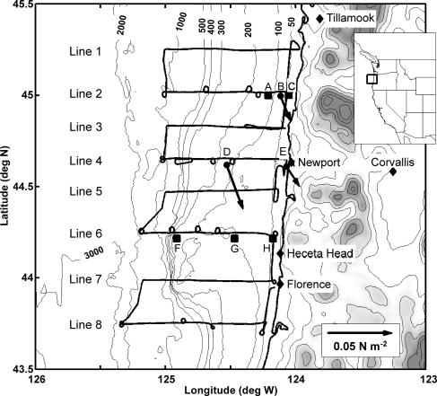
Summertime wind stress along the coast of the northwestern United States typically exhibits intraseasonal oscillations (ISOs) with periods from approximately 15 to 40 days, as well as fluctuations on the 2- to 6-day "weather-band" and 1-day diurnal time scales. Coastal upwelling of cool, nutrient-rich water is driven by extended periods of equatorward alongshore winds, and we show that the approximately 20-day ISOs in alongshore wind stress dominated the upwelling process during summer 2001 off Oregon. These wind stress ISOs resulted from north-south positional ISOs of the atmospheric jet stream (JS). Upper-ocean temperature, phytoplankton, and zooplankton varied principally on the approximately 20-day time scale as well, and these correlated with the ISOs in alongshore wind stress and JS position, even though there also were weather-band stress fluctuations of comparable magnitude. Such wind stress ISOs are typical along Oregon in the summer upwelling season, occurring in 10 of 12 years examined, including 2001. We present a previously unreported direct connection from the atmospheric JS to oceanic primary and secondary production on the intraseasonal time scale and show the leading importance of ISOs in driving this coastal upwelling ecosystem during a typical summer.


Conflict of interest statement

The authors declare no conflict of interest.

Figures

Fig. 1.
Fig. 1.
Atmospheric conditions during a typical JS ISO (northward phase, Left; southward phase, Right). JS flow (as indicated by the height of the 200 hPa pressure surface; Upper) and surface atmospheric pressure patterns (Lower) on July 24, 2001 (Left) and August 1, 2001 (Right). H indicates the center of the North Pacific High pressure system, and L indicates either the Thermal Low (Left and Right, over land) or an eastward traveling ETC (Right, over water south of Alaska). Conditions on these days were typical of: (Left) southward, upwelling-favorable winds in the COAST area (rectangle off Oregon coast) associated with the dominance of the North Pacific High throughout the region when the JS is in a northward ISO phase, and (Right) northward, downwelling-favorable winds at COAST driven by a passing Gulf of Alaska Low (the ETC centered at ≈54N 140W) when the JS ISO is in a southward phase. In the upper panels, the vertical line denotes 125 West longitude, through the COAST study region, and the shading represents the regions of greatest wind speed in the JS.
Fig. 2.
Fig. 2.
Time series of several physical variables in the COAST domain for the period of the summer 2001 field experiment. (a) Northward wind stress at NDBC buoy 46050 (thin line is measured, thick line is 8-DLP, medium line is 35-DLP). (b) Upper-ocean temperature from the same buoy (thin line, measured; thick dashed line, 8-DLP; thin dashed line, 35-DLP). (c) The 8- to 35-DBP stress and temperature time series shown together, with a 3-day lead applied to temperature and stress scaled to fit the vertical axis (note the sequence of 20-day temperature ISOs and the high coherence these have with the stress ISOs; correlation r = 0.56, significant at the 95% level). (d) Wind-stress time series together with the JS location time series (both curves are 8- to 35-DBP; vertical axis is degrees of latitude for JS position, same scale for stress as used in c; the JS position curve has been inverted so that a southward position is toward the top of the image; note the strong coherence between the stress and JS position time series; correlation r = 0.60, significant at the 95% level). (e) Alongshore velocity measured at 10 m below the ocean surface at a COAST mooring on the 100-m isobath ≈35 km south of 46050. The two vertical lines denote the days shown in Fig. 1.
Fig. 3.
Fig. 3.
Time series of several variables in the COAST domain for the period of the summer 2001 field experiment. Each variable shows clearly the series of five 20-day ISOs that occurred then. Both observed and modeled values are shown as follows. (a) Alongshore wind stress observed at NDBC 46050 [heavy curve, 8-DLP; light curve, 36-HLP wind stress, which was used to force the circulation/ecosystem model (7)]. (b) Unfiltered phytoplankton biomass from the ecosystem model [this is the average concentration for the Newport Line, spatially averaged from the surface to 60-m depth (or the bottom) and from the shoreline to the 200 m isobath]. (c) The 8-DLP observed phytoplankton biomass from the GLOBEC mooring located near the 200-m isobath on the Newport Line. (d) The curve is unfiltered zooplankton biomass from the ecosystem model (7) [this is the average concentration for the Newport Line (averaged in the same manner as phytoplankton)], and the filled dots show total copepod biomass measured at three locations on the Newport Line. The arrows indicate the phytoplankton maxima that followed the five southward stress ISOs by several days. Note that direct comparisons between observed and modeled plankton data will show quantitative differences due to the fixed-point sensor used in the field sampling vs. the section-averaged model values. The important feature to see is the appearance of 20-day ISOs in every variable.
Fig. 4.
Fig. 4.
Map of the COAST study area during summer 2001 (3). A typical survey track of eight east–west lines is shown (the black line in a “radiator” pattern). Three oceanographic instrument moorings were located on Line 2 [from west to east: NSB (A), NMS (colocated with the COAST MB) (B), and NIS (C)], and three were located on Line 6 [from west to east: SSB (F), SMS (G), and SIS (H)]. The three surface meteorological sites are shown as solid dots: the COAST MB on Line 2 (B), NDBC buoy 46050 on Line 4 (D), and the NWPO3 C-MAN station at Newport (E). The mean wind stress for May through August, 2001, at each met site is shown. Ocean bathymetric contours are in meters. The height contour interval over land is 500 m.

Similar articles

References

    1. Lau W, Waliser D. Intraseasonal Variability in the Atmosphere-Ocean Climate System. Chichester, UK: Springer–Praxis; 2005.
    1. Breaker L, Liu P, Torrence C. Cont Shelf Res. 2001;21:727–750.
    1. Bane J, Levine M, Samelson R, Haines S, Meaux M, Perlin N, Kosro P, Boyd T. J Geophys Res. 2005;110:C10S02.
    1. Barth JA, Menge BA, Lubchenco J, Chan F, Bane JM, Kirincich AR, McManus M, Nielsen K, Pierce S, Washburn L. Proc Natl Acad Sci USA. 2007;104:3719–3724. - PMC - PubMed
    1. Lott F, Robertson A, Ghil M. J Atmos Sci. 2004;61:1259–1283.

LinkOut - more resources