

Web GIS in practice V: 3-D interactive and real-time mapping in Second Life
- PMID: 18042275
- PMCID: PMC2216085
- DOI: 10.1186/1476-072X-6-51
Web GIS in practice V: 3-D interactive and real-time mapping in Second Life
Abstract
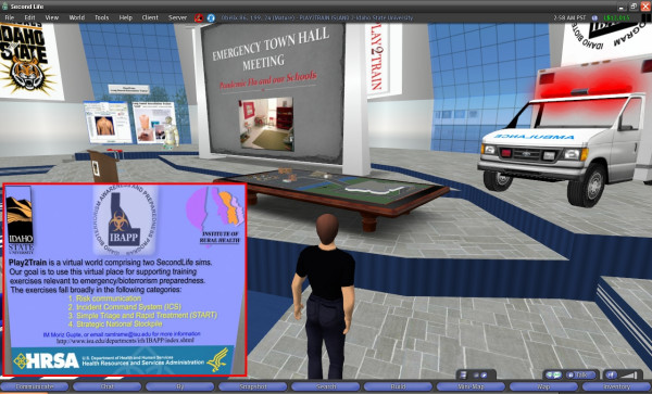
This paper describes technologies from Daden Limited for geographically mapping and accessing live news stories/feeds, as well as other real-time, real-world data feeds (e.g., Google Earth KML feeds and GeoRSS feeds) in the 3-D virtual world of Second Life, by plotting and updating the corresponding Earth location points on a globe or some other suitable form (in-world), and further linking those points to relevant information and resources. This approach enables users to visualise, interact with, and even walk or fly through, the plotted data in 3-D. Users can also do the reverse: put pins on a map in the virtual world, and then view the data points on the Web in Google Maps or Google Earth. The technologies presented thus serve as a bridge between mirror worlds like Google Earth and virtual worlds like Second Life. We explore the geo-data display potential of virtual worlds and their likely convergence with mirror worlds in the context of the future 3-D Internet or Metaverse, and reflect on the potential of such technologies and their future possibilities, e.g. their use to develop emergency/public health virtual situation rooms to effectively manage emergencies and disasters in real time. The paper also covers some of the issues associated with these technologies, namely user interface accessibility and individual privacy.
Figures


Similar articles
-
Web GIS in practice VI: a demo playlist of geo-mashups for public health neogeographers.Int J Health Geogr. 2008 Jul 18;7:38. doi: 10.1186/1476-072X-7-38. Int J Health Geogr. 2008. PMID: 18638385 Free PMC article.
-
Web GIS in practice X: a Microsoft Kinect natural user interface for Google Earth navigation.Int J Health Geogr. 2011 Jul 26;10:45. doi: 10.1186/1476-072X-10-45. Int J Health Geogr. 2011. PMID: 21791054 Free PMC article.
-
Crowdsourcing, citizen sensing and sensor web technologies for public and environmental health surveillance and crisis management: trends, OGC standards and application examples.Int J Health Geogr. 2011 Dec 21;10:67. doi: 10.1186/1476-072X-10-67. Int J Health Geogr. 2011. PMID: 22188675 Free PMC article.
-
Imaging the world: the state of online mapping.IEEE Comput Graph Appl. 2007 Mar-Apr;27(2):8-13. doi: 10.1109/mcg.2007.39. IEEE Comput Graph Appl. 2007. PMID: 17388197 Review. No abstract available.
-
Interreality in practice: bridging virtual and real worlds in the treatment of posttraumatic stress disorders.Cyberpsychol Behav Soc Netw. 2010 Feb;13(1):55-65. doi: 10.1089/cyber.2009.0320. Cyberpsychol Behav Soc Netw. 2010. PMID: 20528294 Review.
Cited by
-
Health 2.0 and Medicine 2.0: tensions and controversies in the field.J Med Internet Res. 2008 Aug 6;10(3):e23. doi: 10.2196/jmir.1056. J Med Internet Res. 2008. PMID: 18682374 Free PMC article. Review.
-
Integrating open-source technologies to build low-cost information systems for improved access to public health data.Int J Health Geogr. 2008 Jun 9;7:29. doi: 10.1186/1476-072X-7-29. Int J Health Geogr. 2008. PMID: 18541035 Free PMC article.
-
From urban planning and emergency training to Pokémon Go: applications of virtual reality GIS (VRGIS) and augmented reality GIS (ARGIS) in personal, public and environmental health.Int J Health Geogr. 2017 Feb 20;16(1):7. doi: 10.1186/s12942-017-0081-0. Int J Health Geogr. 2017. PMID: 28219378 Free PMC article.
-
Web 3D for public, environmental and occupational health: early examples from second life.Int J Environ Res Public Health. 2008 Dec;5(4):290-317. doi: 10.3390/ijerph5040290. Int J Environ Res Public Health. 2008. PMID: 19190358 Free PMC article.
-
Popularity of the metaverse: Embodied social presence theory perspective.Front Psychol. 2022 Sep 29;13:997751. doi: 10.3389/fpsyg.2022.997751. eCollection 2022. Front Psychol. 2022. PMID: 36248483 Free PMC article.
References
-
- Gelernter D. Mirror Worlds: Or: The Day Software Puts the Universe in a Shoebox How It Will Happen and What It Will Mean. New York: Oxford University Press; 1991.
-
- Second Life http://secondlife.com/
-
- Daden Limited http://www.daden.co.uk/
MeSH terms
LinkOut - more resources
Full Text Sources
Other Literature Sources
