

Predicting traffic-related air pollution in Los Angeles using a distance decay regression selection strategy
- PMID: 19540476
- PMCID: PMC3656661
- DOI: 10.1016/j.envres.2009.06.001
Predicting traffic-related air pollution in Los Angeles using a distance decay regression selection strategy
Abstract
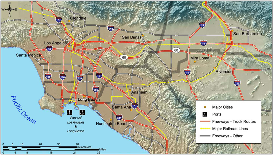
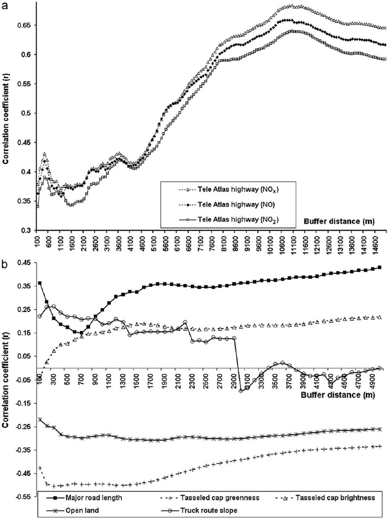
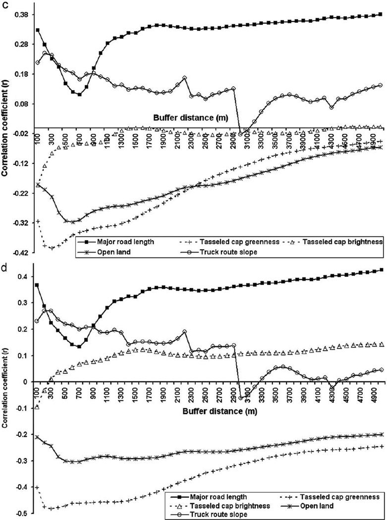
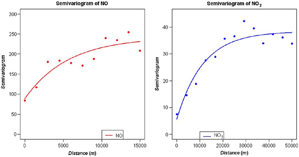
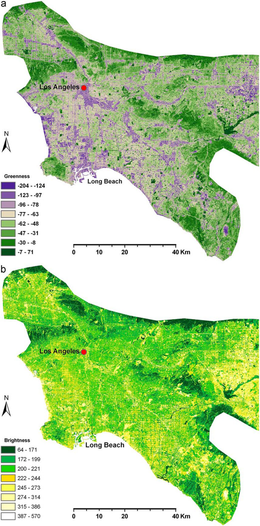
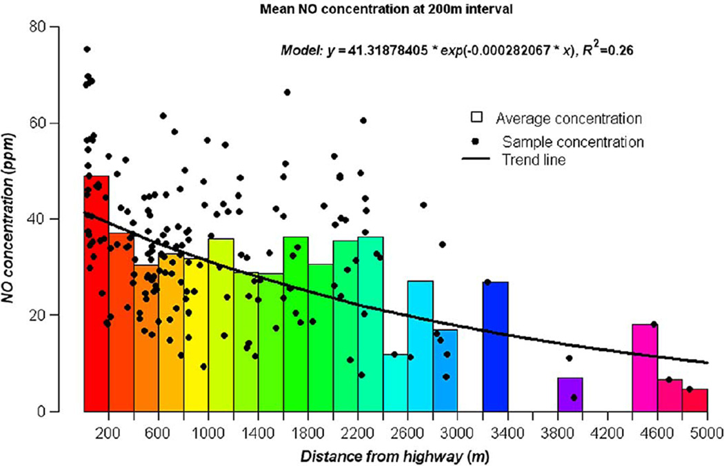
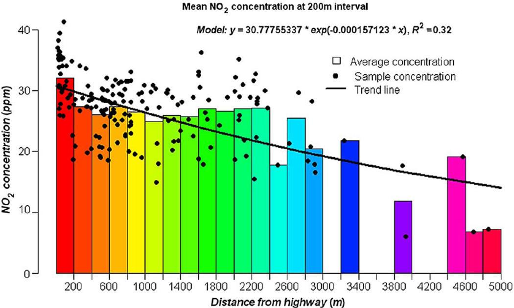
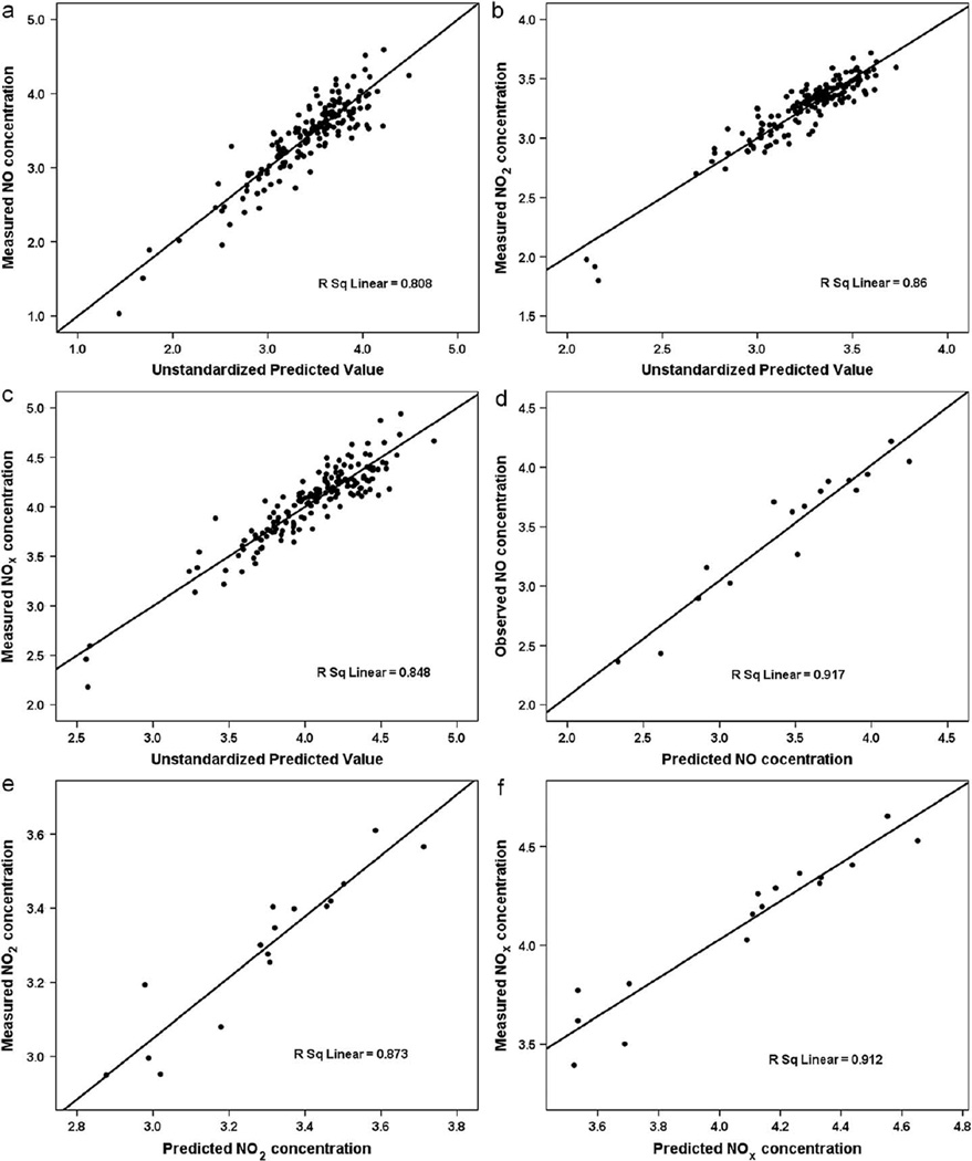
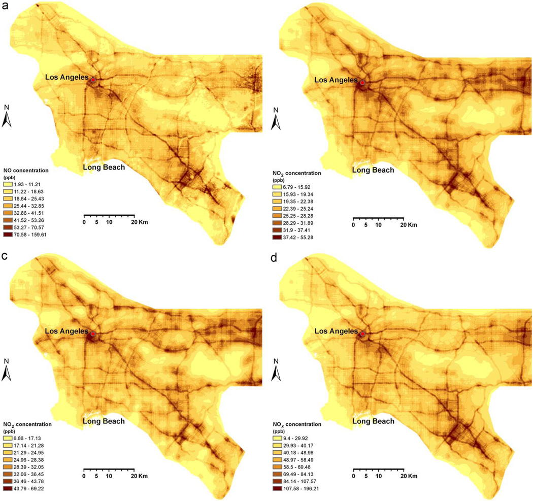
Land use regression (LUR) has emerged as an effective means of estimating exposure to air pollution in epidemiological studies. We created the first LUR models of nitric oxide (NO), nitrogen dioxide (NO2) and nitrogen oxides (NOX) for the complex megalopolis of Los Angeles (LA), California. Two-hundred and one sampling sites (the largest sampling design to date for LUR estimation) for two seasons were selected using a location-allocation algorithm that maximized the potential variability in measured pollutant concentrations and represented populations in the health study. Traffic volumes, truck routes and road networks, land use data, satellite-derived vegetation greenness and soil brightness, and truck route slope gradients were used for predicting NOX concentrations. A novel model selection strategy known as "ADDRESS" (A Distance Decay REgression Selection Strategy) was used to select optimized buffer distances for potential predictor variables and maximize model performance. Final regression models explained 81%, 86% and 85% of the variance in measured NO, NO2 and NOX concentrations, respectively. Cross-validation analyses suggested a prediction accuracy of 87-91%. Remote sensing-derived variables were significantly correlated with NOX concentrations, suggesting these data are useful surrogates for modeling traffic-related pollution when certain land use data are unavailable. Our study also demonstrated that reactive pollutants such as NO and NO2 could have high spatial extents of influence (e.g., > 5000 m from expressway) and high background concentrations in certain geographic areas. This paper represents the first attempt to model traffic-related air pollutants at a fine scale within such a complex and large urban region.
Figures
References
-
- Bailey TC, Gatrell AC. Interactive Spatial Data Analysis. Harlow, Essex: Addison Wesley Longman; 1995.
-
- Bolstad P. GIS Fundamentals: A First Text on Geographic Information Systems. second ed. White Bear Lake, MN: Eider Press; 2005.
-
- Bytnerowicz A, Fenn ME. Nitrogen deposition in California forests: a review. Environ. Pollut. 1996;92:127–146. - PubMed
-
- Cressie N. Statistics for Spatial Data. New York: Wiley; 1993. Revised ed.
-
- Crist EP, Cicone RC. A physically-based transformation of thematic mapper data—the TM tasseled cap. IEEE Trans. Geosci. 1984:256–263. Remote Sensing GE-22.
Publication types
MeSH terms
Substances
Grants and funding
LinkOut - more resources
Full Text Sources
Medical
