

Automated vocabulary discovery for geo-parsing online epidemic intelligence
- PMID: 19930702
- PMCID: PMC2787530
- DOI: 10.1186/1471-2105-10-385
Automated vocabulary discovery for geo-parsing online epidemic intelligence
Abstract
Background: Automated surveillance of the Internet provides a timely and sensitive method for alerting on global emerging infectious disease threats. HealthMap is part of a new generation of online systems designed to monitor and visualize, on a real-time basis, disease outbreak alerts as reported by online news media and public health sources. HealthMap is of specific interest for national and international public health organizations and international travelers. A particular task that makes such a surveillance useful is the automated discovery of the geographic references contained in the retrieved outbreak alerts. This task is sometimes referred to as "geo-parsing". A typical approach to geo-parsing would demand an expensive training corpus of alerts manually tagged by a human.
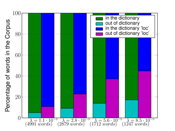
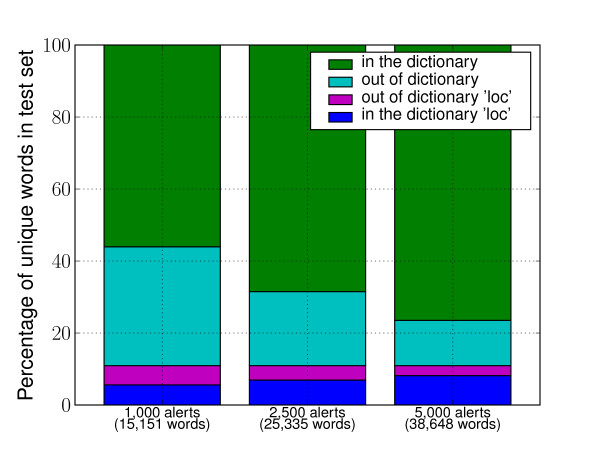
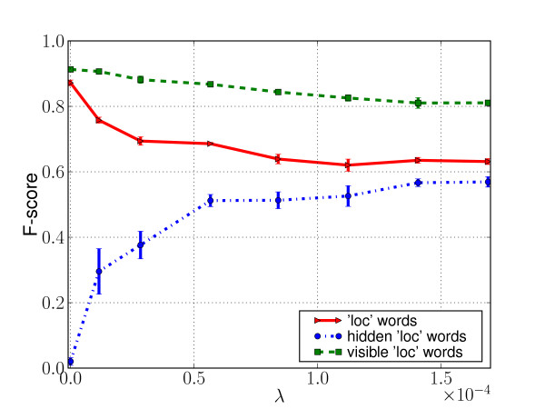
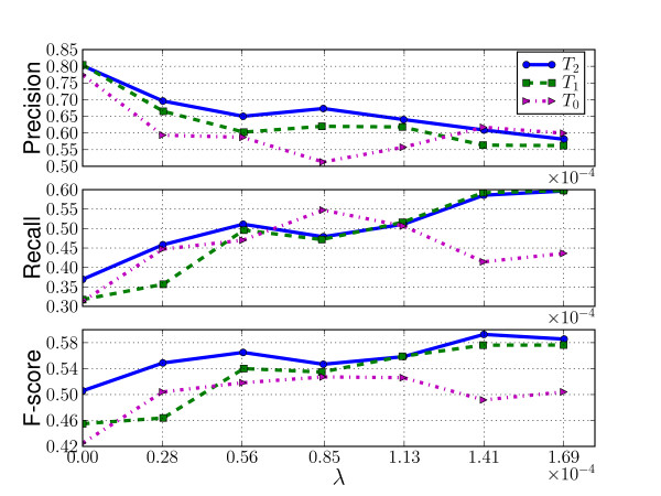
Results: Given that human readers perform this kind of task by using both their lexical and contextual knowledge, we developed an approach which relies on a relatively small expert-built gazetteer, thus limiting the need of human input, but focuses on learning the context in which geographic references appear. We show in a set of experiments, that this approach exhibits a substantial capacity to discover geographic locations outside of its initial lexicon.
Conclusion: The results of this analysis provide a framework for future automated global surveillance efforts that reduce manual input and improve timeliness of reporting.
Figures
References
-
- Mawudeku A, Lemay R, Werker D, Andraghetti R, John RS. In: Infectious Disease Surveillance. M'ikanatha N, Lynfield R, Beneden CV, de Valk H, editor. Blackwell Publishing, MA; 2007. The Global Public Health Intelligence Network.
-
- Brownstein JS, Freifeld CC. HealthMap: the development of automated real-time internet surveillance for epidemic intelligence. Euro Surveill. 2007;12(48):3322. - PubMed
-
- Holden C. Netwatch: Diseases on the move. Science. 2006;314(5804):1363d.
-
- Larkin M. Technology and public health: Healthmap tracks global diseases. Lancet Infect Dis. 2007;7:91.
Publication types
MeSH terms
Grants and funding
LinkOut - more resources
Full Text Sources
