

Targeting trachoma control through risk mapping: the example of Southern Sudan
- PMID: 20808910
- PMCID: PMC2923154
- DOI: 10.1371/journal.pntd.0000799
Targeting trachoma control through risk mapping: the example of Southern Sudan
Abstract
Background: Trachoma is a major cause of blindness in Southern Sudan. Its distribution has only been partially established and many communities in need of intervention have therefore not been identified or targeted. The present study aimed to develop a tool to improve targeting of survey and control activities.
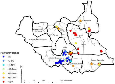
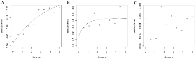
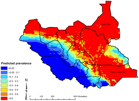
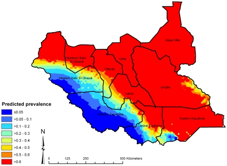
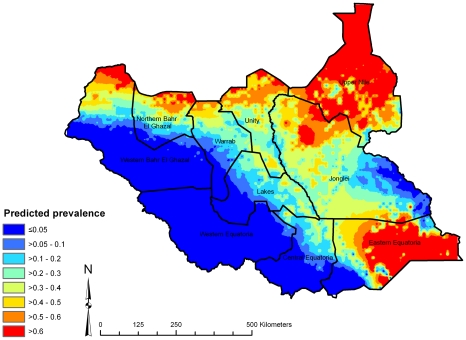
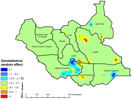
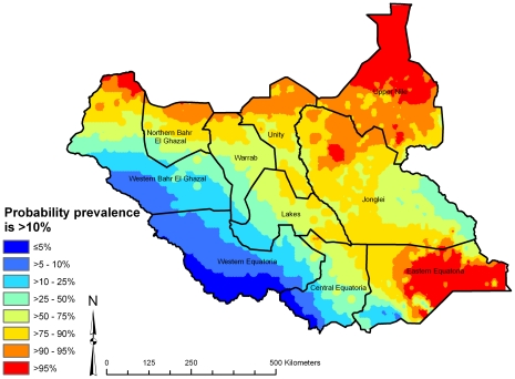
Methods/principal findings: A national trachoma risk map was developed using Bayesian geostatistics models, incorporating trachoma prevalence data from 112 geo-referenced communities surveyed between 2001 and 2009. Logistic regression models were developed using active trachoma (trachomatous inflammation follicular and/or trachomatous inflammation intense) in 6345 children aged 1-9 years as the outcome, and incorporating fixed effects for age, long-term average rainfall (interpolated from weather station data) and land cover (i.e. vegetation type, derived from satellite remote sensing), as well as geostatistical random effects describing spatial clustering of trachoma. The model predicted the west of the country to be at no or low trachoma risk. Trachoma clusters in the central, northern and eastern areas had a radius of 8 km after accounting for the fixed effects.
Conclusion: In Southern Sudan, large-scale spatial variation in the risk of active trachoma infection is associated with aridity. Spatial prediction has identified likely high-risk areas to be prioritized for more data collection, potentially to be followed by intervention.
Conflict of interest statement
The authors have declared that no competing interests exist.
Figures
References
Publication types
MeSH terms
LinkOut - more resources
Full Text Sources
