

Estimation of the effect of soil texture on nitrate-nitrogen content in groundwater using optical remote sensing
- PMID: 21909315
- PMCID: PMC3166751
- DOI: 10.3390/ijerph8083416
Estimation of the effect of soil texture on nitrate-nitrogen content in groundwater using optical remote sensing
Abstract
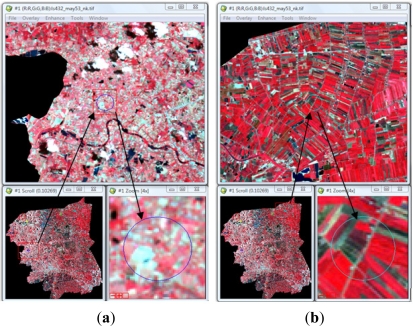
The use of chemical fertilizers in Thailand increased exponentially by more than 100-fold from 1961 to 2004. Intensification of agricultural production causes several potential risks to water supplies, especially nitrate-nitrogen (NO(3) (-)-N) pollution. Nitrate is considered a potential pollutant because its excess application can move into streams by runoff and into groundwater by leaching. The nitrate concentration in groundwater increases more than 3-fold times after fertilization and it contaminates groundwater as a result of the application of excess fertilizers for a long time. Soil texture refers to the relative proportion of particles of various sizes in a given soil and it affects the water permeability or percolation rate of a soil. Coarser soils have less retention than finer soils, which in the case of NO(3) (-)-N allows it to leach into groundwater faster, so there is positive relationship between the percentage of sands and NO(3) (-)-N concentration in groundwater wells. This study aimed to estimate the effect of soil texture on NO(3) (-)-N content in groundwater. Optical reflectance data obtained by remote sensing was used in this study. Our hypothesis was that the quantity of nitrogen leached into groundwater through loam was higher than through clay. Nakhon Pathom province, Thailand, was selected as a study area where the terrain is mostly represented by a flat topography. It was found that classified LANDSAT images delineated paddy fields as covering 29.4% of the study area, while sugarcane covered 10.4%, and 60.2% was represented by "others". The reason for this classified landuse was to determine additional factors, such as vegetation, which might directly affect the quantity of NO(3) (-)-N in soil. Ideally, bare soil would be used as a test site, but in fact, no such places were available in Thailand. This led to an indirect method to estimate NO(3) (-)-N on various soil textures. Through experimentation, it was found that NO(3) (-)-N measured through the loam in sugarcane (I = 0.0054, p < 0.05) was lower than clay represented by paddies (I = 0.0305, p < 0.05). This had a significant negative impact on the assumption. According to the research and local statistical data, farmers have always applied an excess quantity of fertilizer on paddy fields. This is the main reason for the higher quantity of NO(3) (-)-N found in clay than loam in this study. This case might be an exceptional study in terms of quantity of fertilizers applied to agricultural fields.
Keywords: Geographic Informationc Systems (GIS); groundwater; nitrates; remote sensing; soil texture; spatial autocorrelation.
Figures


References
-
- World Health Organization . Guidelines for Drinking-water Quality. 3rd ed. Vol. 1. World Health Organization; Geneva, Switzerland: 2004. Recommendations.
-
- Tirado R, Englande AJ, Promakasikorn L, Novotny V. Technical Note 03/2008. Greenpeace Research Laboratories; Exeter, UK: 2008.
-
- Federal Register. National interim primary drinking water standards. Federal Register 40:59, 566588, 1975.
-
- Gaines TP, Gaines ST. Soil texture effect on nitrate leaching in soil percolates. Commun. Soil Sci. Plant Anal. 1994;25:2561–2570.
-
- Alley WM. Regional Ground Water Quality. Van Nostrand Reinhold; New York, NY, USA: 1993. p. 635.
Publication types
MeSH terms
Substances
LinkOut - more resources
Full Text Sources
