

Using a geographical-information-system-based decision support to enhance malaria vector control in zambia
- PMID: 22548086
- PMCID: PMC3323906
- DOI: 10.1155/2012/363520
Using a geographical-information-system-based decision support to enhance malaria vector control in zambia
Abstract
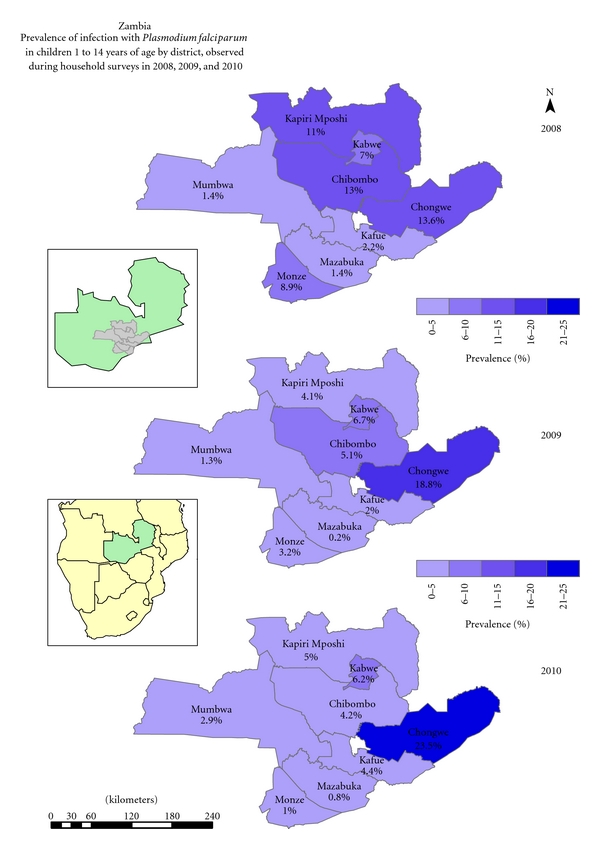
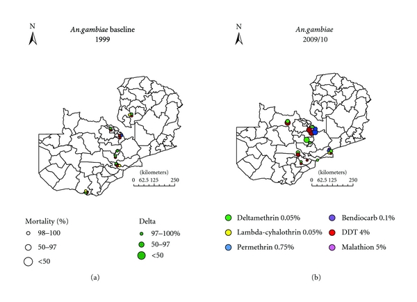
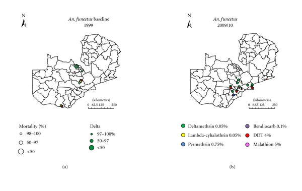
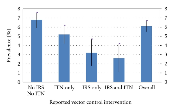
Geographic information systems (GISs) with emerging technologies are being harnessed for studying spatial patterns in vector-borne diseases to reduce transmission. To implement effective vector control, increased knowledge on interactions of epidemiological and entomological malaria transmission determinants in the assessment of impact of interventions is critical. This requires availability of relevant spatial and attribute data to support malaria surveillance, monitoring, and evaluation. Monitoring the impact of vector control through a GIS-based decision support (DSS) has revealed spatial relative change in prevalence of infection and vector susceptibility to insecticides and has enabled measurement of spatial heterogeneity of trend or impact. The revealed trends and interrelationships have allowed the identification of areas with reduced parasitaemia and increased insecticide resistance thus demonstrating the impact of resistance on vector control. The GIS-based DSS provides opportunity for rational policy formulation and cost-effective utilization of limited resources for enhanced malaria vector control.
Figures
References
-
- WHO. Roll back malaria: action or rhetoric? Round table discussion. Bulletin of the World Health Organization. 2010;78:1450–1455.
-
- Hay SI, Tucker CJ, Rogers DJ, Packer MJ. Remotely sensed surrogates of meteorological data for the study of the distribution and abundance of arthropod vectors of disease. Annals of Tropical Medicine and Parasitology. 1996;90:1–19. - PubMed
-
- Daash A, Srivastava A, Nagpal BN, Saxena R, Gupta SK. Geographical information system (GIS) in decision support to control malaria—a case study of Koraput district in Orissa, India. Journal of Vector Borne Diseases. 2009;46(1):72–74. - PubMed
-
- Sharp BL, Le Sueur D. Malaria in South Africa—the past, the present and selected implications for the future. Medecine Tropicale. 1996;56(2):189–196. - PubMed
LinkOut - more resources
Full Text Sources
Other Literature Sources
