

Under-five mortality in high focus states in India: a district level geospatial analysis
- PMID: 22629412
- PMCID: PMC3356406
- DOI: 10.1371/journal.pone.0037515
Under-five mortality in high focus states in India: a district level geospatial analysis
Abstract
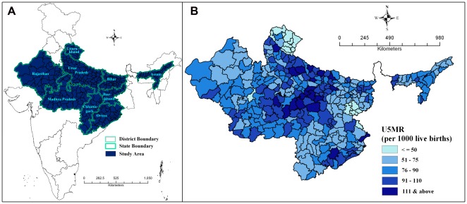
Background: This paper examines if, when controlling for biophysical and geographical variables (including rainfall, productivity of agricultural lands, topography/temperature, and market access through road networks), socioeconomic and health care indicators help to explain variations in the under-five mortality rate across districts from nine high focus states in India. The literature on this subject is inconclusive because the survey data, upon which most studies of child mortality rely, rarely include variables that measure these factors. This paper introduces these variables into an analysis of 284 districts from nine high focus states in India.
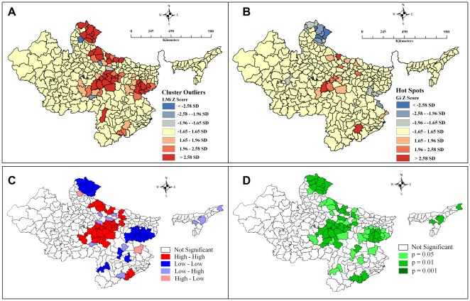
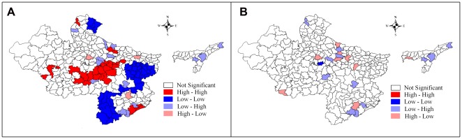
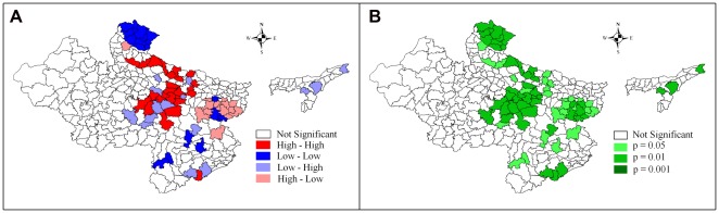
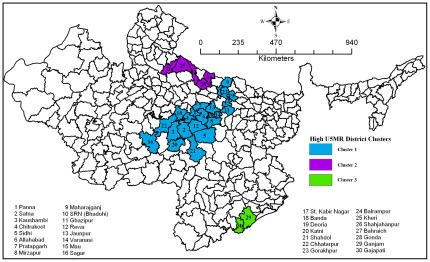
Methodology/principal findings: Information on the mortality indicator was accessed from the recently conducted Annual Health Survey of 2011 and other socioeconomic and geographic variables from Census 2011, District Level Household and Facility Survey (2007-08), Department of Economics and Statistics Divisions of the concerned states. Displaying high spatial dependence (spatial autocorrelation) in the mortality indicator (outcome variable) and its possible predictors used in the analysis, the paper uses the Spatial-Error Model in an effort to negate or reduce the spatial dependence in model parameters. The results evince that the coverage gap index (a mixed indicator of district wise coverage of reproductive and child health services), female literacy, urbanization, economic status, the number of newborn care provided in Primary Health Centers in the district transpired as significant correlates of under-five mortality in the nine high focus states in India. The study identifies three clusters with high under-five mortality rate including 30 districts, and advocates urgent attention.
Conclusion: Even after controlling the possible biophysical and geographical variables, the study reveals that the health program initiatives have a major role to play in reducing under-five mortality rate in the high focus states in India.
Conflict of interest statement
Figures
References
-
- United Nations Children's Fund. Levels & Trends in Child Mortality. Estimates Developed by the UN Inter-agency Group for Child Mortality Estimation. New York, USA: UNICEF; 2010.
-
- Dyson T, Moore M. On kinship structure, female autonomy, and demographic behavior in India. Population and Development Review. 1983;9:35–60.
-
- Arokiasamy P, Pradhan J. Measuring wealth-based health inequality among Indian Children: the importance of equity vs efficiency. Health Policy and Planning. 2011;26:429–440. - PubMed
-
- Registrar General and Census Commissioner. 2012. Annual Health Survey- 2010–11. Ministry of Home Affairs, Government of India. New Delhi. Available: http://www.censusindia.gov.in/2011-Common/AHSurvey.html. Accessed on January 9, 2012.
Publication types
MeSH terms
LinkOut - more resources
Full Text Sources
Other Literature Sources
Medical
Miscellaneous
