

Integrating local and global error statistics for multi-scale RBF network training: an assessment on remote sensing data
- PMID: 22876278
- PMCID: PMC3411665
- DOI: 10.1371/journal.pone.0040093
Integrating local and global error statistics for multi-scale RBF network training: an assessment on remote sensing data
Abstract
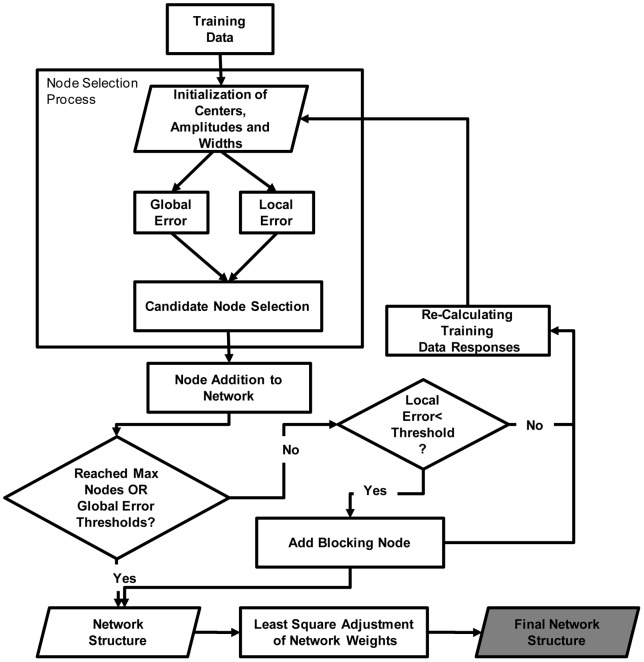
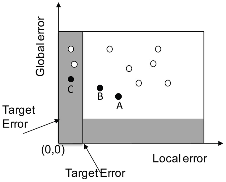
Background: This study discusses the theoretical underpinnings of a novel multi-scale radial basis function (MSRBF) neural network along with its application to classification and regression tasks in remote sensing. The novelty of the proposed MSRBF network relies on the integration of both local and global error statistics in the node selection process.
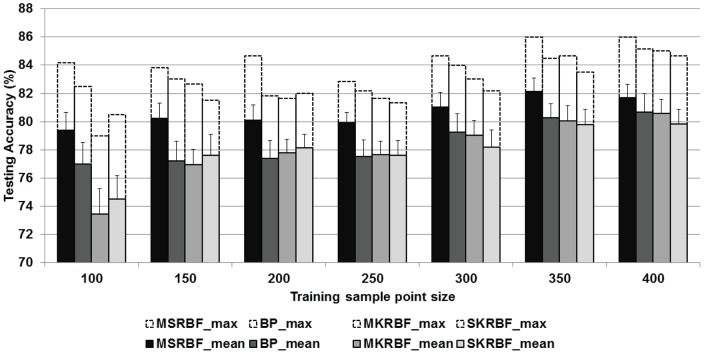
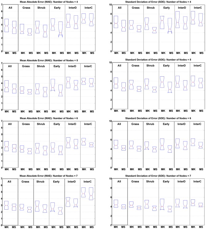
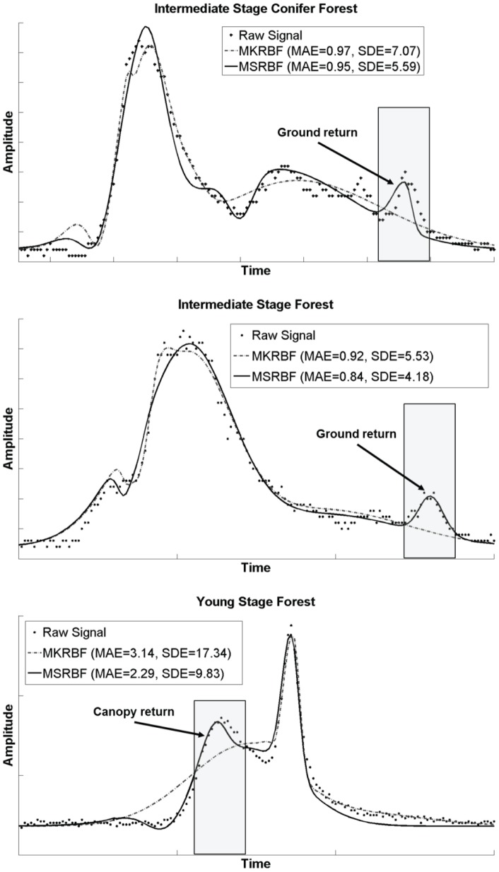
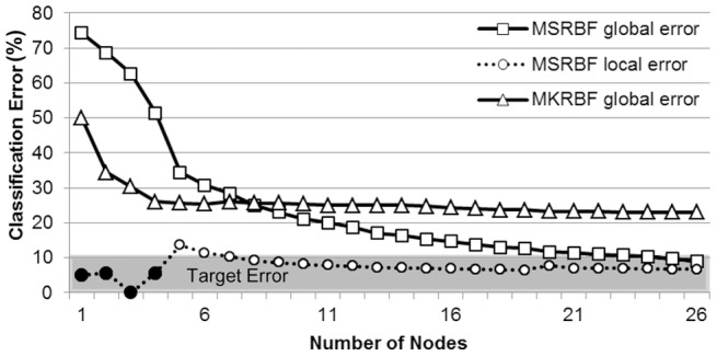
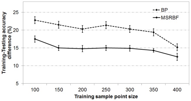
Methodology and principal findings: The method was tested on a binary classification task, detection of impervious surfaces using a Landsat satellite image, and a regression problem, simulation of waveform LiDAR data. In the classification scenario, results indicate that the MSRBF is superior to existing radial basis function and back propagation neural networks in terms of obtained classification accuracy and training-testing consistency, especially for smaller datasets. The latter is especially important as reference data acquisition is always an issue in remote sensing applications. In the regression case, MSRBF provided improved accuracy and consistency when contrasted with a multi kernel RBF network.
Conclusion and significance: Results highlight the potential of a novel training methodology that is not restricted to a specific algorithmic type, therefore significantly advancing machine learning algorithms for classification and regression tasks. The MSRBF is expected to find numerous applications within and outside the remote sensing field.
Conflict of interest statement
Figures
References
-
- Running SW, Nemani RR, Heinsch FA, Zhao M, Reeves M, et al. (2004) A continuous satellite-derived measure of global terrestrial primary production. Bioscience 54: 547–560.
-
- Benediktsson JA, Swain PH, Ersoy OK (1990) Neural network approaches versus statistical methods in classification of multisource remote sensing data. IEEE Transactions on Geoscience and Remote Sensing 28: 540–552.
-
- Joughin I, Gray L, Bindschadler R, Price S, Morse D, et al. (1999) Tributaries of West Antarctic ice streams revealed by RADARSAT interferometry. Science 286: 283–286. - PubMed
-
- Skole D, Tucker C (1993) Tropical deforestation and habitat fragmentation in the amazon: Satellite data from 1978 to 1988. Science 260: 1905–1910. - PubMed
-
- Rollet R, Benie GB, Li W, Wang S, Boucher JM (1998) Image classification algorithm based on the RBF neural network and K-means. International Journal of Remote Sensing 19: 3003–3009.
Publication types
MeSH terms
LinkOut - more resources
Full Text Sources
