

Web-based GIS: the vector-borne disease airline importation risk (VBD-AIR) tool
- PMID: 22892045
- PMCID: PMC3503742
- DOI: 10.1186/1476-072X-11-33
Web-based GIS: the vector-borne disease airline importation risk (VBD-AIR) tool
Abstract
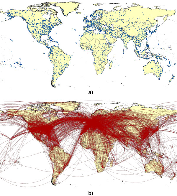
Background: Over the past century, the size and complexity of the air travel network has increased dramatically. Nowadays, there are 29.6 million scheduled flights per year and around 2.7 billion passengers are transported annually. The rapid expansion of the network increasingly connects regions of endemic vector-borne disease with the rest of the world, resulting in challenges to health systems worldwide in terms of vector-borne pathogen importation and disease vector invasion events. Here we describe the development of a user-friendly Web-based GIS tool: the Vector-Borne Disease Airline Importation Risk Tool (VBD-AIR), to help better define the roles of airports and airlines in the transmission and spread of vector-borne diseases.
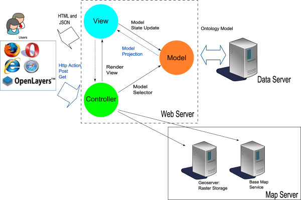
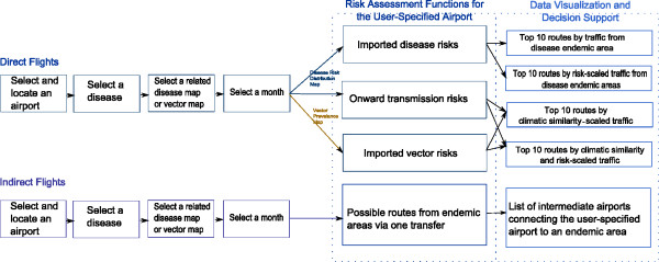
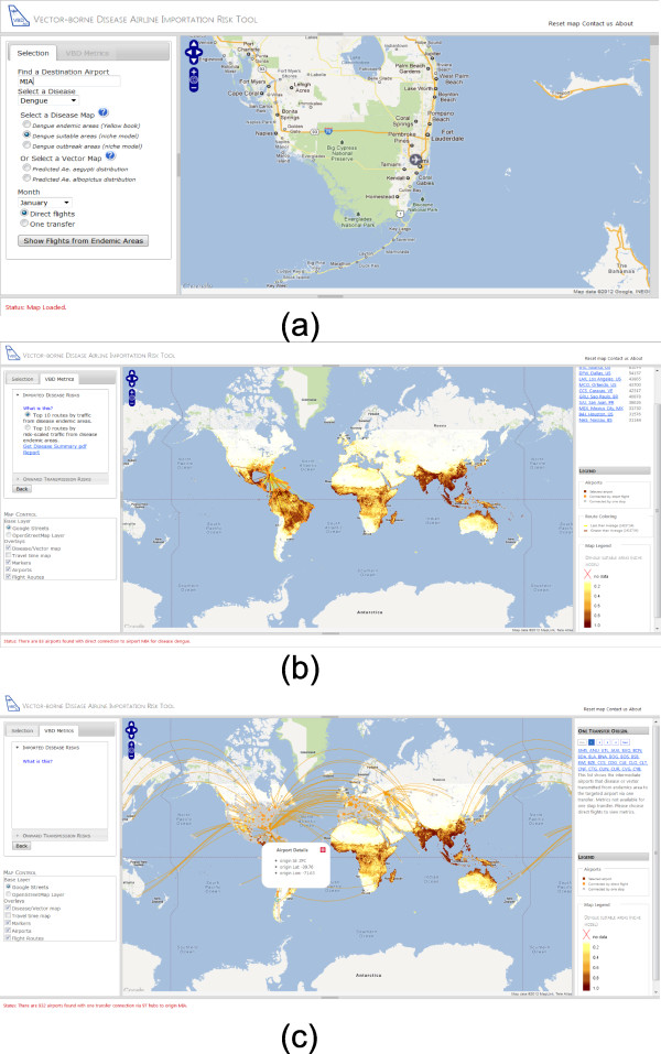
Methods: Spatial datasets on modeled global disease and vector distributions, as well as climatic and air network traffic data were assembled. These were combined to derive relative risk metrics via air travel for imported infections, imported vectors and onward transmission, and incorporated into a three-tier server architecture in a Model-View-Controller framework with distributed GIS components. A user-friendly web-portal was built that enables dynamic querying of the spatial databases to provide relevant information.
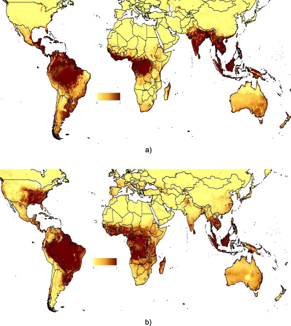
Results: The VBD-AIR tool constructed enables the user to explore the interrelationships among modeled global distributions of vector-borne infectious diseases (malaria. dengue, yellow fever and chikungunya) and international air service routes to quantify seasonally changing risks of vector and vector-borne disease importation and spread by air travel, forming an evidence base to help plan mitigation strategies. The VBD-AIR tool is available at http://www.vbd-air.com.
Conclusions: VBD-AIR supports a data flow that generates analytical results from disparate but complementary datasets into an organized cartographical presentation on a web map for the assessment of vector-borne disease movements on the air travel network. The framework built provides a flexible and robust informatics infrastructure by separating the modules of functionality through an ontological model for vector-borne disease. The VBD‒AIR tool is designed as an evidence base for visualizing the risks of vector-borne disease by air travel for a wide range of users, including planners and decisions makers based in state and local government, and in particular, those at international and domestic airports tasked with planning for health risks and allocating limited resources.
Figures
References
-
- IATA. Singapore: Annual Report 2011 International Air Transport Association; 2011. http://www.iata.org/pressroom/Documents/annual-report-2011.pdf.
-
- World Health Organization. The world health report 2007: a safer future: global public health security in the 21st century. Switzerland: WHO Press; 2007.
-
- Tatem AJ, Huang Z, Das A, Qi Q, Qiu Y. Air travel and vector-borne disease movement. Parasitology. 2012. pp. 1–15. In press. - PubMed
Publication types
MeSH terms
Grants and funding
LinkOut - more resources
Full Text Sources
Other Literature Sources
Medical
Miscellaneous
