

The Global Distribution of Infant Mortality: A subnational spatial view
- PMID: 22962545
- PMCID: PMC3433806
- DOI: 10.1002/psp.484
The Global Distribution of Infant Mortality: A subnational spatial view
Abstract
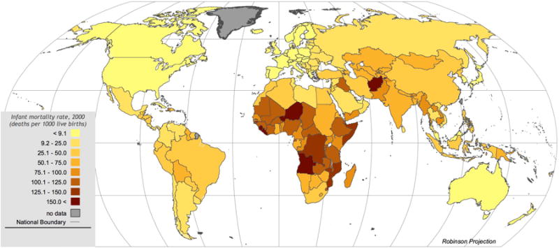
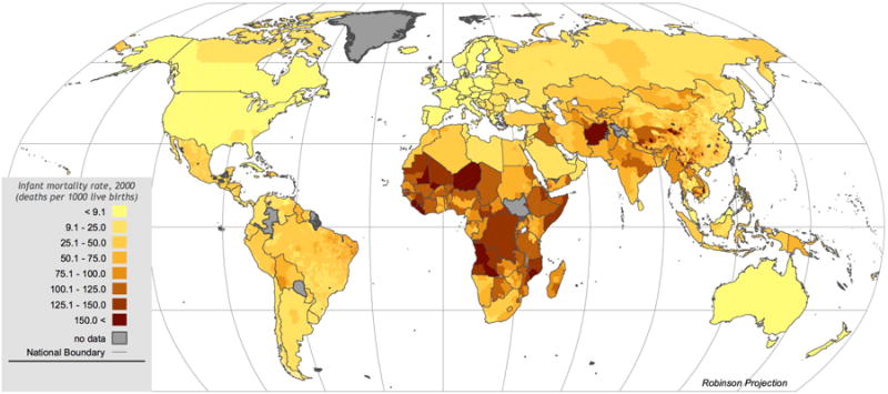
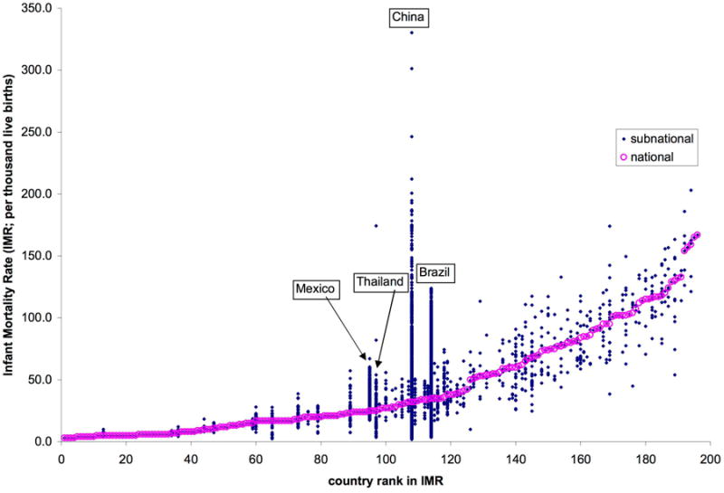
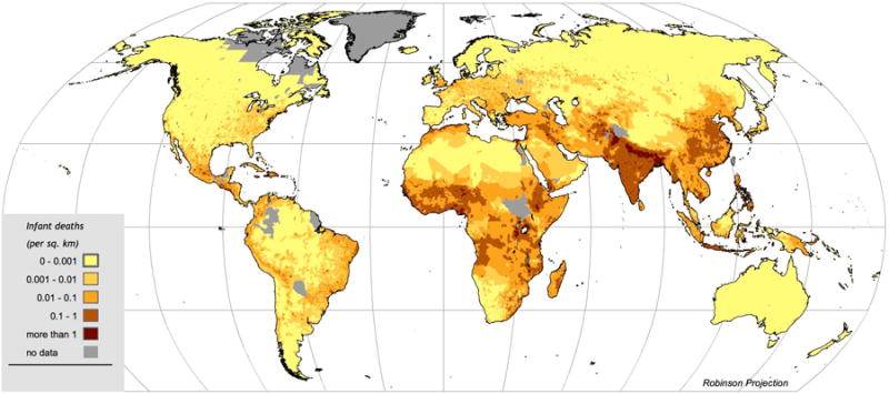
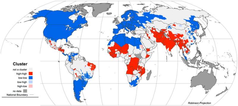
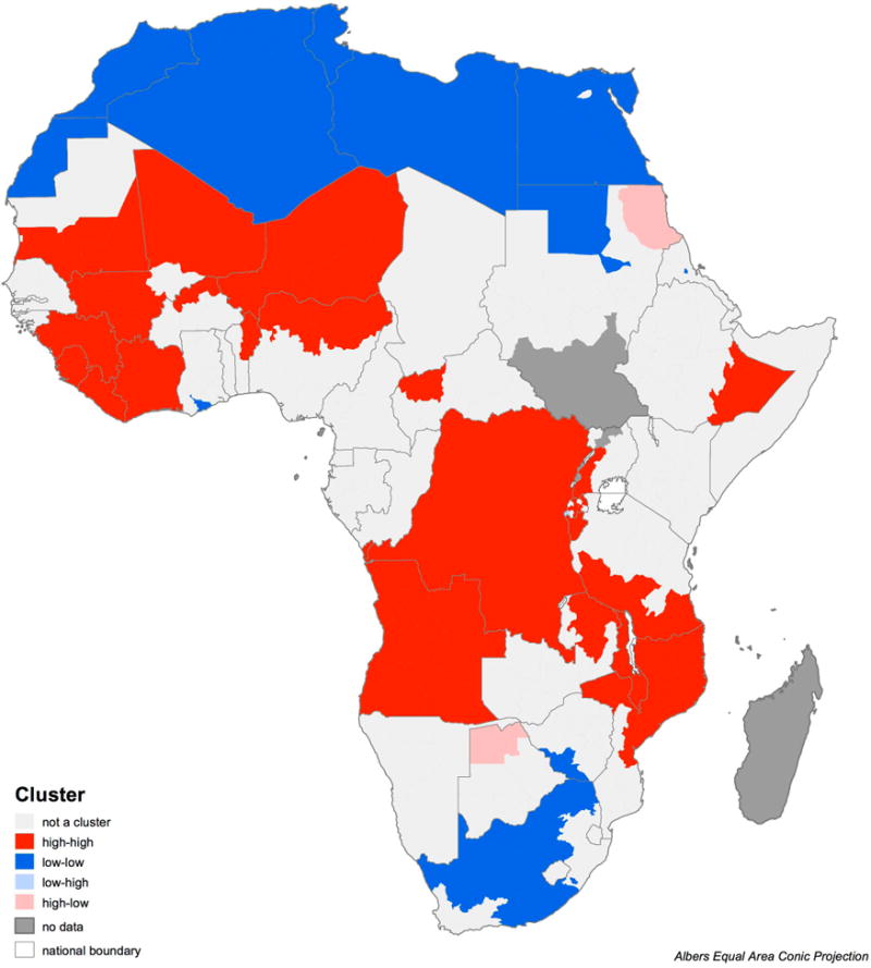
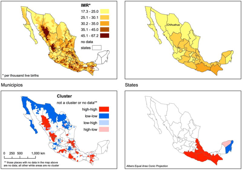
We describe the compilation of a spatially explicit dataset detailing infant mortality rates in over 10,000 national and subnational units worldwide, benchmarked to the year 2000. Although their resolution is highly variable, subnational data are available for countries representing over 90% of non-OECD population. Concentration of global infant deaths is higher than implied by national data alone. Assigning both national and subnational data to map grid cells so that they may be easily integrated with other geographic data, we generate infant mortality rates for environmental regions, including biomes and coastal zones, by continent. Rates for these regions also show striking refinements from the use of the higher resolution data. Possibilities and limitations for related work are discussed.
Figures
References
-
- Adetunji Jacob A. Infant mortality levels in Africa: does method of estimation matter? Genus. 1996;52(3-4):89–106. Jul-Dec 1996. - PubMed
-
- Alder Jacqueline, Russell Arthurton, Neville Ash, et al. Marine and Coastal Ecosystems and Human Well-Being. United Nations Environmental Programme; Nairobi: 2006.
-
- Anselin Luc. Local Indicators of Spatial Association — LISA. Geographical Analysis. 1995;27:93–115.
-
- Anselin Luc, Ibnu Syabri, Youngihn Kho. GeoDa: An Introduction to Spatial Data Analysis. Geographical Analysis. 2006;38:5–22.
-
- Assuncao Renato M, Reis Edna A. A new proposal to adjust Moran's I for population density. Statistics in Medicine. 1999;18:2147–2161. - PubMed
Grants and funding
LinkOut - more resources
Full Text Sources