

Spatio-temporal analyses of cropland degradation in the irrigated lowlands of Uzbekistan using remote-sensing and logistic regression modeling
- PMID: 23054271
- PMCID: PMC3641299
- DOI: 10.1007/s10661-012-2904-6
Spatio-temporal analyses of cropland degradation in the irrigated lowlands of Uzbekistan using remote-sensing and logistic regression modeling
Abstract
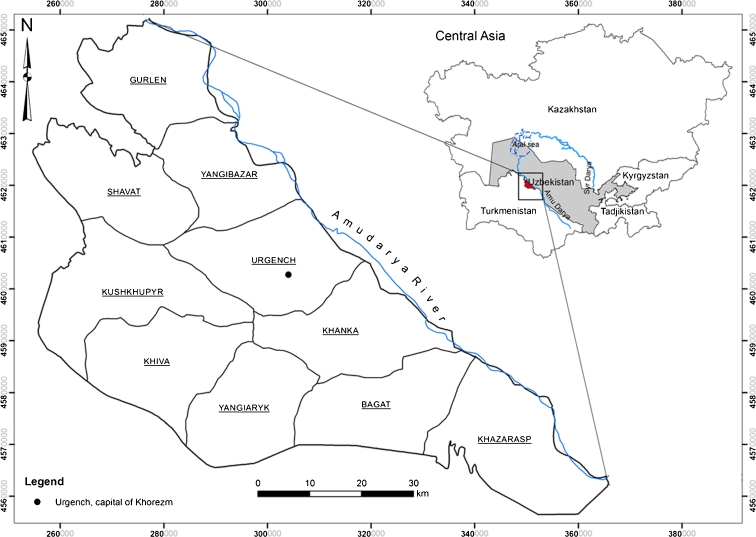
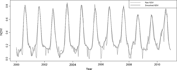
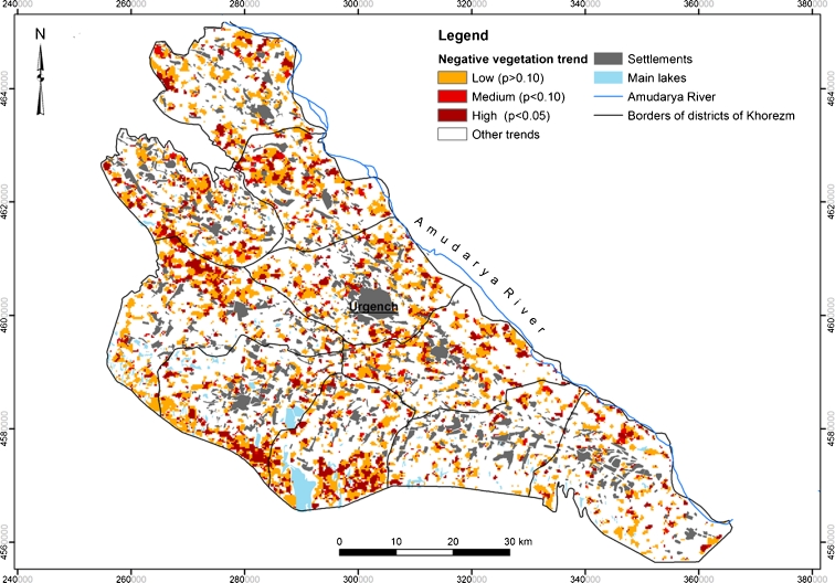
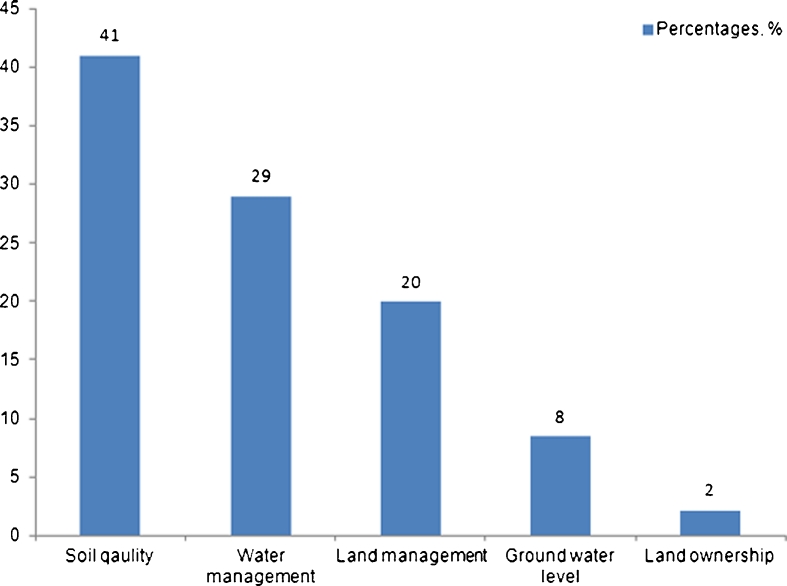
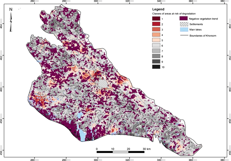
Advancing land degradation in the irrigated areas of Central Asia hinders sustainable development of this predominantly agricultural region. To support decisions on mitigating cropland degradation, this study combines linear trend analysis and spatial logistic regression modeling to expose a land degradation trend in the Khorezm region, Uzbekistan, and to analyze the causes. Time series of the 250-m MODIS NDVI, summed over the growing seasons of 2000-2010, were used to derive areas with an apparent negative vegetation trend; this was interpreted as an indicator of land degradation. About one third (161,000 ha) of the region's area experienced negative trends of different magnitude. The vegetation decline was particularly evident on the low-fertility lands bordering on the natural sandy desert, suggesting that these areas should be prioritized in mitigation planning. The results of logistic modeling indicate that the spatial pattern of the observed trend is mainly associated with the level of the groundwater table (odds = 330 %), land-use intensity (odds = 103 %), low soil quality (odds = 49 %), slope (odds = 29 %), and salinity of the groundwater (odds = 26 %). Areas, threatened by land degradation, were mapped by fitting the estimated model parameters to available data. The elaborated approach, combining remote-sensing and GIS, can form the basis for developing a common tool for monitoring land degradation trends in irrigated croplands of Central Asia.
Figures
References
-
- Akramkhanov A, Vlek P. The assessment of spatial distribution of soil salinity risk using neural network. Environmental Monitoring and Assessment. 2011;184(4):1–11. - PubMed
-
- Akramkhanov A, Martius C, Park SJ, Hendrickx JMH. Environmental factors of spatial distribution of soil salinity on flat irrigated terrain. Geoderma. 2011;163(1–2):55–62. doi: 10.1016/j.geoderma.2011.04.001. - DOI
-
- Belsley D, Kuh E, Welsch R. Regression diagnostics: identifying influential data and sources of collinearity. New York: Wiley; 1980.
-
- Biro, K., Pradhan, B., Buchroithner, M., & Makescin, F. (2010). Use of Multi-temporal Satellite Data for Land-Use/Land-Cover Change Analyses and its Impacts on Soil Properties in the Northern Part of Gadarif Region, in: Proceedings 30th EARSeL Symposium, 31 May-3 June, Paris, France.
Publication types
MeSH terms
LinkOut - more resources
Full Text Sources
