

East with the night: longitudinal migration of the Orinoco goose (Neochen jubata) between Manú National Park, Peru and the Llanos de Moxos, Bolivia
- PMID: 23056512
- PMCID: PMC3464272
- DOI: 10.1371/journal.pone.0046886
East with the night: longitudinal migration of the Orinoco goose (Neochen jubata) between Manú National Park, Peru and the Llanos de Moxos, Bolivia
Abstract
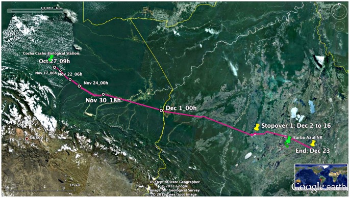
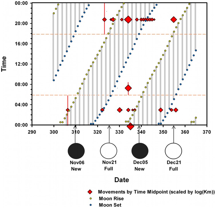
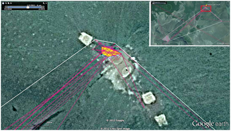
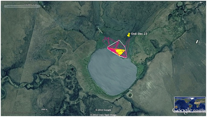
We report on the intra-Amazonian migration of a pair of Orinoco Geese (Neochen jubata) from Manú National Park, Peru. The species is Critically Endangered in Peru, so a major aim of the study was to aid conservation planning by learning the wet season location of the country's last known breeding population. We captured a breeding pair on October 27, 2010, and fitted the birds with Microwave Telemetry, Inc. GPS/Argos satellite PTT's. The pair migrated ∼655 km from Manú National Park to the Llanos de Moxos, Bolivia (Dept. of Bení) in a predominantly longitudinal migration, reaching their final destination on December 23, 2010. Major movements (>5 km per time period) were almost exclusively at night and were undertaken with and without moonlight. Foraging areas used at stopovers in the Llanos de Moxos were remarkably limited, suggesting the importance of grazing lawns maintained by the geese and other herbivores, possibly including cattle. Orinoco Geese are resident in the Llanos de Moxos year-round, so the Manú geese represent a partial migration from the Bení region. We hypothesize that cavity nest limitation explains the partial migration of Orinoco Geese from the Llanos de Moxos.
Conflict of interest statement
Figures
References
-
- Jahn AE, Levey DJ, Johnson JE, Mamani AM, Davis SE (2006) Towards a mechanistic interpretation of bird migration in South America. El Hornero 2: 99–108.
-
- Sekercioglu CH (2010) Partial migration in tropical birds: the frontier of movement ecology. J Anim Ecol 79: 933–936. - PubMed
-
- Veigl FX (2006) Noticias detalladas sobre el estado dela Provincia de Maynas en América Meridional hasta el año de 1768. Monumenta Amazónica B 11: 203–204.
-
- Kriese KD (2004) Breeding ecology of the Orinoco Goose (Neochen jubata) in the Venezuelan Llanos: the paradox of a tropical grazer. PhD Dissertation, University of California, Davis. 180 p.
-
- Wilson RP, McMahon CR (2006) Measuring devices on wild animals: what constitutes acceptable practice? Front Ecol Environ 4(3): 147–154.
Publication types
MeSH terms
LinkOut - more resources
Full Text Sources
