

Multivariate and multiscale data assimilation in terrestrial systems: a review
- PMID: 23443380
- PMCID: PMC3571784
- DOI: 10.3390/s121216291
Multivariate and multiscale data assimilation in terrestrial systems: a review
Abstract
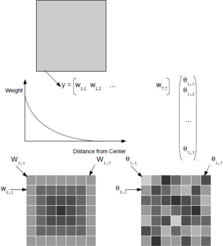
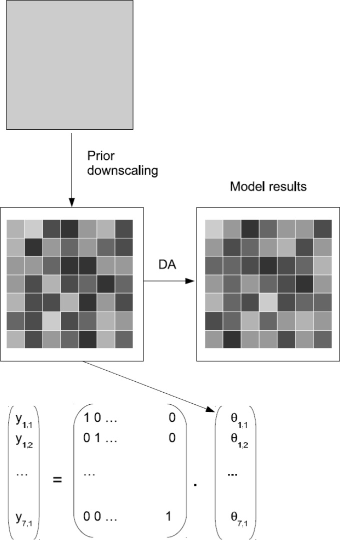
More and more terrestrial observational networks are being established to monitor climatic, hydrological and land-use changes in different regions of the World. In these networks, time series of states and fluxes are recorded in an automated manner, often with a high temporal resolution. These data are important for the understanding of water, energy, and/or matter fluxes, as well as their biological and physical drivers and interactions with and within the terrestrial system. Similarly, the number and accuracy of variables, which can be observed by spaceborne sensors, are increasing. Data assimilation (DA) methods utilize these observations in terrestrial models in order to increase process knowledge as well as to improve forecasts for the system being studied. The widely implemented automation in observing environmental states and fluxes makes an operational computation more and more feasible, and it opens the perspective of short-time forecasts of the state of terrestrial systems. In this paper, we review the state of the art with respect to DA focusing on the joint assimilation of observational data precedents from different spatial scales and different data types. An introduction is given to different DA methods, such as the Ensemble Kalman Filter (EnKF), Particle Filter (PF) and variational methods (3/4D-VAR). In this review, we distinguish between four major DA approaches: (1) univariate single-scale DA (UVSS), which is the approach used in the majority of published DA applications, (2) univariate multiscale DA (UVMS) referring to a methodology which acknowledges that at least some of the assimilated data are measured at a different scale than the computational grid scale, (3) multivariate single-scale DA (MVSS) dealing with the assimilation of at least two different data types, and (4) combined multivariate multiscale DA (MVMS). Finally, we conclude with a discussion on the advantages and disadvantages of the assimilation of multiple data types in a simulation model. Existing approaches can be used to simultaneously update several model states and model parameters if applicable. In other words, the basic principles for multivariate data assimilation are already available. We argue that a better understanding of the measurement errors for different observation types, improved estimates of observation bias and improved multiscale assimilation methods for data which scale nonlinearly is important to properly weight them in multiscale multivariate data assimilation. In this context, improved cross-validation of different data types, and increased ground truth verification of remote sensing products are required.
Figures


References
-
- Reichle R.H. Data assimilation methods in the earth sciences. Adv. Water Resour. 2008;31:1411–1418.
-
- Rayner P.J. The current state of carbon-cycle data assimilation. Curr. Opin. Env. Sustain. 2010;2:289–296.
-
- Oleson K.W., Niu G.Y., Yang Z.L., Lawrence D.M., Thornton P.E., Lawrence P.J., Stöckli R., Dickinson R.E., Bonan G.B., Levis S., et al. Improvements to the community land model and their impact on the hydrological cycle. J. Geophys. Res. 2008;113:G01021.
-
- Cohn S.E. An introduction to estimation theory. J. Meteorol. Soc. Jpn. 1997;75:257–288.
Publication types
MeSH terms
LinkOut - more resources
Full Text Sources
Other Literature Sources
