Malaria entomological risk factors in relation to land cover in the Lower Caura River Basin, Venezuela
- PMID: 23579803
- PMCID: PMC3970659
- DOI: 10.1590/0074-0276108022013015
Malaria entomological risk factors in relation to land cover in the Lower Caura River Basin, Venezuela
Abstract
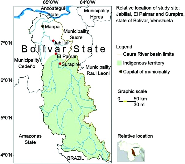
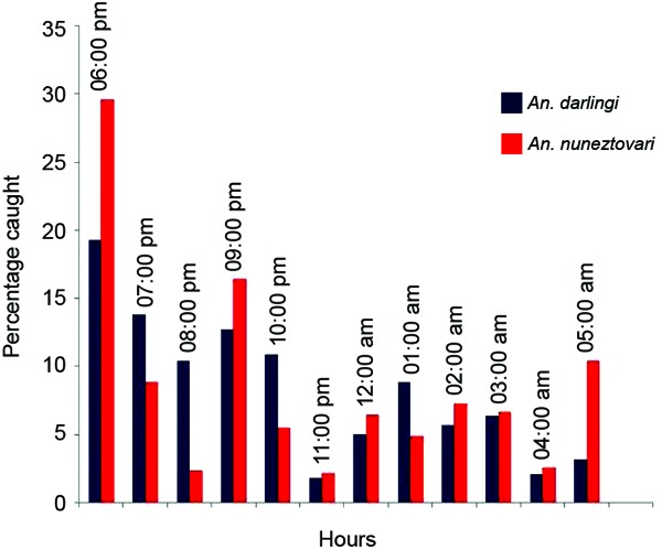
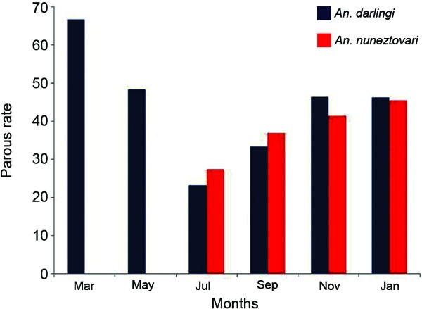
To explore the effects of deforestation and resulting differences in vegetation and land cover on entomological parameters, such as anopheline species composition, abundance, biting rate, parity and entomological inoculation rate (EIR), three villages were selected in the Lower Caura River Basin, state of Bolívar, Venezuela. All-night mosquito collections were conducted between March 2008-January 2009 using CDC light traps and Mosquito Magnet® Liberty Plus. Human landing catches were performed between 06:00 pm-10:00 pm, when anophelines were most active. Four types of vegetation were identified. The Annual Parasite Index was not correlated with the type of vegetation. The least abundantly forested village had the highest anopheline abundance, biting rate and species diversity. Anopheles darlingi and Anopheles nuneztovari were the most abundant species and were collected in all three villages. Both species showed unique biting cycles. The more abundantly forested village of El Palmar reported the highest EIR. The results confirmed previous observations that the impacts of deforestation and resulting changes in vegetation cover on malaria transmission are complex and vary locally.
Figures

References
-
- Afrane YA, Lawson BW, Githeko AK, Yan G. Effects of microclimatic changes due and land cover on the duration of gonotrophic cycles of Anopheles gambiae Giles (Diptera: Culicidae) in western Kenya highlands. J Med Entomol. 2005;42:974–980. - PubMed
-
- Bevilacqua M, Medina D, Cárdenas L. Situación de los Bosques de la Guayana, Venezuela. La cuenca del río Caura como caso de estudio. 2006. Available from: acoana.org/serie.html.
-
- Bevilacqua M, Medina DA, Cárdenas L, Rubio-Palis Y, Moreno JE, Martinez A. Orientaciones para fortalecer el programa de malaria en zonas remotas con población indígena en el Caura, Venezuela. Bol Malariol Salud Ambient. 2009;49:53–71.
Publication types
MeSH terms
LinkOut - more resources
Full Text Sources
Other Literature Sources
Medical