

Uncovering archaeological landscapes at Angkor using lidar
- PMID: 23847206
- PMCID: PMC3732978
- DOI: 10.1073/pnas.1306539110
Uncovering archaeological landscapes at Angkor using lidar
Abstract
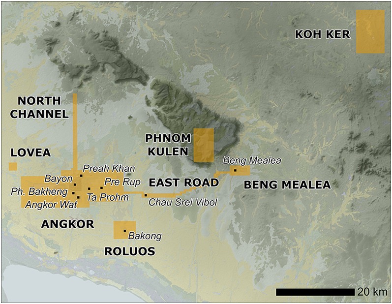
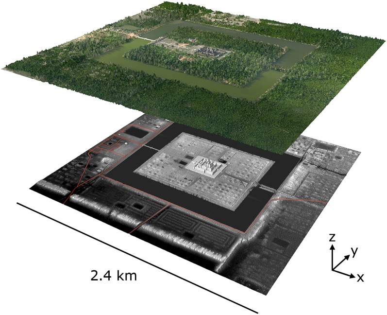
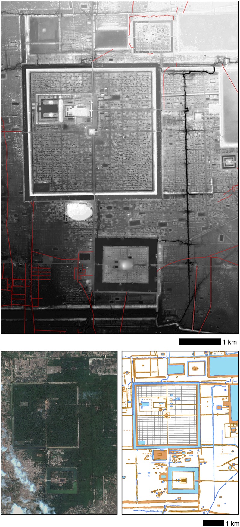
Previous archaeological mapping work on the successive medieval capitals of the Khmer Empire located at Angkor, in northwest Cambodia (∼9th to 15th centuries in the Common Era, C.E.), has identified it as the largest settlement complex of the preindustrial world, and yet crucial areas have remained unmapped, in particular the ceremonial centers and their surroundings, where dense forest obscures the traces of the civilization that typically remain in evidence in surface topography. Here we describe the use of airborne laser scanning (lidar) technology to create high-precision digital elevation models of the ground surface beneath the vegetation cover. We identify an entire, previously undocumented, formally planned urban landscape into which the major temples such as Angkor Wat were integrated. Beyond these newly identified urban landscapes, the lidar data reveal anthropogenic changes to the landscape on a vast scale and lend further weight to an emerging consensus that infrastructural complexity, unsustainable modes of subsistence, and climate variation were crucial factors in the decline of the classical Khmer civilization.
Keywords: Southeast Asia; resilience; sustainability; urbanism; water management.
Conflict of interest statement
The authors declare no conflict of interest.
Figures
References
-
- Fletcher R, Pottier C. The Gossamer city: A new inquiry. Mus Int. 2002;54(1–2):23–27.
-
- Gaucher J. Angkor Thom, une utopie réalisée? Structuration de l'espace et modèle indien d'urbanisme dans le Cambodge ancien. Arts Asiatiques. 2004;59:58–86.
-
- Pottier C (2012) Beyond the temples: Angkor and its territory. Old Myths and New Approaches: Interpreting Ancient Religious Sites in Southeast Asia, ed Haendel A (Monash University Publishing, Clayton, Melbourne, Australia), pp 12–27.
-
- Pottier C (2003) Nouvelles recherches sur l'aménagement du territoire angkorien à travers l'histoire. Comptes-rendus des séances de l'Académie des Inscriptions et Belles-Lettres 147:427–449.
Publication types
MeSH terms
LinkOut - more resources
Full Text Sources
Other Literature Sources
