

Validation of a remote sensing model to identify Simulium damnosum s.l. breeding sites in Sub-Saharan Africa
- PMID: 23936571
- PMCID: PMC3723572
- DOI: 10.1371/journal.pntd.0002342
Validation of a remote sensing model to identify Simulium damnosum s.l. breeding sites in Sub-Saharan Africa
Abstract
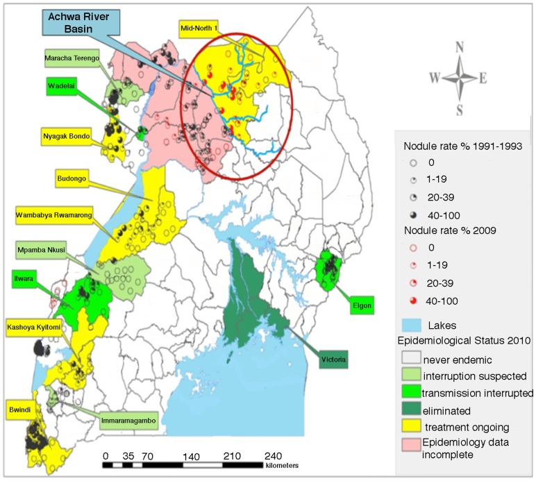
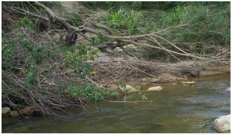
Background: Recently, most onchocerciasis control programs have begun to focus on elimination. Developing an effective elimination strategy relies upon accurately mapping the extent of endemic foci. In areas of Africa that suffer from a lack of infrastructure and/or political instability, developing such accurate maps has been difficult. Onchocerciasis foci are localized near breeding sites for the black fly vectors of the infection. The goal of this study was to conduct ground validation studies to evaluate the sensitivity and specificity of a remote sensing model developed to predict S. damnosum s.l. breeding sites.
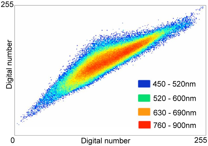
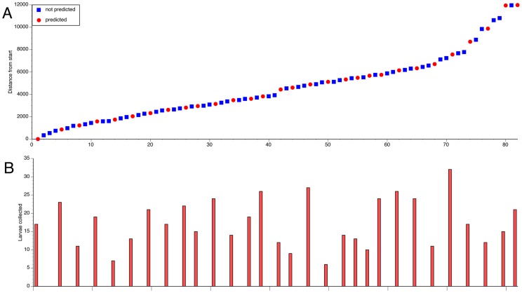
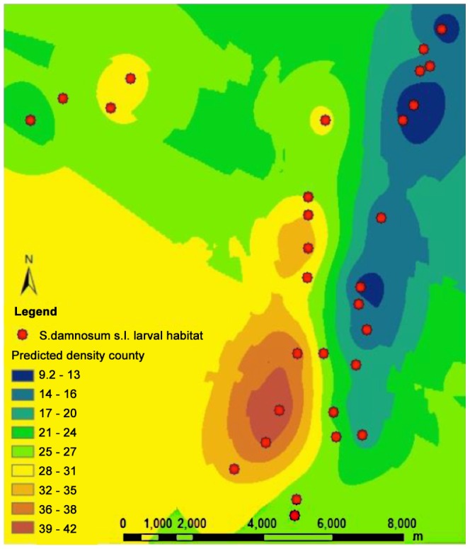
Methodology/principal findings: Remote sensing images from Togo were analyzed to identify areas containing signature characteristics of S. damnosum s.l. breeding habitat. All 30 sites with the spectral signature were found to contain S. damnosum larvae, while 0/52 other sites judged as likely to contain larvae were found to contain larvae. The model was then used to predict breeding sites in Northern Uganda. This area is hyper-endemic for onchocerciasis, but political instability had precluded mass distribution of ivermectin until 2009. Ground validation revealed that 23/25 sites with the signature contained S. damnosum larvae, while 8/10 sites examined lacking the signature were larvae free. Sites predicted to have larvae contained significantly more larvae than those that lacked the signature.
Conclusions/significance: This study suggests that a signature extracted from remote sensing images may be used to predict the location of S. damnosum s.l. breeding sites with a high degree of accuracy. This method should be of assistance in predicting communities at risk for onchocerciasis in areas of Africa where ground-based epidemiological surveys are difficult to implement.
Conflict of interest statement
The authors have declared that no competing interests exist.
Figures

References
-
- African Programme for Onchocerciasis Control (2005) Final communiqué of the 11th session of the Joint Action Forum (JAF) of APOC, Paris, France 6–9 December 2005. Ouagadougou, Burkina Faso: African Programme for Onchocerciasis Control
-
- Amazigo U, Noma M, Bump J, Benton B, Liese B, et al. (2006) Onchocerciasis. In: Jamison DT, Feachem RG, Makgoba MW, Bos ER, Baingana FK et al.., editors. Disease and Mortality in Sub-Saharan Africa. 2nd ed. Washington, DC: World Bank. - PubMed
Publication types
MeSH terms
Grants and funding
LinkOut - more resources
Full Text Sources
Other Literature Sources
