

Using Google Street View for systematic observation of the built environment: analysis of spatio-temporal instability of imagery dates
- PMID: 24298903
- PMCID: PMC3923560
- DOI: 10.1186/1476-072X-12-53
Using Google Street View for systematic observation of the built environment: analysis of spatio-temporal instability of imagery dates
Abstract
Background: Recently, Google Street View (GSV) has been examined as a tool for remotely conducting systematic observation of the built environment. Studies have found it offers benefits over in-person audits, including efficiency, safety, cost, and the potential to expand built environment research to larger areas and more places globally. However, one limitation has been the lack of documentation on the date of imagery collection. In 2011, Google began placing a date stamp on images which now enables investigation of this concern. This study questions the spatio-temporal stability in the GSV date stamp. Specifically, is the imagery collected contemporaneously? If not, how frequently and where is imagery from different time periods woven together to represent environmental conditions in a particular place. Furthermore, how much continuity exists in imagery for a particular time period? Answering these questions will provide guidance on the use of GSV as a tool for built environment audits.
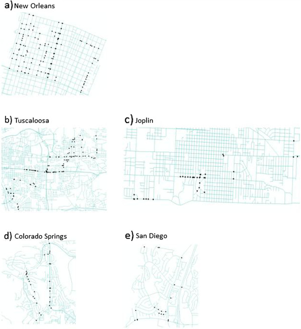
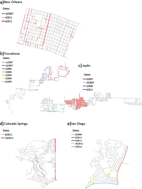
Methods: GSV was used to virtually "drive" five sites that are a part of the authors' ongoing studies. Each street in the sites was "driven" one mouse-click at a time while observing the date stamp on each image. Every time the date stamp changed, this "disruption" was marked on the map. Every street segment in the site was coded by the date the imagery for that segment was collected. Spatial query and descriptive statistics were applied to understand the spatio-temporal patterns of imagery dates.
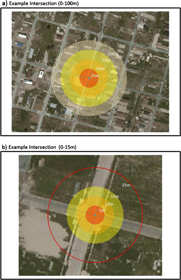
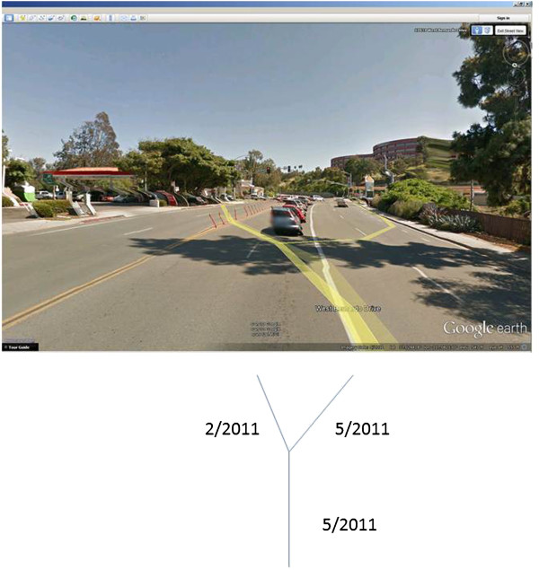
Results: Spatio-temporal instability is present in the dates of GSV imagery. Of the 353 disruptions, 82.4% occur close to (<25 m) intersections. The remainder occurs inconsistently in other locations. The extent of continuity for a set of images collected with the same date stamp ranged from 3.13 m to 3373.06 m, though the majority of continuous segments were less than 400 m.
Conclusion: GSV offers some benefits over traditional built environment audits. However, this investigation empirically identifies a previously undocumented limitation in its application for research. Imagery dates can change often and without warning. Caution should be used at intersections where these disruptions are most likely to occur, though caution should be used everywhere when using GSV as a data collection tool.
Figures
References
MeSH terms
LinkOut - more resources
Full Text Sources
Other Literature Sources
Medical
