

Predicting pre-Columbian anthropogenic soils in Amazonia
- PMID: 24403329
- PMCID: PMC3896013
- DOI: 10.1098/rspb.2013.2475
Predicting pre-Columbian anthropogenic soils in Amazonia
Abstract
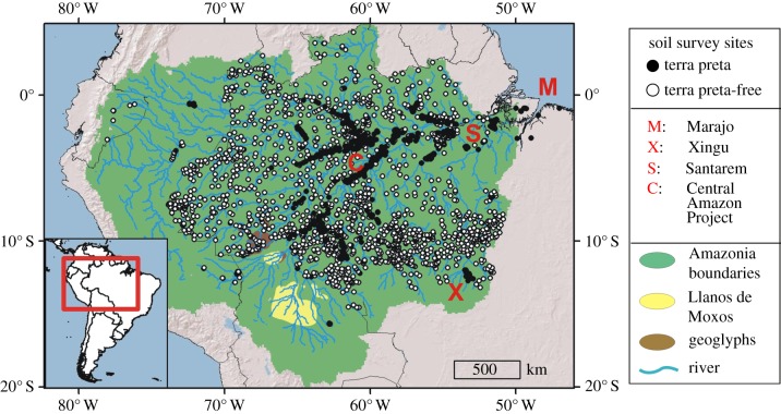
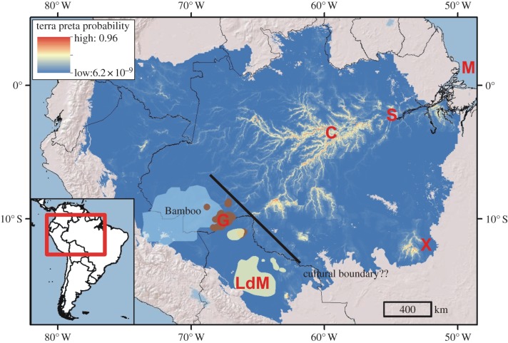
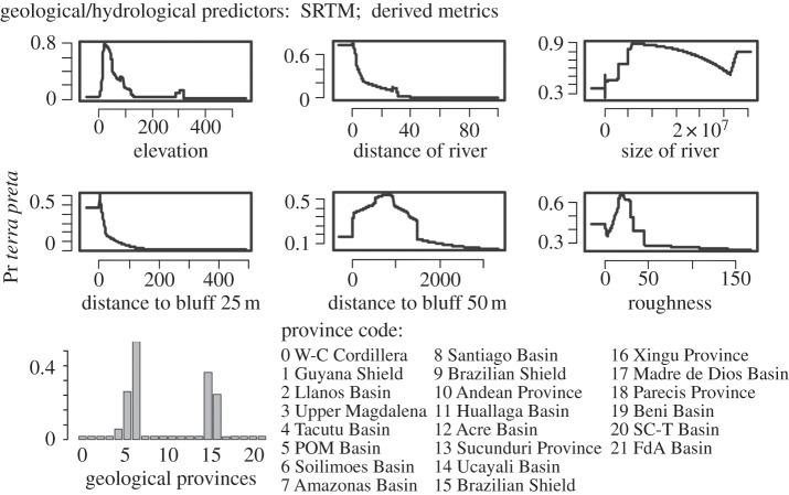
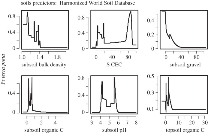
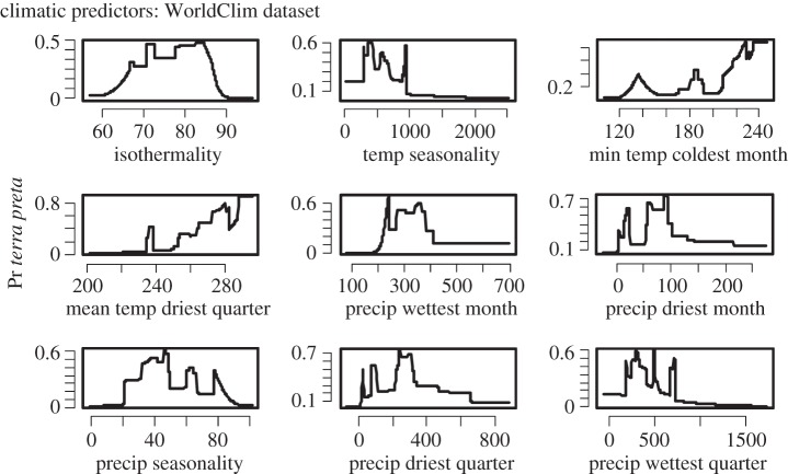
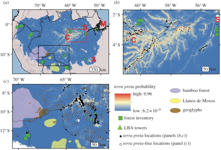
The extent and intensity of pre-Columbian impacts on lowland Amazonia have remained uncertain and controversial. Various indicators can be used to gauge the impact of pre-Columbian societies, but the formation of nutrient-enriched terra preta soils has been widely accepted as an indication of long-term settlement and site fidelity. Using known and newly discovered terra preta sites and maximum entropy algorithms (Maxent), we determined the influence of regional environmental conditions on the likelihood that terra pretas would have been formed at any given location in lowland Amazonia. Terra pretas were most frequently found in central and eastern Amazonia along the lower courses of the major Amazonian rivers. Terrain, hydrologic and soil characteristics were more important predictors of terra preta distributions than climatic conditions. Our modelling efforts indicated that terra pretas are likely to be found throughout ca 154 063 km(2) or 3.2% of the forest. We also predict that terra preta formation was limited in most of western Amazonia. Model results suggested that the distribution of terra preta was highly predictable based on environmental parameters. We provided targets for future archaeological surveys under the vast forest canopy and also highlighted how few of the long-term forest inventory sites in Amazonia are able to capture the effects of historical disturbance.
Keywords: Amazonia; anthrosols; maxent algorithms; modified soils; pre-Columbian impacts; terra preta.
Figures
References
-
- Erickson CL. 2006. The domesticated landscapes of the Bolivian Amazon. In Time and complexity in historical ecology (eds Balee W, Erickson CL.), pp. 235–278 New York, NY: Columbia University Press
-
- Heckenberger M, Russell J, Fausto C, Toney J, Schmidt M, Pereira E, Franchetto B, Kuikuro A. 2008. Pre-Columbian urbanism, anthropogenic landscapes, and the future of the Amazon. Science 321, 1214–1217 (doi:10.1126/science.1159769) - DOI - PubMed
-
- Pärssinen M, Schaan D, Ranzi A. 2009. Pre-Columbian geometric earthworks in the upper Purús: a complex society in western Amazonia. Antiquity 83, 1084–1095
-
- Neves E, Petersen J. 2006. Political economy and pre-Columbian landscape transformation in central Amazonia. In Time and complexity in historical ecology: studies in the neotropical lowlands (eds Balee W, Erickson CL.), pp. 279–310 New York, NY: Columbia University Press
-
- Glaser B, Woods WI. 2004. Amazonian dark earths: explorations in space and time. Berlin, Germany: Springer
Publication types
MeSH terms
Substances
LinkOut - more resources
Full Text Sources
Other Literature Sources