

Comparing supervised and unsupervised multiresolution segmentation approaches for extracting buildings from very high resolution imagery
- PMID: 25284960
- PMCID: PMC4183749
- DOI: 10.1016/j.isprsjprs.2014.07.002
Comparing supervised and unsupervised multiresolution segmentation approaches for extracting buildings from very high resolution imagery
Abstract
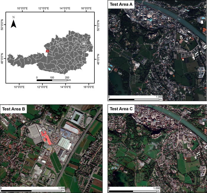
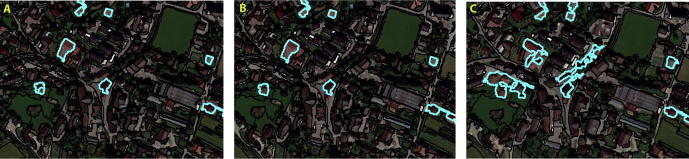
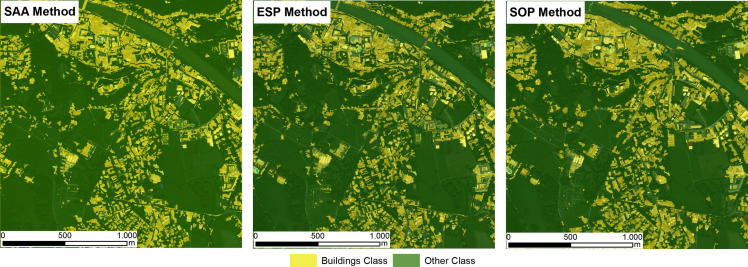
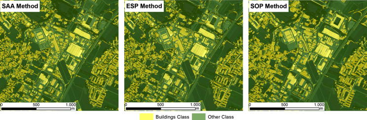
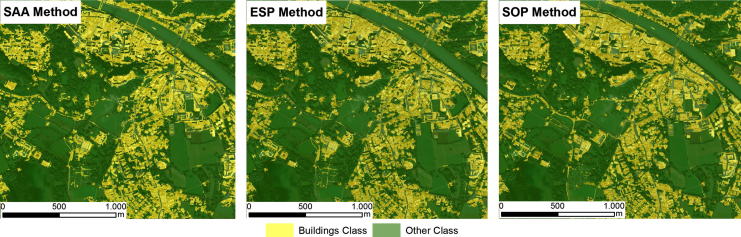
Although multiresolution segmentation (MRS) is a powerful technique for dealing with very high resolution imagery, some of the image objects that it generates do not match the geometries of the target objects, which reduces the classification accuracy. MRS can, however, be guided to produce results that approach the desired object geometry using either supervised or unsupervised approaches. Although some studies have suggested that a supervised approach is preferable, there has been no comparative evaluation of these two approaches. Therefore, in this study, we have compared supervised and unsupervised approaches to MRS. One supervised and two unsupervised segmentation methods were tested on three areas using QuickBird and WorldView-2 satellite imagery. The results were assessed using both segmentation evaluation methods and an accuracy assessment of the resulting building classifications. Thus, differences in the geometries of the image objects and in the potential to achieve satisfactory thematic accuracies were evaluated. The two approaches yielded remarkably similar classification results, with overall accuracies ranging from 82% to 86%. The performance of one of the unsupervised methods was unexpectedly similar to that of the supervised method; they identified almost identical scale parameters as being optimal for segmenting buildings, resulting in very similar geometries for the resulting image objects. The second unsupervised method produced very different image objects from the supervised method, but their classification accuracies were still very similar. The latter result was unexpected because, contrary to previously published findings, it suggests a high degree of independence between the segmentation results and classification accuracy. The results of this study have two important implications. The first is that object-based image analysis can be automated without sacrificing classification accuracy, and the second is that the previously accepted idea that classification is dependent on segmentation is challenged by our unexpected results, casting doubt on the value of pursuing 'optimal segmentation'. Our results rather suggest that as long as under-segmentation remains at acceptable levels, imperfections in segmentation can be ruled out, so that a high level of classification accuracy can still be achieved.
Keywords: Buildings; OBIA; OpenStreetMap; Random forest classifier; Supervised segmentation; Unsupervised segmentation.
Figures
References
-
- Anders N.S., Seijmonsbergen A.C., Bouten W. Segmentation optimization and stratified object-based analysis for semi-automated geomorphological mapping. Remote Sens. Environ. 2011;115:2976–2985.
-
- Arvor D., Durieux L., Andrés S., Laporte M.-A. Advances in geographic object-based image analysis with ontologies: a review of main contributions and limitations from a remote sensing perspective. ISPRS J. Photogrammetry Remote Sens. 2013;82:125–137.
-
- Baatz M., Schäpe A. In: Angewandte Geographische Informations-Verarbeitung XII. Strobl J., Blaschke T., Griesebner G., editors. Wichmann Verlag; Karlsruhe, Germany: 2000. Multiresolution segmentation – an optimization approach for high quality multi-scale image segmentation; pp. 12–23.
-
- Benz U.C., Hofmann P., Willhauck G., Lingenfelder I., Heynen M. Multi-resolution, object-oriented fuzzy analysis of remote sensing data for GIS-ready information. ISPRS J. Photogrammetry Remote Sens. 2004;58:239–258.
LinkOut - more resources
Full Text Sources
Other Literature Sources