

Entropy, complexity, and spatial information
- PMID: 25309123
- PMCID: PMC4179993
- DOI: 10.1007/s10109-014-0202-2
Entropy, complexity, and spatial information
Abstract
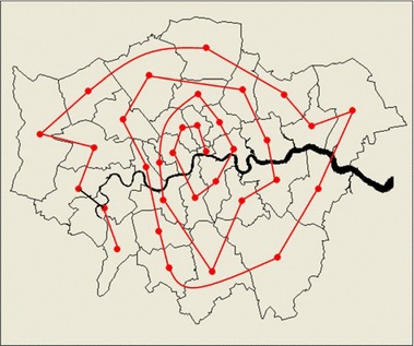
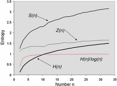
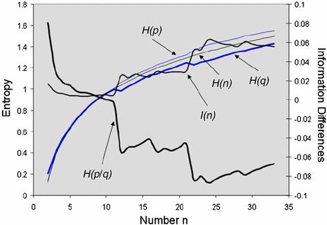
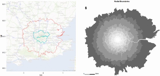
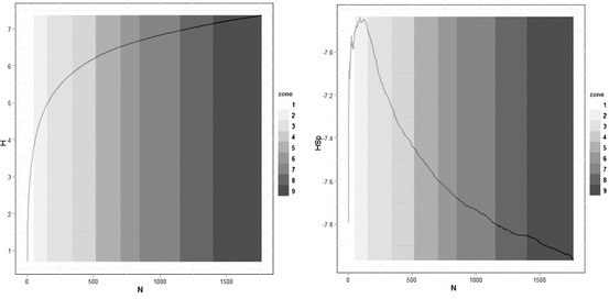
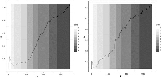
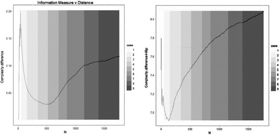
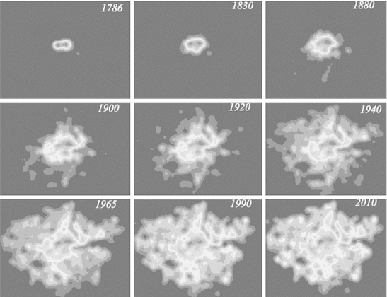
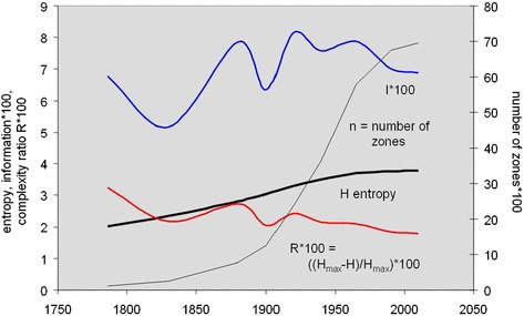
We pose the central problem of defining a measure of complexity, specifically for spatial systems in general, city systems in particular. The measures we adopt are based on Shannon's (in Bell Syst Tech J 27:379-423, 623-656, 1948) definition of information. We introduce this measure and argue that increasing information is equivalent to increasing complexity, and we show that for spatial distributions, this involves a trade-off between the density of the distribution and the number of events that characterize it; as cities get bigger and are characterized by more events-more places or locations, information increases, all other things being equal. But sometimes the distribution changes at a faster rate than the number of events and thus information can decrease even if a city grows. We develop these ideas using various information measures. We first demonstrate their applicability to various distributions of population in London over the last 100 years, then to a wider region of London which is divided into bands of zones at increasing distances from the core, and finally to the evolution of the street system that characterizes the built-up area of London from 1786 to the present day. We conclude by arguing that we need to relate these measures to other measures of complexity, to choose a wider array of examples, and to extend the analysis to two-dimensional spatial systems.
Keywords: Density; Entropy; Information; London population; London street system; Spatial complexity.
Figures
References
-
- Anderson PW. More and different: notes from a thoughtful Curmudgeon. Singapore: World Scientific; 2011.
-
- Badii R, Politi A. Complexity. Cambridge: Cambridge University Press; 1997.
-
- Batty M. Spatial entropy. Geogr Anal. 1974;6(1):1–31. doi: 10.1111/j.1538-4632.1974.tb01014.x. - DOI
-
- Batty M. Entropy in spatial aggregation. Geogr Anal. 1976;8(1):1–21. doi: 10.1111/j.1538-4632.1976.tb00525.x. - DOI
LinkOut - more resources
Full Text Sources
Other Literature Sources