

Elephant movement closely tracks precipitation-driven vegetation dynamics in a Kenyan forest-savanna landscape
- PMID: 25520813
- PMCID: PMC4267703
- DOI: 10.1186/2051-3933-2-2
Elephant movement closely tracks precipitation-driven vegetation dynamics in a Kenyan forest-savanna landscape
Abstract
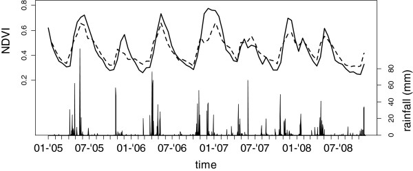
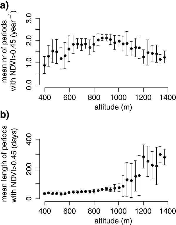
Background: This study investigates the ranging behavior of elephants in relation to precipitation-driven dynamics of vegetation. Movement data were acquired for five bachelors and five female family herds during three years in the Marsabit protected area in Kenya and changes in vegetation were mapped using MODIS normalized difference vegetation index time series (NDVI). In the study area, elevations of 650 to 1100 m.a.s.l experience two growth periods per year, while above 1100 m.a.s.l. growth periods last a year or longer.
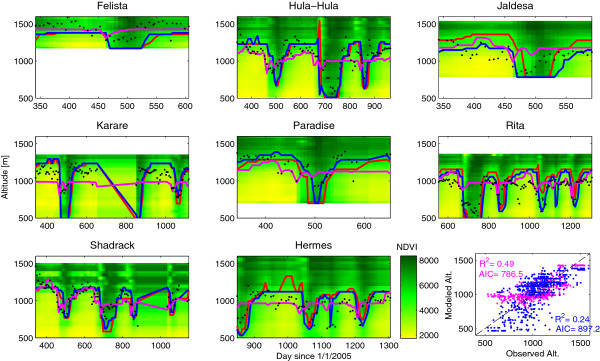
Results: We find that elephants respond quickly to changes in forage and water availability, making migrations in response to both large and small rainfall events. The elevational migration of individual elephants closely matched the patterns of greening and senescing of vegetation in their home range. Elephants occupied lower elevations when vegetation activity was high, whereas they retreated to the evergreen forest at higher elevations while vegetation senesced. Elephant home ranges decreased in size, and overlapped less with increasing elevation.
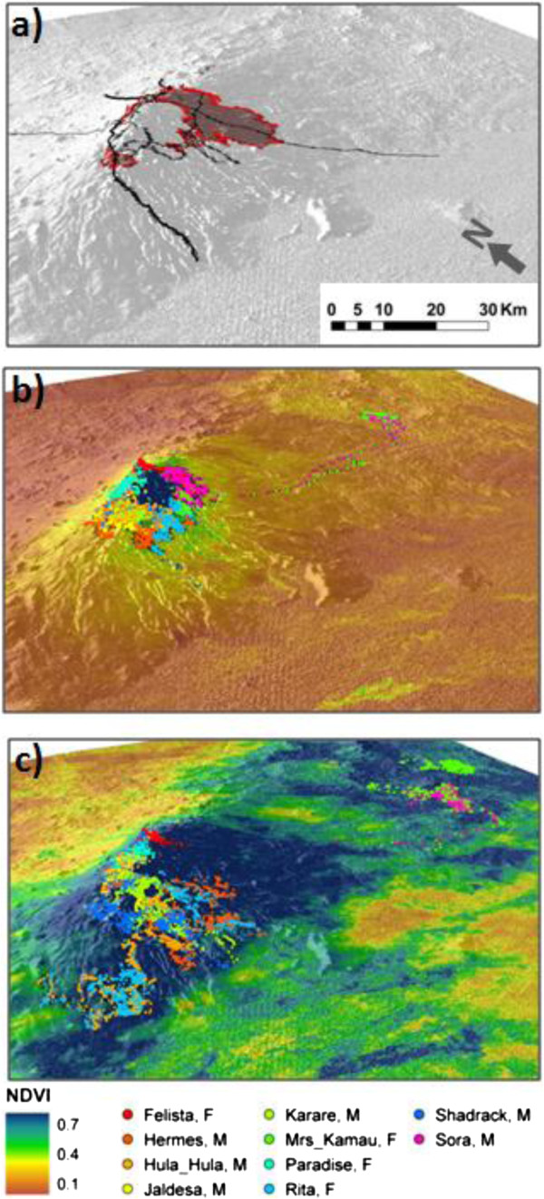
Conclusions: A recent hypothesis that ungulate migrations in savannas result from countervailing seasonally driven rainfall and fertility gradients is demonstrated, and extended to shorter-distance migrations. In other words, the trade-off between the poor forage quality and accessibility in the forest with its year-round water sources on the one hand and the higher quality forage in the low-elevation scrubland with its seasonal availability of water on the other hand, drives the relatively short migrations (the two main corridors are 20 and 90 km) of the elephants. In addition, increased intra-specific competition appears to influence the animals' habitat use during the dry season indicating that the human encroachment on the forest is affecting the elephant population.
Keywords: Human-elephant conflict; NDVI; Rainfall; Remote sensing; Seasonality.
Figures
References
-
- Berger J. The last mile: how to sustain long-distance migration in mammals. Conserv Biol. 2004;18:320–331. doi: 10.1111/j.1523-1739.2004.00548.x. - DOI
-
- Thirgood S, Mosser A, Tham S, Hopcraft G, Mwangomo E, Mlengeya T, Kilewo M, Fryxell J, Sinclair ARE, Borner M. Can parks protect migratory ungulates? The case of the Serengeti wildebeest. Anim Conservat. 2004;7:113–120. doi: 10.1017/S1367943004001404. - DOI
-
- Bolger DT, Newmark WD, Morrison TA, Doak DF. The need for integrative approaches to understand and conserve migratory ungulates. Ecol Lett. 2008;11:63–77. - PubMed
-
- Harris G, Thirgood S, Hopcraft JG, Cromsigt JPGM, Berger J. Global decline in aggregated migrations of large terrestrial mammals. Endangered Species Research. 2009;7:55–76. doi: 10.3354/esr00173. - DOI
LinkOut - more resources
Full Text Sources
Other Literature Sources
