

Deriving Animal Behaviour from High-Frequency GPS: Tracking Cows in Open and Forested Habitat
- PMID: 26107643
- PMCID: PMC4479590
- DOI: 10.1371/journal.pone.0129030
Deriving Animal Behaviour from High-Frequency GPS: Tracking Cows in Open and Forested Habitat
Abstract
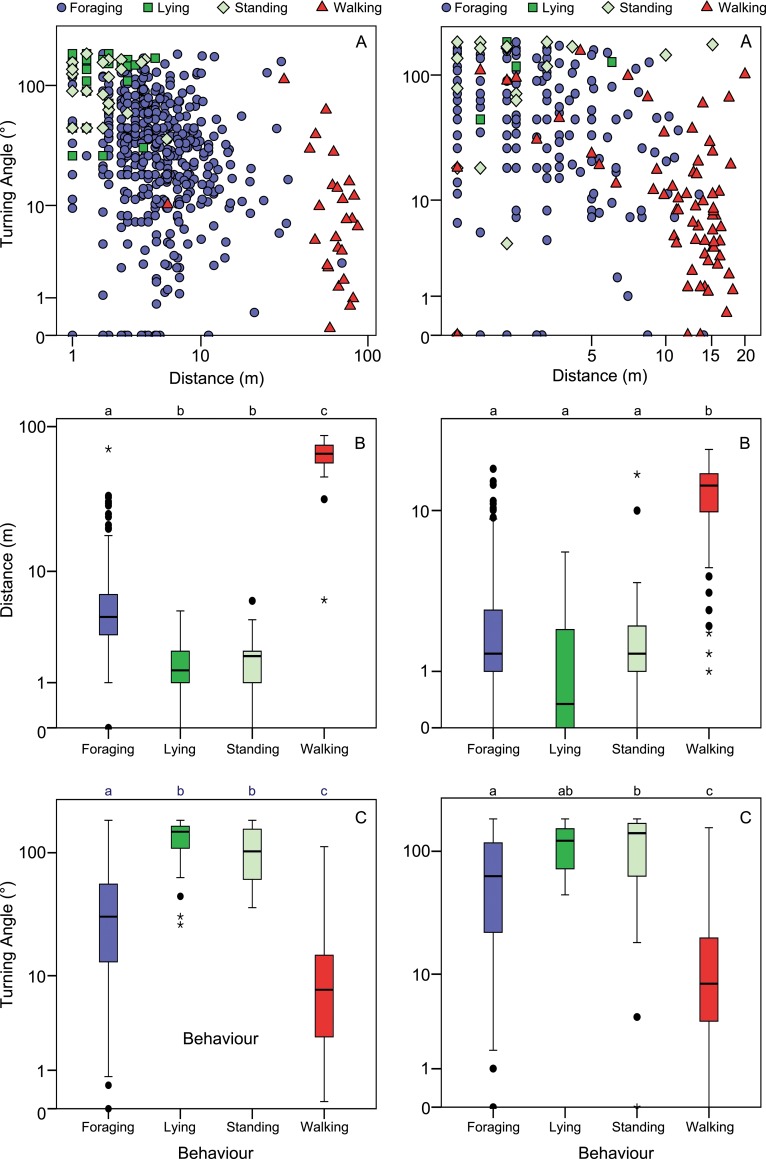
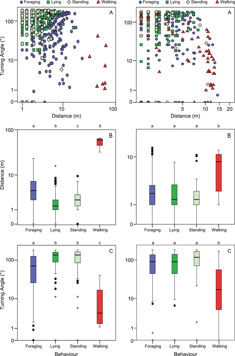
The increasing spatiotemporal accuracy of Global Navigation Satellite Systems (GNSS) tracking systems opens the possibility to infer animal behaviour from tracking data. We studied the relationship between high-frequency GNSS data and behaviour, aimed at developing an easily interpretable classification method to infer behaviour from location data. Behavioural observations were carried out during tracking of cows (Bos Taurus) fitted with high-frequency GPS (Global Positioning System) receivers. Data were obtained in an open field and forested area, and movement metrics were calculated for 1 min, 12 s and 2 s intervals. We observed four behaviour types (Foraging, Lying, Standing and Walking). We subsequently used Classification and Regression Trees to classify the simultaneously obtained GPS data as these behaviour types, based on distances and turning angles between fixes. GPS data with a 1 min interval from the open field was classified correctly for more than 70% of the samples. Data from the 12 s and 2 s interval could not be classified successfully, emphasizing that the interval should be long enough for the behaviour to be defined by its characteristic movement metrics. Data obtained in the forested area were classified with a lower accuracy (57%) than the data from the open field, due to a larger positional error of GPS locations and differences in behavioural performance influenced by the habitat type. This demonstrates the importance of understanding the relationship between behaviour and movement metrics, derived from GNSS fixes at different frequencies and in different habitats, in order to successfully infer behaviour. When spatially accurate location data can be obtained, behaviour can be inferred from high-frequency GNSS fixes by calculating simple movement metrics and using easily interpretable decision trees. This allows for the combined study of animal behaviour and habitat use based on location data, and might make it possible to detect deviations in behaviour at the individual level.
Conflict of interest statement
Figures
References
-
- Cumming GS, Gaidet N, Ndlovu M. Towards a unification of movement ecology and biogeography: conceptual framework and a case study on Afrotropical ducks. J Biogeogr. 2012; 39: 1401–1411.
-
- Bouten W, Baaij EW, Shamoun-Baranes J, Camphuysen KCJ. A flexible GPS tracking system for studying bird behaviour at multiple scales. J Ornithol 2013; 154: 571–580.
Publication types
MeSH terms
LinkOut - more resources
Full Text Sources
Other Literature Sources
