

Sea surface temperature and salinity from French research vessels, 2001-2013
- PMID: 26504523
- PMCID: PMC4603393
- DOI: 10.1038/sdata.2015.54
Sea surface temperature and salinity from French research vessels, 2001-2013
Abstract
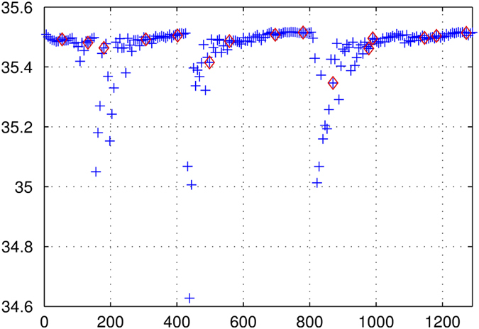
French Research vessels have been collecting thermo-salinometer (TSG) data since 1999 to contribute to the Global Ocean Surface Underway Data (GOSUD) programme. The instruments are regularly calibrated and continuously monitored. Water samples are taken on a daily basis by the crew and later analysed in the laboratory. We present here the delayed mode processing of the 2001-2013 dataset and an overview of the resulting quality. Salinity measurement error was a few hundredths of a unit or less on the practical salinity scale (PSS), due to careful calibration and instrument maintenance, complemented with a rigorous adjustment on water samples. In a global comparison, these data show excellent agreement with an ARGO-based salinity gridded product. The Sea Surface Salinity and Temperature from French REsearch SHips (SSST-FRESH) dataset is very valuable for the 'calibration and validation' of the new satellite observations delivered by the Soil Moisture and Ocean Salinity (SMOS) and Aquarius missions.
Conflict of interest statement
The authors declare no competing financial interests.
Figures


References
Data Citations
-
- Gaillard F. 2015. Pôle Océan. http://doi.org/z79
-
- Gaillard F. 2015. Pôle Océan. http://doi.org/z77
References
-
- Durack P. J., Wijffels S. E. & Matear R. J. Ocean salinities reveal strong global water cycle intensification during 1950 to 2000. Science 336, 455–458 (2012). - PubMed
-
- Roemmich D. et al. Argo: The Challenge of Continuing 10 Years of Progress. Oceanography 22, 46–55 (2009).
-
- Lee T., Lagerloef G., Gierach M., Kao H.-Y., Yueh S. & Dohan K. Aquarius reveals salinity structure of tropical instability waves. Geophys. Res. Lett. 39, L12610 (2012).
-
- Maes C., Dewitte B., Sudre J., Garçon V. & Varillon D. Small-scale features of temperature and salinity surface fields in the Coral Sea: Small-Scale Features in the Coral Sea. J. Geophys. Res. Oceans 118, 5426–5438 (2013).
-
- Foltz G. R., Schmid C. & Lumpkin R. Transport of Surface Freshwater from the Equatorial to the Subtropical North Atlantic Ocean. J. Phys. Oceanogr. 45, 1086–1102 (2015).
Publication types
LinkOut - more resources
Full Text Sources
Other Literature Sources
Miscellaneous
