

Automated Identification of River Hydromorphological Features Using UAV High Resolution Aerial Imagery
- PMID: 26556355
- PMCID: PMC4701264
- DOI: 10.3390/s151127969
Automated Identification of River Hydromorphological Features Using UAV High Resolution Aerial Imagery
Abstract
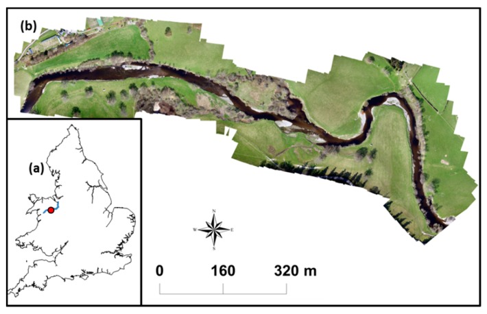
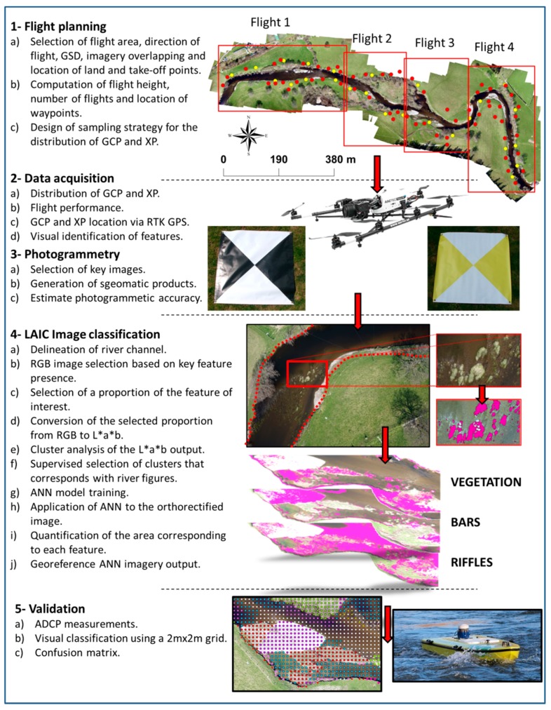
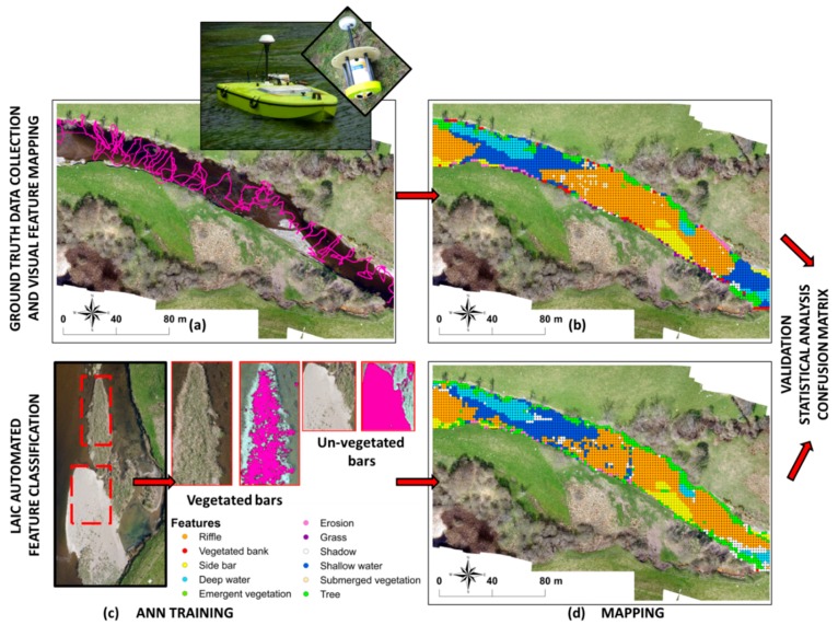
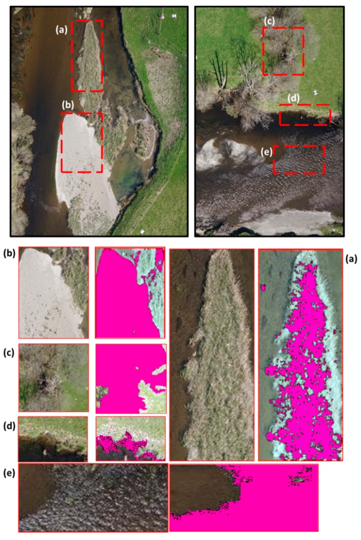
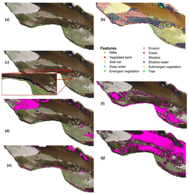
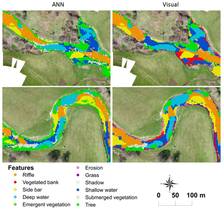
European legislation is driving the development of methods for river ecosystem protection in light of concerns over water quality and ecology. Key to their success is the accurate and rapid characterisation of physical features (i.e., hydromorphology) along the river. Image pattern recognition techniques have been successfully used for this purpose. The reliability of the methodology depends on both the quality of the aerial imagery and the pattern recognition technique used. Recent studies have proved the potential of Unmanned Aerial Vehicles (UAVs) to increase the quality of the imagery by capturing high resolution photography. Similarly, Artificial Neural Networks (ANN) have been shown to be a high precision tool for automated recognition of environmental patterns. This paper presents a UAV based framework for the identification of hydromorphological features from high resolution RGB aerial imagery using a novel classification technique based on ANNs. The framework is developed for a 1.4 km river reach along the river Dee in Wales, United Kingdom. For this purpose, a Falcon 8 octocopter was used to gather 2.5 cm resolution imagery. The results show that the accuracy of the framework is above 81%, performing particularly well at recognising vegetation. These results leverage the use of UAVs for environmental policy implementation and demonstrate the potential of ANNs and RGB imagery for high precision river monitoring and river management.
Keywords: Artificial Neural Network; Unmanned Aerial Vehicle; feature recognition; hydromorphology; photogrammetry.
Figures
References
-
- European Commission Directive 2000/60/EC of the European Parliament and of the Council of 23 October 2000 establishing a framework for community action in the field of water policy. Off. J. Eur. Union. 2000;327:1–72.
-
- European Commission Council Regulation (EC) No 1100/2007 of 18 September 2007 establishing measures for the recovery of the stock of European eel. Off. J. Eur. Communities. 2007;248:17–23.
-
- Russi D., ten Brink P., Farmer A., Badura R., Coates D., Förster J., Kumar R., Davidson N. The Economics of Ecosystems and Biodiversity for Water and Wetlands. Institute for European Environmental Policy; London, UK: 2013.
-
- Rinaldi M., Belleti B., van de Bund W., Bertoldi W., Gurnell A., Buijse T., Mosselman E. Review on Eco-Hydromorphological Methods. Deliverable 1.1, REFORM (REstoring Rivers for Effective Catchment Management) European Commission; Belgium, Germany: 2013.
-
- LAWA . Gewasserstrukturgutekartierung in der Bundesrepublik Deutschland—Ubersichtsverfahren. Empfehlungen Oberirdische Gewasser. Landerarbeitsgemeinschaft Wasser; Schwerin, Germany: 2002.
LinkOut - more resources
Full Text Sources
Other Literature Sources
