

Using Geographic Information Systems and Spatial Analysis Methods to Assess Household Water Access and Sanitation Coverage in the SHINE Trial
- PMID: 26602299
- PMCID: PMC4657592
- DOI: 10.1093/cid/civ847
Using Geographic Information Systems and Spatial Analysis Methods to Assess Household Water Access and Sanitation Coverage in the SHINE Trial
Abstract
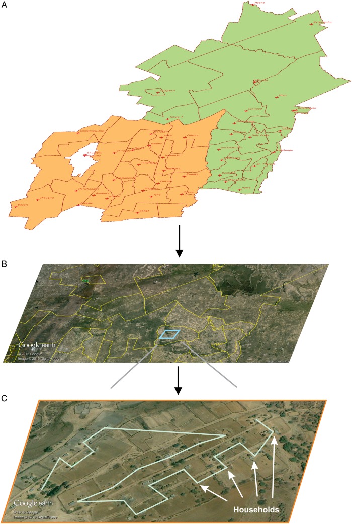
Access to water and sanitation are important determinants of behavioral responses to hygiene and sanitation interventions. We estimated cluster-specific water access and sanitation coverage to inform a constrained randomization technique in the SHINE trial. Technicians and engineers inspected all public access water sources to ascertain seasonality, function, and geospatial coordinates. Households and water sources were mapped using open-source geospatial software. The distance from each household to the nearest perennial, functional, protected water source was calculated, and for each cluster, the median distance and the proportion of households within <500 m and >1500 m of such a water source. Cluster-specific sanitation coverage was ascertained using a random sample of 13 households per cluster. These parameters were included as covariates in randomization to optimize balance in water and sanitation access across treatment arms at the start of the trial. The observed high variability between clusters in both parameters suggests that constraining on these factors was needed to reduce risk of bias.
Keywords: geographic information systems; georeferenced dataset; spatial analysis; water access; water coverage.
© The Author 2015. Published by Oxford University Press for the Infectious Diseases Society of America.
Figures


References
-
- United Nations. The human right to water and sanitation. New York: UN General Assemly, 2010. Available at: http://daccess-dds-ny.un.org/doc/UNDOC/GEN/N09/479/35/PDF/N0947935.pdf?O.... Accessed 3 October 2015.
-
- United Nations. Human rights and access to safe drinking water and sanitation; Human Rights Council. New York: United Nations, 2011. Available at: http://daccess-dds-ny.un.org/doc/RESOLUTION/GEN/G11/124/85/PDF/G1112485..... Accessed 3 October 2015.
-
- World Health Organization. WHO/UNICEF joint monitoring programme. Geneva, Switzerland: WHO, 2015. Available at: http://www.wssinfo.org/. Accessed 3 October 2015.
Publication types
MeSH terms
Grants and funding
LinkOut - more resources
Full Text Sources
Other Literature Sources
Medical
