Editorial
doi: 10.2105/AJPH.2015.302951.
Protecting Personally Identifiable Information When Using Online Geographic Tools for Public Health Research
Affiliations
- PMID: 26794375
- PMCID: PMC4815822
- DOI: 10.2105/AJPH.2015.302951
Item in Clipboard
Editorial
Protecting Personally Identifiable Information When Using Online Geographic Tools for Public Health Research
Am J Public Health.
2016 Feb.
No abstract available
Figures
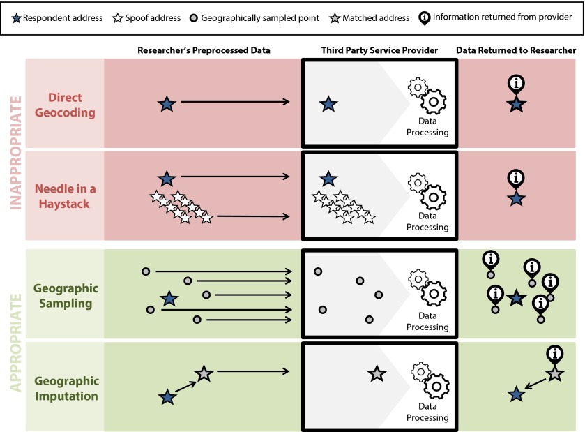
Using online geographic services appropriately—maintaining study participant confidentiality while using online geographic services to gather contextual data.
References
-
- adaptlab. Google Street View Project. Available at: http://69.89.27.208/∼adaptlab/gallery/104-2. Accessed March 6, 2015.
-
- Petitcolas FAP, Anderson RJ, Kuhn MG. Information hiding—a survey. Proc IEEE. 1999;87(7):1062–1078.
-
- Scarfone K. Guide to General Server Security: Recommendations of the National Institute of Standards and Technology. Diane Publishing; Collingdale, PA: 2009.
Publication types
MeSH terms
Grants and funding
LinkOut - more resources
Full Text Sources
Other Literature Sources