

Modeling Caribou Movements: Seasonal Ranges and Migration Routes of the Central Arctic Herd
- PMID: 27045587
- PMCID: PMC4821536
- DOI: 10.1371/journal.pone.0150333
Modeling Caribou Movements: Seasonal Ranges and Migration Routes of the Central Arctic Herd
Abstract
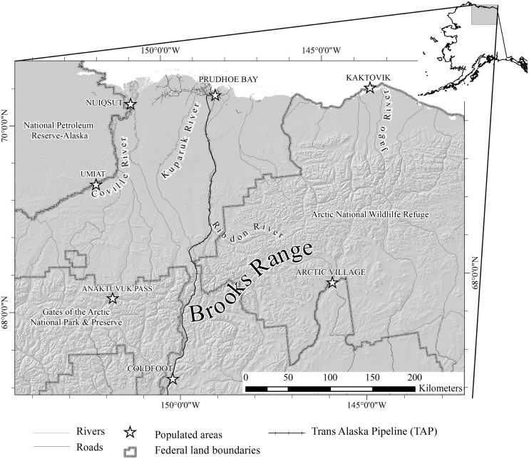
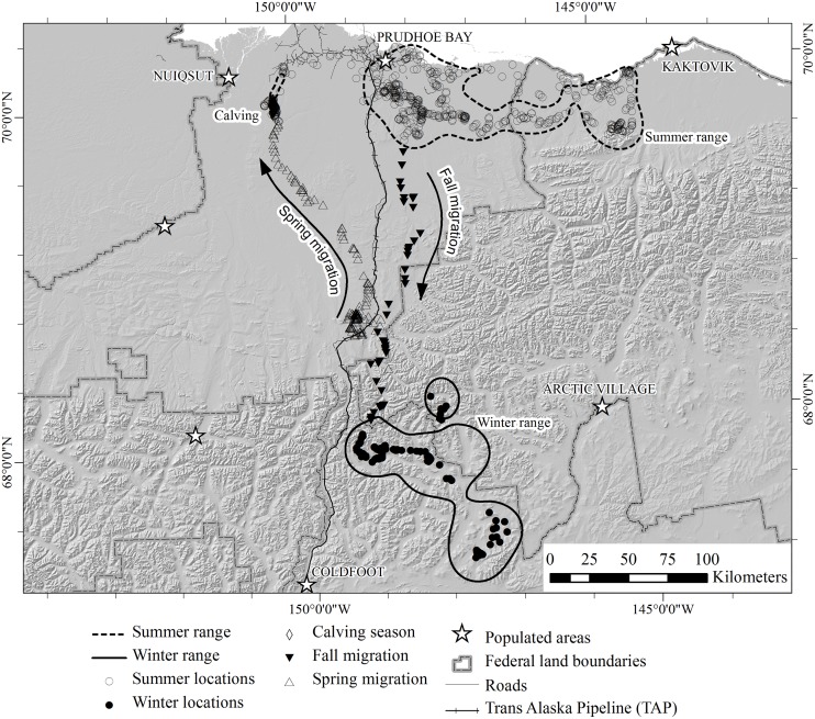
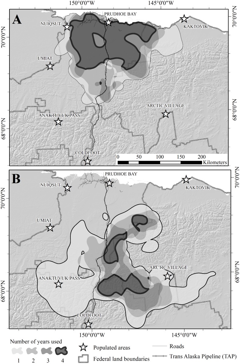
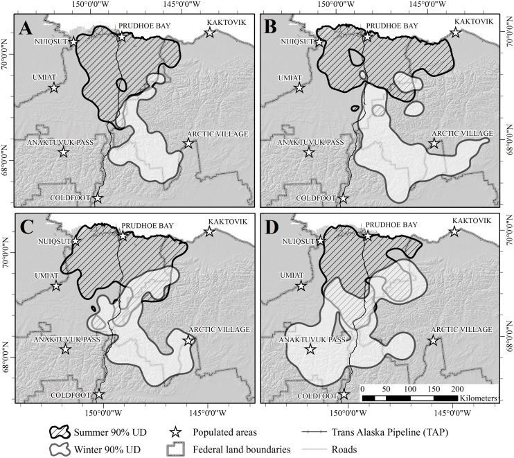
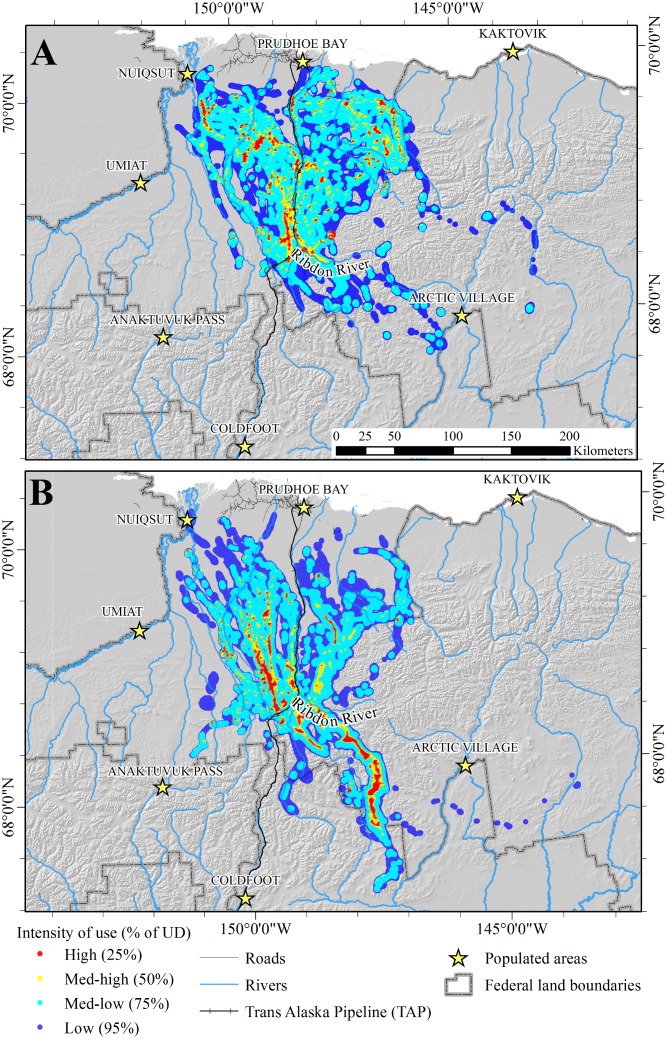
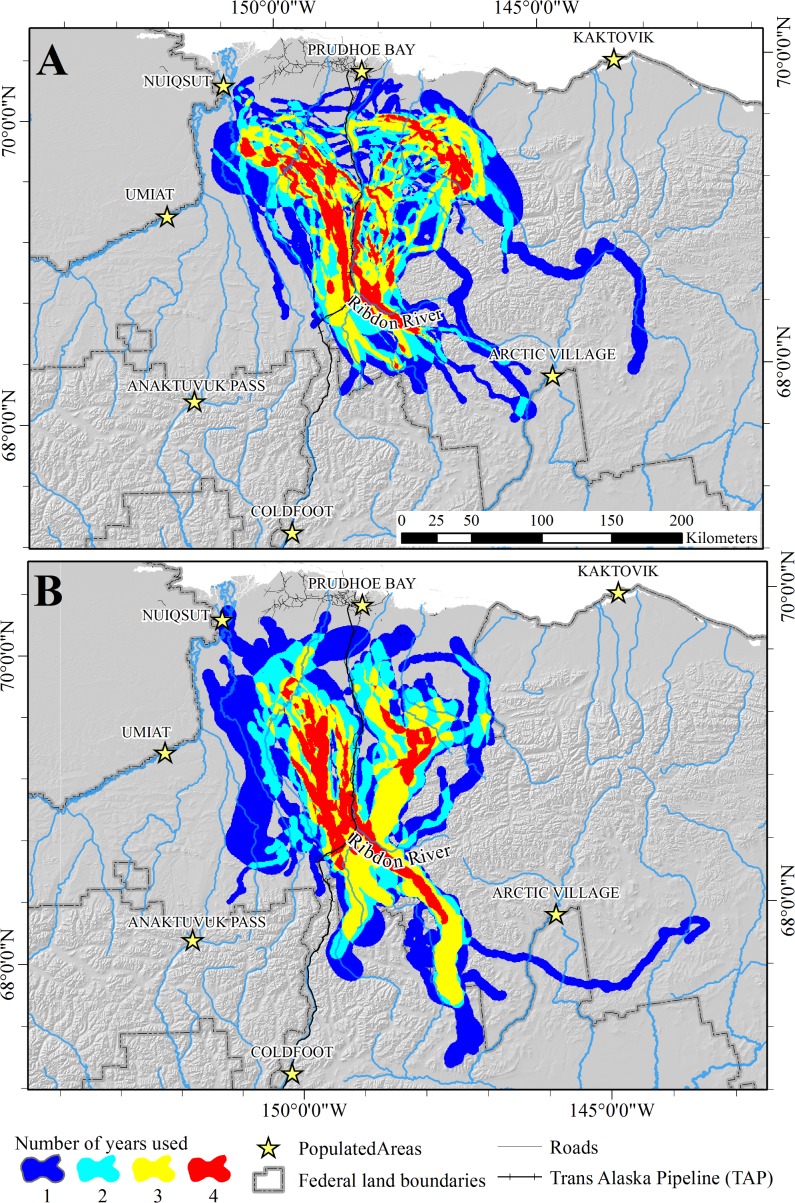
Migration is an important component of the life history of many animals, but persistence of large-scale terrestrial migrations is being challenged by environmental changes that fragment habitats and create obstacles to animal movements. In northern Alaska, the Central Arctic herd (CAH) of barren-ground caribou (Rangifer tarandus granti) is known to migrate over large distances, but the herd's seasonal distributions and migratory movements are not well documented. From 2003-2007, we used GPS radio-collars to determine seasonal ranges and migration routes of 54 female caribou from the CAH. We calculated Brownian bridges to model fall and spring migrations for each year and used the mean of these over all 4 years to identify areas that were used repeatedly. Annual estimates of sizes of seasonal ranges determined by 90% fixed kernel utilization distributions were similar between summer and winter (X̅ = 27,929 SE = 1,064 and X̅ = 26,585 SE = 4912 km2, respectively). Overlap between consecutive summer and winter ranges varied from 3.3-18.3%. Percent overlap between summer ranges used during consecutive years (X̅ = 62.4% SE = 3.7%) was higher than for winter ranges (X̅ = 42.8% SE = 5.9%). Caribou used multiple migration routes each year, but some areas were used by caribou during all years, suggesting that these areas should be managed to allow for continued utilization by caribou. Restoring migration routes after they have been disturbed or fragmented is challenging. However, prior knowledge of movements and threats may facilitate maintenance of migratory paths and seasonal ranges necessary for long-term persistence of migratory species.
Conflict of interest statement
Figures
References
-
- Mose VN, Nguyen-Huu T, Western D, Auger P, Nyandwi C. Modelling the dynamics of migrations for large herbivore populations in the Amboseli National Park, Kenya. Ecol Model. 2013;254(0):43–9. 10.1016/j.ecolmodel.2013.01.016 - DOI
-
- Berger J. The last mile: how to sustain long-distance migration in mammals. Conservation Biology. 2004;18(2):320–31.
-
- Oosenbrug SM, Theberge JB. Altitudinal movements and summer habitat preferences of woodland caribou in the Kluane Ranges, Yukon Territory. Arctic. 1980;33(1):59–72.
Publication types
MeSH terms
Grants and funding
LinkOut - more resources
Full Text Sources
Other Literature Sources
