

A novel method for mapping village-scale outdoor resting microhabitats of the primary African malaria vector, Anopheles gambiae
- PMID: 27659918
- PMCID: PMC5034649
- DOI: 10.1186/s12936-016-1534-9
A novel method for mapping village-scale outdoor resting microhabitats of the primary African malaria vector, Anopheles gambiae
Abstract
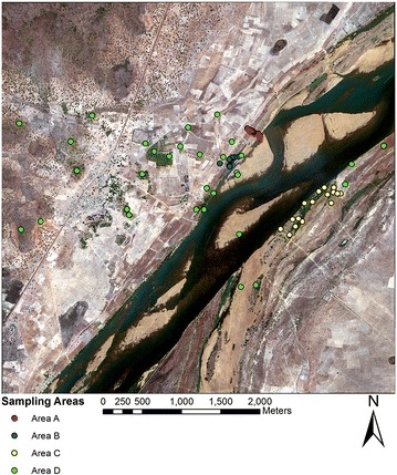
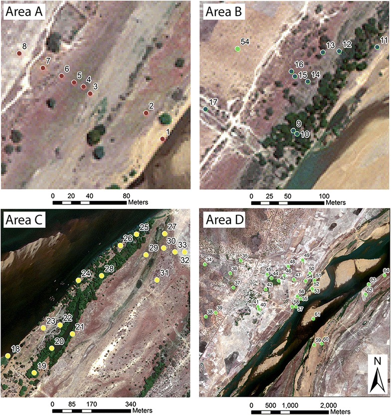
Background: Knowledge of Anopheles resting habitats is needed to advance outdoor malaria vector control. This study presents a technique to map locations of resting habitats using high-resolution satellite imagery (world view 2) and probabilistic Dempster-Shafer (D-S) modelling, focused on a rural village in southern Mali, West Africa where field sampling was conducted to determine outdoor habitat preferences of Anopheles gambiae, the main vector in the study area.
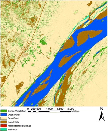
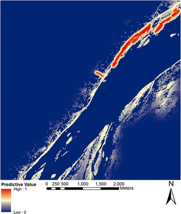
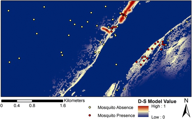
Methods: A combination of supervised and manual image classification was used to derive an accurate land-cover map from the satellite image that provided classes (i.e., photosynthetically active vegetation, water bodies, wetlands, and buildings) suitable for habitat assessment. Linear fuzzy functions were applied to the different image classes to scale resting habitat covariates into a common data range (0-1) with fuzzy breakpoints parameterized experimentally through comparison with mosquito outdoor resting data. Fuzzy layers were entered into a Dempster-Shafer (D-S) weight-of-evidence model that produced pixel-based probability of resting habitat locations.
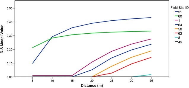
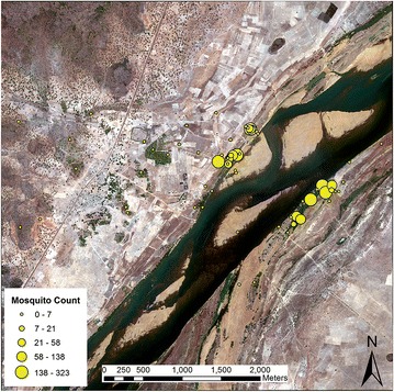
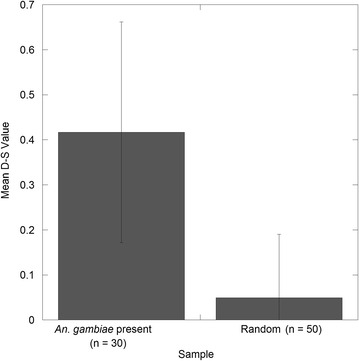
Results: The D-S model provided a highly detailed suitability map of resting locations. The results indicated a significant difference (p < 0.001) between D-S values at locations positive for An. gambiae and a set of randomly sampled points. Further, a negative binomial regression indicated that although the D-S estimates did not predict abundance (p > 0.05) subsequent analysis suggested that the D-S modelling approach may provide a reasonable estimate locations of low-to-medium An. gambiae density. These results suggest that that D-S modelling performed well in identifying presence points and specifically resting habitats.
Conclusion: The use of a D-S modelling framework for predicting the outdoor resting habitat locations provided novel information on this little-known aspect of anopheline ecology. The technique used here may be applied more broadly at different geographic scales using Google Earth, Landsat or other remotely-sensed imagery to assess the malaria vector resting habitats where outdoor control measures can reduce the burden of the disease in Africa and elsewhere.
Keywords: Anopheles; Dempster-Schafer modeling; Mali; Resting habitats; Species distribution modeling.
Figures

References
-
- WHO. World Malaria report 2014. Geneva: World Health Organization; 2014. http://www.who.int/malaria/publications/world_malaria_report_2014/en/. Accessed 7 Jan 2016.
Grants and funding
LinkOut - more resources
Full Text Sources
Other Literature Sources
