

Dynamical Mapping of Anopheles darlingi Densities in a Residual Malaria Transmission Area of French Guiana by Using Remote Sensing and Meteorological Data
- PMID: 27749938
- PMCID: PMC5066951
- DOI: 10.1371/journal.pone.0164685
Dynamical Mapping of Anopheles darlingi Densities in a Residual Malaria Transmission Area of French Guiana by Using Remote Sensing and Meteorological Data
Abstract
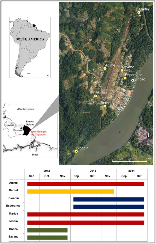
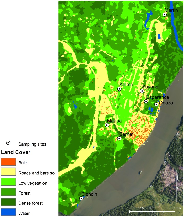
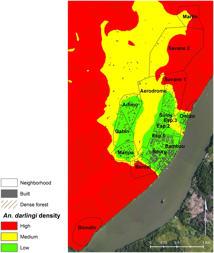
Local variation in the density of Anopheles mosquitoes and the risk of exposure to bites are essential to explain the spatial and temporal heterogeneities in the transmission of malaria. Vector distribution is driven by environmental factors. Based on variables derived from satellite imagery and meteorological observations, this study aimed to dynamically model and map the densities of Anopheles darlingi in the municipality of Saint-Georges de l'Oyapock (French Guiana). Longitudinal sampling sessions of An. darlingi densities were conducted between September 2012 and October 2014. Landscape and meteorological data were collected and processed to extract a panel of variables that were potentially related to An. darlingi ecology. Based on these data, a robust methodology was formed to estimate a statistical predictive model of the spatial-temporal variations in the densities of An. darlingi in Saint-Georges de l'Oyapock. The final cross-validated model integrated two landscape variables-dense forest surface and built surface-together with four meteorological variables related to rainfall, evapotranspiration, and the minimal and maximal temperatures. Extrapolation of the model allowed the generation of predictive weekly maps of An. darlingi densities at a resolution of 10-m. Our results supported the use of satellite imagery and meteorological data to predict malaria vector densities. Such fine-scale modeling approach might be a useful tool for health authorities to plan control strategies and social communication in a cost-effective, targeted, and timely manner.
Conflict of interest statement
The authors have declared that no competing interests exist.
Figures
References
-
- WHO. World Malaria Report 2015. Geneva: World Health Organization; 2015. Available: http://www.who.int/malaria/publications/world-malaria-report-2015/report....
MeSH terms
LinkOut - more resources
Full Text Sources
Other Literature Sources
Medical
