

A Portable Farmland Information Collection System with Multiple Sensors
- PMID: 27782076
- PMCID: PMC5087546
- DOI: 10.3390/s16101762
A Portable Farmland Information Collection System with Multiple Sensors
Abstract
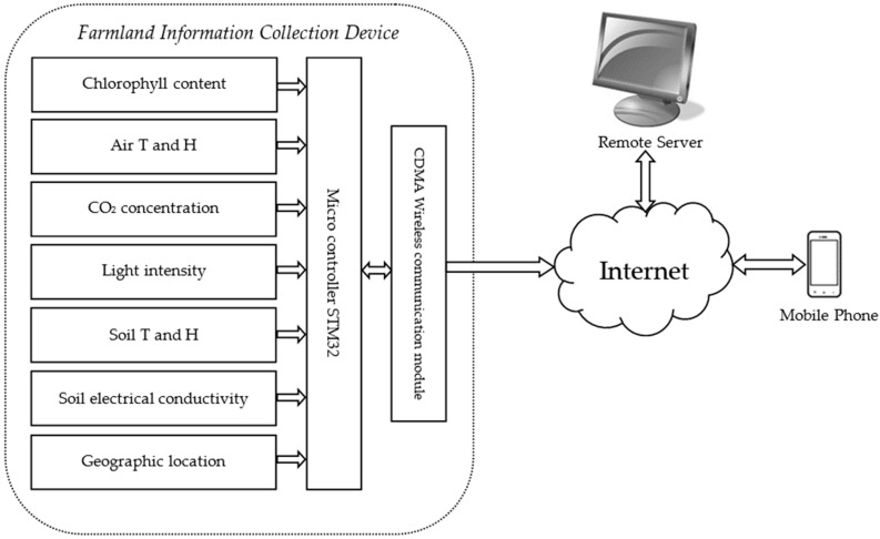
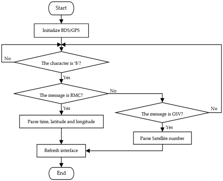
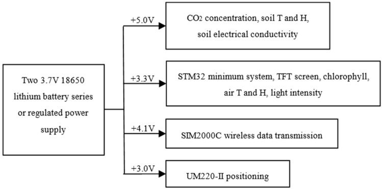
Precision agriculture is the trend of modern agriculture, and it is also one of the important ways to realize the sustainable development of agriculture. In order to meet the production requirements of precision agriculture-efficient use of agricultural resources, and improving the crop yields and quality-some necessary field information in crop growth environment needs to be collected and monitored. In this paper, a farmland information collection system is developed, which includes a portable farmland information collection device based on STM32 (a 32-bit comprehensive range of microcontrollers based on ARM Crotex-M3), a remote server and a mobile phone APP. The device realizes the function of portable and mobile collecting of multiple parameters farmland information, such as chlorophyll content of crop leaves, air temperature, air humidity, and light intensity. UM220-III (Unicore Communication Inc., Beijing, China) is used to realize the positioning based on BDS/GPS (BeiDou Navigation Satellite System, BDS/Global Positioning System, GPS) dual-mode navigation and positioning system, and the CDMA (Code Division Multiple Access, CDMA) wireless communication module is adopted to realize the real-time remote transmission. The portable multi-function farmland information collection system is real-time, accurate, and easy to use to collect farmland information and multiple information parameters of crops.
Keywords: CDMA; agriculture information collection; chlorophyll relative content; multiple sensors.
Conflict of interest statement
The authors declare no conflict of interest.
Figures


References
-
- Wang X.D., Wang H.M., Dang A.R. Research on large-scale dynamic monitoring of land use with RS, GPS and GIS; Proceedings of the IEEE 2000 International Geoscience and Remote Sensing Symposium; New York, NY, USA. 24–28 July 2000; pp. 2134–2136.
-
- Du K.M., Chu J.X., Sun Z.F., Zheng F.X., Xia Y., Yang X.D. Design and implementation of monitoring system for agricultural environment based on Web-GIS with Internet of Things. Trans. Chin. Soc. Agric. Eng. 2016;4:171–178.
-
- Chen X., Zhao J.Y., Bi J.F., Li L.Y. Research of real-time agriculture information collection system based on mobile GIS; Proceedings of the International Conference on Agro-Geoinformatics; Shanghai, China. 2–4 August 2012; pp. 1–4.
-
- Jula A., Sundararajan E., Othman Z. Cloud computing service composition: A systematic literature review. Expert Syst. Appl. 2014;8:3809–3824. doi: 10.1016/j.eswa.2013.12.017. - DOI
LinkOut - more resources
Full Text Sources
Other Literature Sources
