

Impact of Highland Topography Changes on Exposure to Malaria Vectors and Immunity in Western Kenya
- PMID: 27790610
- PMCID: PMC5063849
- DOI: 10.3389/fpubh.2016.00227
Impact of Highland Topography Changes on Exposure to Malaria Vectors and Immunity in Western Kenya
Abstract
Background: It is almost an axiom that in the African highlands (above 1,500 m) transmission of Plasmodium falciparum is limited primarily by low ambient temperature and that small changes in temperature could result in temporary favorable conditions for unstable transmission within populations that have acquired little functional immunity. The pattern of malaria transmission in the highland plateau ecosystems is less distinct due to the flat topography and diffuse hydrology resulting from numerous streams. The non-homogeneous distribution of larval breeding habitats in east African highlands obviously affects Anopheles spatial distribution which, consequently, leads to heterogeneous human exposure to malaria. Another delicate parameter in the fragile transmission risk of malaria in the highlands is the rapid loss of primary forest due to subsistence agriculture. The implication of this change in land cover on malaria transmission is that deforestation can lead to changes in microclimate of both adult and larval habitats hence increase larvae survival, population density, and gametocytes development in adult mosquitoes. Deforestation has been documented to enhancing vectorial capacity of Anopheles gambiae by nearly 100% compared to forested areas.
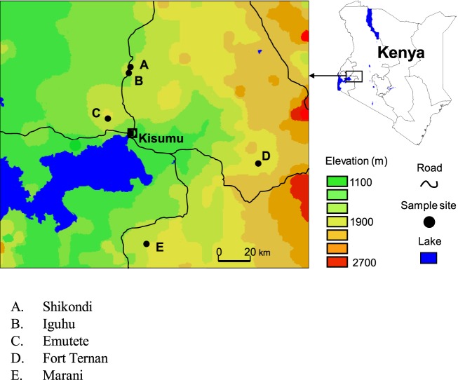
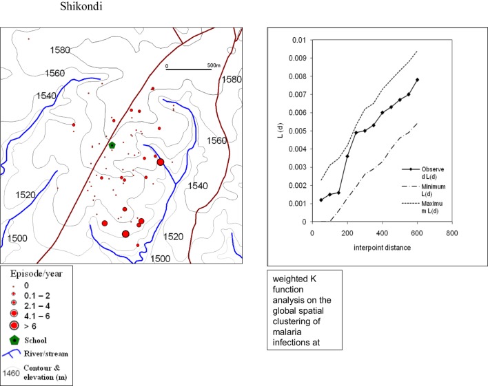
Method: The study was conducted in five different ecosystems in the western Kenya highlands, two U-shaped valleys (Iguhu, Emutete), two V-shaped valleys (Marani, Fort Ternan), and one plateau (Shikondi) for 16 months among 6- to 15-year-old children. Exposure to malaria was tested using circumsporozoite protein (CSP) and merozoite surface protein immunochromatographic antibody tests. Malaria parasite was examined using different tools, which include microscopy based on blood smears, rapid diagnostic test based on HRP 2 proteins, and serology based on human immune response to parasite and vector antigens have been also examined in the highlands in comparison with different topographical systems of western Kenya.
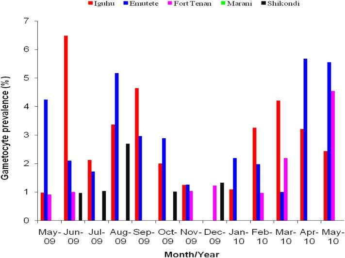
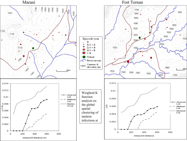
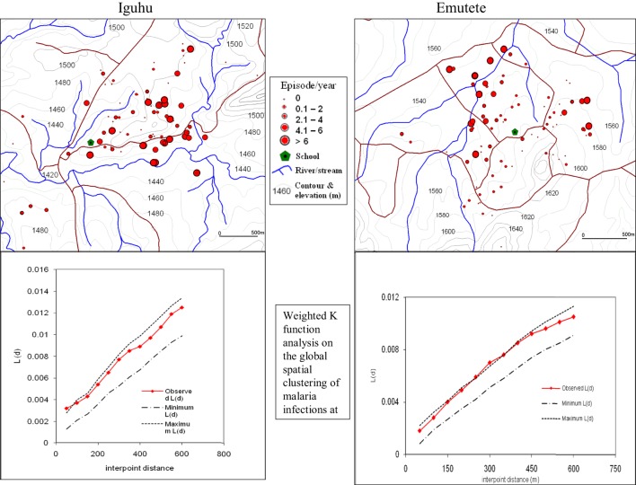
Results: The results suggested that changes in the topography had implication on transmission in highlands of western Kenya and appropriate diagnosis, treatment, and control tool needed to be considered accordingly. Both plateau and U-shaped valley found to have higher parasite density than V-shaped valley. People in V-valley were less immune than in plateau and U-valley residents.
Conclusion: Topography diversity in western Kenya highlands has a significant impact on exposure rates of human to malaria vectors and parasite. The residents of V-shaped valleys are at risk of having explosive malaria outbreaks during hyper-transmission periods due to low exposure to malaria parasite; hence, they have low immune response to malaria, while the U-shaped valleys have stable malaria transmission, therefore, the human population has developed immunity to malaria due to continuous exposure to malaria.
Keywords: U-valley; V-valley; exposure; highland; immunity; rapid diagnostic kit; topography.
Figures
References
-
- WHO. Factsheet on the World Malaria Report 2015. Geneva: World Health Organisation; (2015).
-
- Garnham P. The incidence of malaria at high altitudes. J Natl Malar Soc (1948) 7(4):275–84. - PubMed
-
- Roberts J. The control of epidemic malaria in the highlands of western Kenya. Part II. The campaign. J Trop Med Hyg (1964) 67(8):191–9. - PubMed
LinkOut - more resources
Full Text Sources
Other Literature Sources