

Mapping poverty using mobile phone and satellite data
- PMID: 28148765
- PMCID: PMC5332562
- DOI: 10.1098/rsif.2016.0690
Mapping poverty using mobile phone and satellite data
Abstract
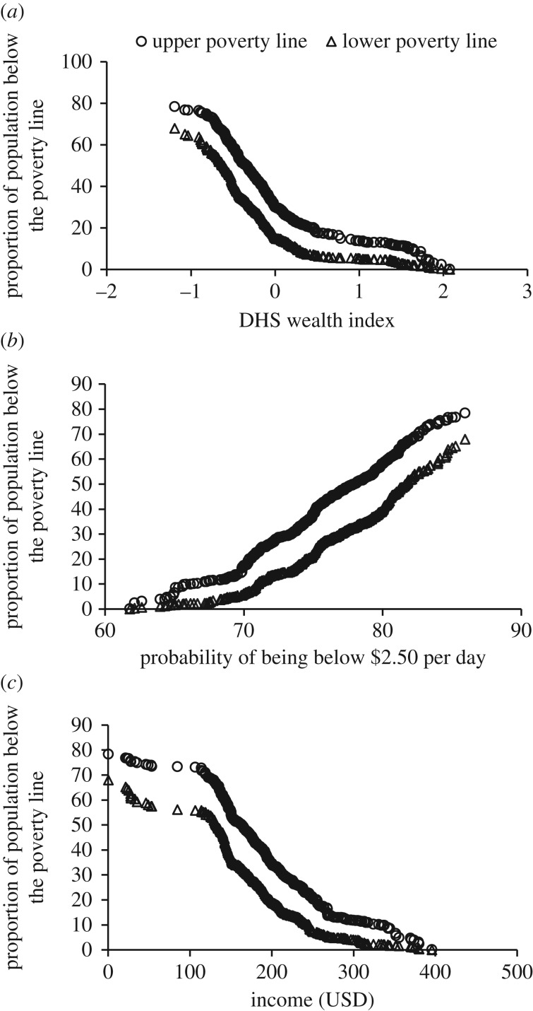
Poverty is one of the most important determinants of adverse health outcomes globally, a major cause of societal instability and one of the largest causes of lost human potential. Traditional approaches to measuring and targeting poverty rely heavily on census data, which in most low- and middle-income countries (LMICs) are unavailable or out-of-date. Alternate measures are needed to complement and update estimates between censuses. This study demonstrates how public and private data sources that are commonly available for LMICs can be used to provide novel insight into the spatial distribution of poverty. We evaluate the relative value of modelling three traditional poverty measures using aggregate data from mobile operators and widely available geospatial data. Taken together, models combining these data sources provide the best predictive power (highest r2 = 0.78) and lowest error, but generally models employing mobile data only yield comparable results, offering the potential to measure poverty more frequently and at finer granularity. Stratifying models into urban and rural areas highlights the advantage of using mobile data in urban areas and different data in different contexts. The findings indicate the possibility to estimate and continually monitor poverty rates at high spatial resolution in countries with limited capacity to support traditional methods of data collection.
Keywords: Bayesian geostatistical modelling; mobile phone data; poverty mapping; remote sensing.
© 2017 The Authors.
Figures
References
-
- Cruz M, Foster J, Quillin B, Schellekens P. 2015. Ending extreme poverty and sharing prosperity: progress and policies. 83. Washington, DC: World Bank Development Economics Group.
-
- Population and poverty | UNFPA - United Nations Population Fund. 2016. See http://www.unfpa.org/resources/population-and-poverty (accessed: 21 January 2016).
-
- Braithwaite A, Dasandi N, Hudson D. 2014 doi: 10.1177/0738894214559673. Does poverty cause conflict? Isolating the causal origins of the conflict trap. Confl. Manag. Peace Sci. 33 , 45–66. ( ) - DOI
-
- United Nations General Assembly. 2015. Transforming our world: the 2030 Agenda for Sustainable Development.
Publication types
MeSH terms
Associated data
Grants and funding
LinkOut - more resources
Full Text Sources
Other Literature Sources