

Automated detection and enumeration of marine wildlife using unmanned aircraft systems (UAS) and thermal imagery
- PMID: 28338047
- PMCID: PMC5364474
- DOI: 10.1038/srep45127
Automated detection and enumeration of marine wildlife using unmanned aircraft systems (UAS) and thermal imagery
Abstract
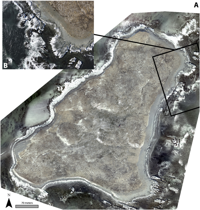
Estimating animal populations is critical for wildlife management. Aerial surveys are used for generating population estimates, but can be hampered by cost, logistical complexity, and human risk. Additionally, human counts of organisms in aerial imagery can be tedious and subjective. Automated approaches show promise, but can be constrained by long setup times and difficulty discriminating animals in aggregations. We combine unmanned aircraft systems (UAS), thermal imagery and computer vision to improve traditional wildlife survey methods. During spring 2015, we flew fixed-wing UAS equipped with thermal sensors, imaging two grey seal (Halichoerus grypus) breeding colonies in eastern Canada. Human analysts counted and classified individual seals in imagery manually. Concurrently, an automated classification and detection algorithm discriminated seals based upon temperature, size, and shape of thermal signatures. Automated counts were within 95-98% of human estimates; at Saddle Island, the model estimated 894 seals compared to analyst counts of 913, and at Hay Island estimated 2188 seals compared to analysts' 2311. The algorithm improves upon shortcomings of computer vision by effectively recognizing seals in aggregations while keeping model setup time minimal. Our study illustrates how UAS, thermal imagery, and automated detection can be combined to efficiently collect population data critical to wildlife management.
Conflict of interest statement
The authors declare no competing financial interests.
Figures


References
-
- Krebs C. J., Hickman G. C. & Hickman S. M. Ecology: The Experimental Analysis of Distribution and Abundance. Blackwell Science Inc, New York (1994).
-
- Lancia R. A., Kendall W. L., Pollock K. H. & Nichols J. D. Estimating the number of animals in wildlife populations. In Braun C. E. (ed) Techniques for Wildlife Investigations and Management. Wildlife Society, Bethesda, Maryland, 106–153 (2005).
-
- Buckland S. T., Anderson D. R., Burnham K. P. & Laake J. L. Distance Sampling. In Encyclopedia of Biostatistics. John Wiley & Sons Ltd, Chichester, UK (2005).
-
- Bonner S. J. & Holmberg J. Mark-recapture with multiple, non-invasive marks. Biometrics 69, 766–775 (2013). - PubMed
Publication types
MeSH terms
LinkOut - more resources
Full Text Sources
Other Literature Sources
