

Losing a jewel-Rapid declines in Myanmar's intact forests from 2002-2014
- PMID: 28520726
- PMCID: PMC5435175
- DOI: 10.1371/journal.pone.0176364
Losing a jewel-Rapid declines in Myanmar's intact forests from 2002-2014
Abstract
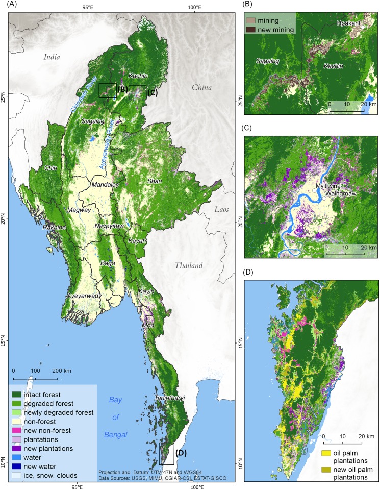
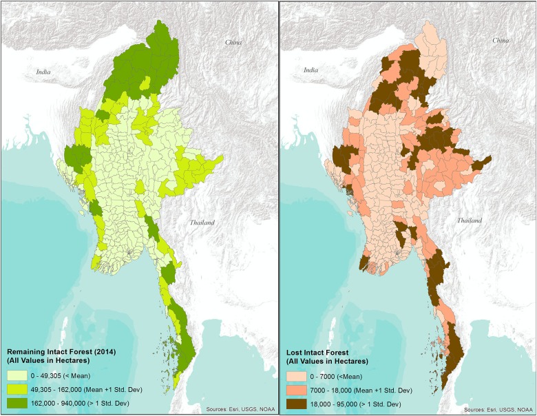
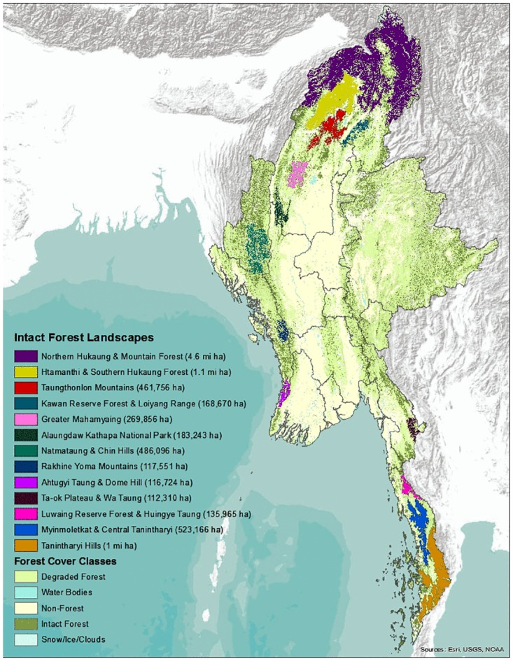
New and rapid political and economic changes in Myanmar are increasing the pressures on the country's forests. Yet, little is known about the past and current condition of these forests and how fast they are declining. We mapped forest cover in Myanmar through a consortium of international organizations and environmental non-governmental groups, using freely-available public domain data and open source software tools. We used Landsat satellite imagery to assess the condition and spatial distribution of Myanmar's intact and degraded forests with special focus on changes in intact forest between 2002 and 2014. We found that forests cover 42,365,729 ha or 63% of Myanmar, making it one of the most forested countries in the region. However, severe logging, expanding plantations, and degradation pose increasing threats. Only 38% of the country's forests can be considered intact with canopy cover >80%. Between 2002 and 2014, intact forests declined at a rate of 0.94% annually, totaling more than 2 million ha forest loss. Losses can be extremely high locally and we identified 9 townships as forest conversion hotspots. We also delineated 13 large (>100,000 ha) and contiguous intact forest landscapes, which are dispersed across Myanmar. The Northern Forest Complex supports four of these landscapes, totaling over 6.1 million ha of intact forest, followed by the Southern Forest Complex with three landscapes, comprising 1.5 million ha. These remaining contiguous forest landscape should have high priority for protection. Our project demonstrates how open source data and software can be used to develop and share critical information on forests when such data are not readily available elsewhere. We provide all data, code, and outputs freely via the internet at (for scripts: https://bitbucket.org/rsbiodiv/; for the data: http://geonode.themimu.info/layers/geonode%3Amyan_lvl2_smoothed_dec2015_resamp).
Conflict of interest statement
Figures
References
-
- Bryant RL. The Political Ecology of Forestry in Burma: 1824–1994. University of Hawaii Press; 1997. 257 p.
-
- Gin OK. Southeast Asia: A Historical Encyclopedia from Angkor Wat to East Timor [Internet]. [cited 2015 Dec 9]. http://www.abc-clio.com/ABC-CLIOCorporate/product.aspx?pc=A1403C
-
- Selmier WT II. Investing on the edge of the world: Sumiyuki Kazama on establishing capital markets in Myanmar. Bus Horiz;2013;56(6):757–65.
-
- Food and Agriculture Organization of the United Nations Statistics Division. [cited 2015 Dec 10]. http://faostat3.fao.org/browse/area/28/E
-
- Kyaw WW, Sukchai S, Ketjoy N, Ladpala S. Energy utilization and the status of sustainable energy in Union of Myanmar. Energy Procedia. 2011;9:351–8.
MeSH terms
LinkOut - more resources
Full Text Sources
Other Literature Sources
Miscellaneous
