. 2017 May;10(5):2214-2231.
doi: 10.1109/JSTARS.2016.2626966. Epub 2016 Dec 1.

Comparison of SeaWinds Backscatter Imaging Algorithms

Comparison of SeaWinds Backscatter Imaging Algorithms

David G Long. IEEE J Sel Top Appl Earth Obs Remote Sens. 2017 May.

Abstract

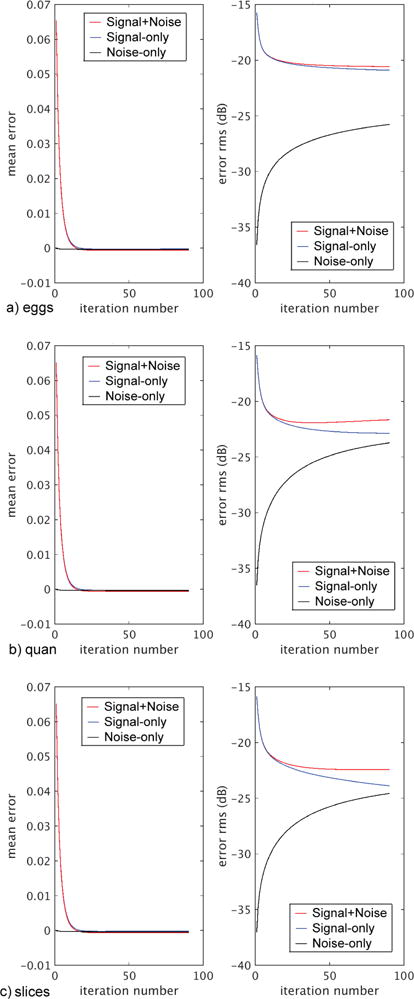
This paper compares the performance and tradeoffs of various backscatter imaging algorithms for the SeaWinds scatterometer when multiple passes over a target are available. Reconstruction methods are compared with conventional gridding algorithms. In particular, the performance and tradeoffs in conventional 'drop in the bucket' (DIB) gridding at the intrinsic sensor resolution are compared to high-spatial-resolution imaging algorithms such as fine-resolution DIB and the scatterometer image reconstruction (SIR) that generate enhanced-resolution backscatter images. Various options for each algorithm are explored, including considering both linear and dB computation. The effects of sampling density and reconstruction quality versus time are explored. Both simulated and actual data results are considered. The results demonstrate the effectiveness of high-resolution reconstruction using SIR as well as its limitations and the limitations of DIB and fDIB.

Keywords: QuikSCAT; RapidScat; SeaWinds; backscatter; reconstruction; sampling; scatterometer; variable aperture.


Figures

Fig. 1
Fig. 1
Illustration of the QuikSCAT and SeaWinds observation geometry. Antenna feeds for inner horizontal (HH) polarization (H-pol) and outer vertical (VV) polarization (V-pol) beams share the same dish reflector, producing separate beams. The off-nadir pointing antenna rotates at 18 rpm, resulting in a circular scan at fixed incidence angles. Coupled with the along-orbit motion of the spacecraft, the resulting measurements are collected along a dual-helix pattern. A given point within the swath is first observed by at least one forward-looking beam, and later by at least one aft-looking beam. Within the inner swath the point is observed by both antennas, while in the outer swath the point is observed by only the outer scan.
Fig. 2
Fig. 2
Illustration of how the (top row) egg and (bottom row) slice SRFs vary as a function of antenna rotation angle for (left column) H-pol [the inner-beam] and (right column) V-pol [the outer-beam]. Contours are shown at −3 dB from the peak response. For clarity, only contours are shown for slices. The linear-space egg SRF linear gain scale extends from zero to one. Selected SRFs from one rotation of the antenna are plotted. For the purposes of visualization the selected SRFs have been horizontally shifted to appear close to each other since the actual radius is very large. Note the change in orientation of the footprints as a function of antenna rotation angle. The jagged edges of the slice contours are the result of the quantized grid on which the SRF is evaluated.
Fig. 3
Fig. 3
Illustration of QuikSCAT coverage versus time. (left column) Northern hemisphere polar view extending 4000 km from the pole at the image center. (right column) global view. The latitude range shown extends ±60°. (rows from top to bottom) 1 rev, 2 revs, 7 revs, 15 revs (~1 day), 30 revs (2 days). Each orbit number has a different grayscale value, with more recent orbits having a lighter color and covering previous orbits. Note that for visibility a different grayscale is used for each image.
Fig. 4
Fig. 4
Illustrations of the measurement locations within a small study area. (a) eggs. (b) slices.
Fig. 5
Fig. 5
Normalized histogram of the number of measurements that fall within one fine-resolution pixel for various time periods for the polar study region for (a) eggs and (b) slices.
Fig. 6
Fig. 6
Observed normalized histogram of the computed δ-dense metric for (a) eggs and (b) slices for various time periods for the polar study region.
Fig. 7
Fig. 7
Illustration of the measurement SRF for one pulse for representative (left column) eggs and (right column) slices for both (top row) H-pol and (bottom row) V-pol. Contours are shown at −3, −6, −9, and −12 dB from the peak response. The image area is 100 km × 100 km. The large 22.25 km square box corresponds to the low-resolution DIB pixel size, while the small 2.225 km square box corresponds to the size of single fine-resolution pixel. For clarity, slices are offset from the center as indicated by the positions of the small squares. The orientation (rotation) and shape of the slices and eggs change from location to location and versus time. The linear gain grayscale extends from zero to one.
Fig. 8
Fig. 8
Comparison of the effective SRF of pixels from different processing algorithms computed at the fine (2.225 km) pixel scale. (columns, left to right) DIB, fDIB, AVE and SIR. (rows, top to bottom) H-pol eggs, V-pol eggs, H-pol slices, and V-pol slices. The size of each panel is 100 km ×100 km. Contours are shown at −3, −6, −9, and −12 dB from the peak response which is normalized to one. The linear grayscale extends from zero to one. The large 22.25 km square box corresponds to the low-resolution DIB pixel size, while the small black 2.225 km square box corresponds to a single fine-resolution pixel. For the arbitrarily selected pixel location, the number of measurements included in each SRF is summarized in Table II.
Fig. 9
Fig. 9
QuikSCAT H-pol noisy simulation results for backscatter images. (a) DIB eggs. (b) fDIB eggs. (c) AVE eggs. (d) SIR eggs. (e) DIB slices. (f) fDIB slices. (g) qAVE slices. (h) qSIR slices. (i) Truth image. (j) AVE slices. (k) SIR slices. Error statistics are summarized in Tab. III.
Fig. 10
Fig. 10
The error difference (true-estimated in dB) between the estimated and true images shown in Fig. 9. (a) DIB eggs. (b) fDIB eggs. (c) AVE eggs. (d) SIR eggs. (e) DIB slices. (f) fDIB slices. (g) qAVE slices. (h) qSIR slices. (j) AVE slices. (k) SIR slices. Error statistics are summarized in Tab. III.
Fig. 11
Fig. 11
SIR reconstruction error versus iteration number for (panel a) egg, (panel b) quantized slices, (panel c) slices. In each panel, the left plot is the mean error expressed in linear space, while the right plot shows RMS error in dB. The noise-only RMS error is computed as the RMS difference between the noisy signal+noise image and the noise-free signal-only image. The minimum RMS error is at about 20 iterations for slices and somewhat higher for eggs.
Fig. 12
Fig. 12
SIR RMS noise error versus RMS signal error for various algorithm cases for the H-pol simulation. Note that the first iteration of SIR is at the far right. As SIR is iterated, the curve moves to the left, i.e., the number of iterations increases from right to left. In the legend, -L denotes use of linear measurements while the other cases use dB space measurements.
Fig. 13
Fig. 13
SIR-spectral simulation results showing vertically-averaged pixel rows. (top panel) Eggs. (center panel) Quantized slices. (lower panel) Slices. Color key for lines is: (cyan) true image, (red) DIB, (black) AVE, (blue) SIR.
Fig. 14
Fig. 14
Computed spectra of vertically averaged rows. (top panel) Eggs. (center panel) Quantized slices. (lower panel) Slices. Color key for lines is: (cyan) true image, (red) DIB, (black) AVE, (blue) SIR.
Fig. 15
Fig. 15
A map of the locations of actual data study areas over Antarctica, and maps of the individual study areas with annotation of selected features. Note that the scales are different for each region.
Fig. 16
Fig. 16
Polar study area QuikSCAT H-pol σo images created from four days (254–257, 1999) of data for different cases: (top row) eggs, (center row) quantized slices, and (bottom row) slices. The columns are, from left to right, DIB, fDIB, AVE, SIR. The grayscale extends from −20 dB to 0 dB. The linear and dB processing are visually similar and so only the dB measurement images are shown.
Fig. 17
Fig. 17
QuikSCAT SIR V-pol σo slice images spanning different time periods in 2007. (a) 1 day, JD 201. (b) 1 day, JD 229. (c) 4 days, JD 200-203. (d) 30 days, JD 200-229.
Fig. 18
Fig. 18
QuikSCAT DIB V-pol σo slice images spanning different time periods in 2007. (a) DIB 4 day, JD 200-203. (b) DIB 30 day, JD 200-229. (c) fDIB 4 days, JD 200-203. (d) fDIB 30 days, JD 200-229.

References

    1. Spencer MW, Wu C, Long DG. Improved resolution backscatter measurements with the SeaWinds pencil-beam scatterometer. IEEE Trans Geosci Remote Sensing. 2000;38(1):89–104. doi: 10.1109/36.823904. - DOI
    1. Ulaby F, Long DG. Microwave Radar and Radiometric Remote Sensing. University of Michigan Press; Ann Arbor, Michigan: 2014.
    1. Long DG, Drinkwater MR. Azimuth variation in microwave scatterometer and radiometer data over Antarctica. IEEE Trans Geosci Remote Sensing. 2000;38(4):1857–1870. doi: 10.1109/36.851769. - DOI
    1. Paget AP, Long DG. RapidScat diurnal cycles over land. IEEE Trans Geosci Remote Sensing. 2016;54(6):3336–3344. doi: 10.1109/TGRS.2016.2544835. - DOI
    1. Remund QP, Long DG. A decade of QuikSCAT scatterometer sea ice extent data. IEEE Trans Geosci Remote Sensing. 2014;52(7):4281–4290. doi: 10.1109/TGRS.2013.2281056. - DOI

LinkOut - more resources