

An assessment of forest biomass maps in Europe using harmonized national statistics and inventory plots
- PMID: 29449758
- PMCID: PMC5806600
- DOI: 10.1016/j.foreco.2017.11.047
An assessment of forest biomass maps in Europe using harmonized national statistics and inventory plots
Abstract
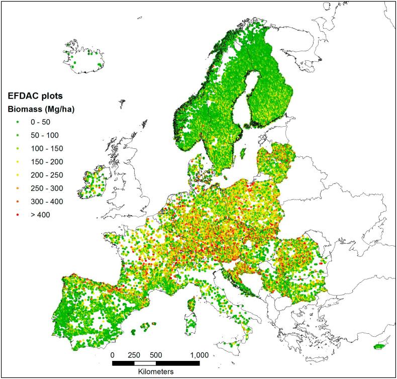
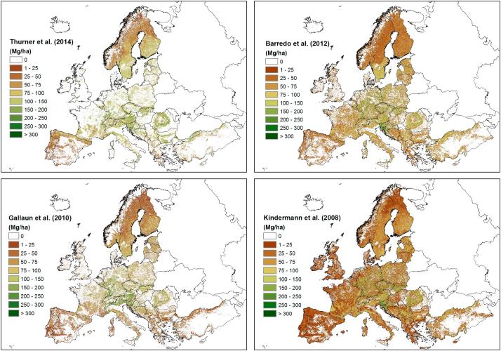
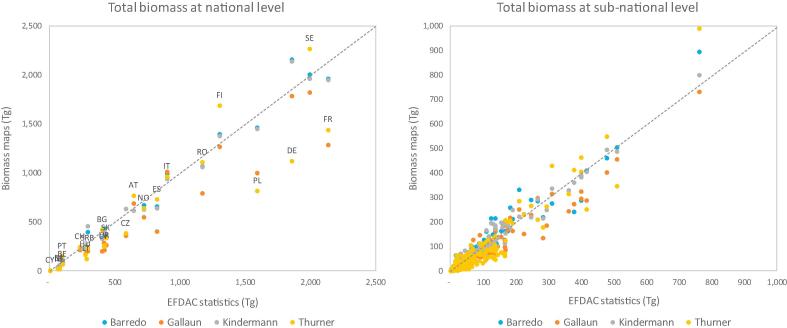
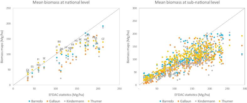
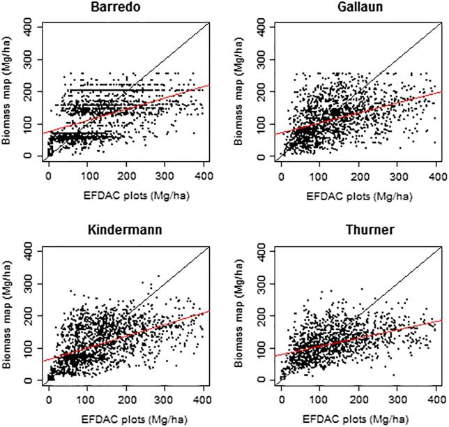
Maps of aboveground forest biomass based on different input data and modelling approaches have been recently produced for Europe, opening up the possibility for several applications and products not obtainable by summary statistics. However, the accuracy assessment of the existing maps is limited by the lack of reference data consistent over the study region and representative of the maps cells. Here, we used harmonized forest biomass data for 26 European countries derived by National Forest Inventories using a common biomass definition and estimator to assess four biomass maps. The assessment was performed at regional, national and sub-national scales using harmonized statistics derived from almost half million ground plot measurements, and at pixel level using a subset of 22,166 plots covering most European forest types. The field plots were temporally aligned with the maps using growth rates and further screened using an innovative approach based on tree cover variability to remove the plots not representative of the map cells. The harmonized reference data showed that all maps tended to overestimate at low biomass (<100 Mg ha-1) and underestimate at medium - high biomass (>100 Mg ha-1), resulting in an overall negative bias (23-43 Mg ha-1 at national level) relative to the harmonized estimates. The maps relative errors ranged from 29% to 40% at national level and increased at higher resolutions, reaching 58-67% at pixel level. We also assessed the effect of the harmonization of the national statistics and report that the harmonized biomass values present significant differences compared to the national estimates for 14 countries, and provide a slightly higher stock (+3.8%) at European scale. We show that harmonized and representative reference data are essential to properly assess the accuracy of biomass maps, and we further identify the factors affecting the maps performance and provide indications for their improvements.
Keywords: Aboveground biomass; Carbon cycle; Forest inventory; Forest plot; NFI; Remote sensing.
Figures
References
-
- Alberdi I., Michalak R., Fischer C., Gasparini P., Brändli U.B., Tomter S.M. Towards harmonized assessment of European forest availability for wood supply in Europe. Forest Policy Econ. 2016;70:20–29.
-
- Avitabile V., Baccini A., Friedl M.A., Schmullius C. Capabilities and limitations of Landsat and land cover data for aboveground woody biomass estimation of Uganda. Remote Sens. Environ. 2012;117:366–380.
-
- Avitabile V., Herold M., Heuvelink G., Lewis S.L., Phillips O.L., Asner G.P. An integrated pan-tropical biomass map using multiple reference datasets. Global Change Biol. 2016;22(4):1406–1420. - PubMed
-
- Barredo J.I., San-Miguel-Ayanz J., Caudullo G., Busetto L. EUR-Scientific and Technical Research; 2012. A European map of living forest biomass and carbon stock. Reference Report by the Joint Research Centre of the European Commission; p. 25730.
LinkOut - more resources
Full Text Sources
Other Literature Sources
Research Materials