

Digital version of the European Atlas of natural radiation
- PMID: 29496295
- PMCID: PMC6290173
- DOI: 10.1016/j.jenvrad.2018.02.008
Digital version of the European Atlas of natural radiation
Abstract
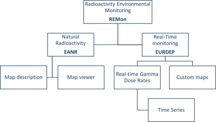
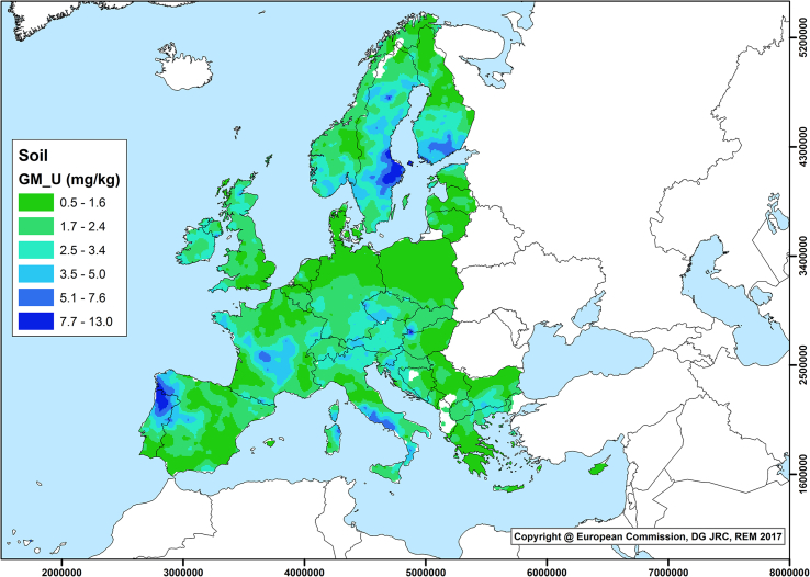
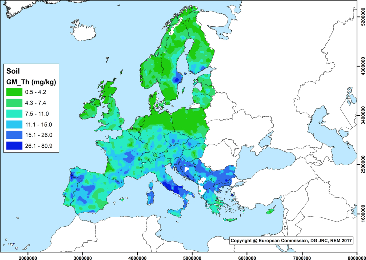
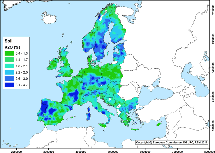
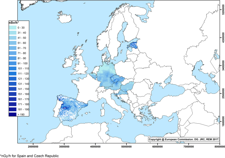
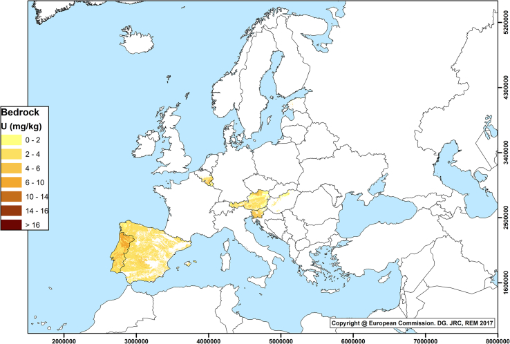
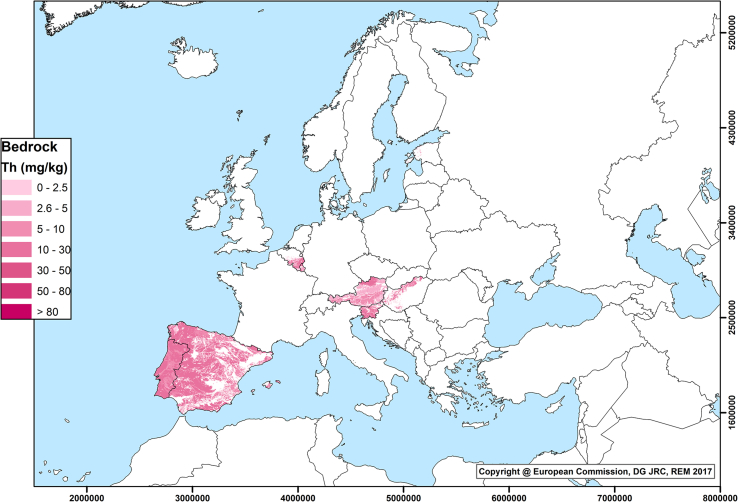
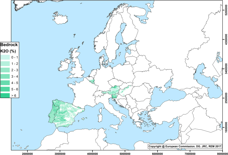
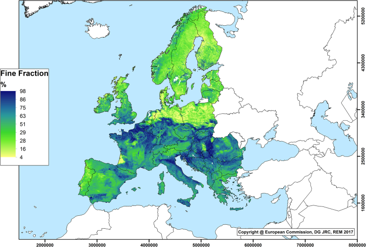
The European Atlas of Natural Radiation is a collection of maps displaying the levels of natural radioactivity caused by different sources. It has been developed and is being maintained by the Joint Research Centre (JRC) of the European Commission, in line with its mission, based on the Euratom Treaty: to collect, validate and report information on radioactivity levels in the environment of the EU Member States. This work describes the first version of the European Atlas of Natural Radiation, available in digital format through a web portal, as well as the methodology and results for the maps already developed. So far the digital Atlas contains: an annual cosmic-ray dose map; a map of indoor radon concentration; maps of uranium, thorium and potassium concentration in soil and in bedrock; a terrestrial gamma dose rate map; and a map of soil permeability. Through these maps, the public will be able to: familiarize itself with natural environmental radioactivity; be informed about the levels of natural radioactivity caused by different sources; have a more balanced view of the annual dose received by the European population, to which natural radioactivity is the largest contributor; and make direct comparisons between doses from natural sources of ionizing radiation and those from man-made (artificial) ones, hence, to better assess the latter. Work will continue on the European Geogenic Radon Map and on estimating the annual dose that the public may receive from natural radioactivity, by combining all the information from the different maps. More maps could be added to the Atlas, such us radon in outdoor air and in water and concentration of radionuclides in water, even if these sources usually contribute less to the total exposure.
Keywords: Digital Atlas; Europe; Mapping; Natural radiation.
Copyright © 2018 The Authors. Published by Elsevier Ltd.. All rights reserved.
Figures
References
-
- Annoni A., Luze C., Guble E., Ihd J., editors. Map Projections for Europe. European Commission, Joint Research Centre; 2001. p. 131.http://mapref.org/LinkedDocuments/MapProjectionsForEurope-EUR-20120.pdf (last accessed 25 January 2018)
-
- Appleton J.D., Miles J.C.H. A statistical evaluation of the geogenic controls on indoor radon concentrations and radon risk. J. Environ. Radioact. 2010;101(10):799–803. - PubMed
-
- Barnet I., Pacherova P., Neznal M. 2008. Radon in Geological Environment—Czech Experience; pp. 19–28. Czech Geological Survey Special Papers, No. 19, Prague.
-
- Batista e Silva F., Lavalle C. A high-resolution grid map for Europe. J. Maps. 2013;9(1):16–28.
MeSH terms
Substances
LinkOut - more resources
Full Text Sources
Other Literature Sources
