. 2018 May;557(7707):651-659.
doi: 10.1038/s41586-018-0123-1. Epub 2018 May 16.

Emerging trends in global freshwater availability

Affiliations

Emerging trends in global freshwater availability

M Rodell et al. Nature. 2018 May.

Erratum in

Abstract

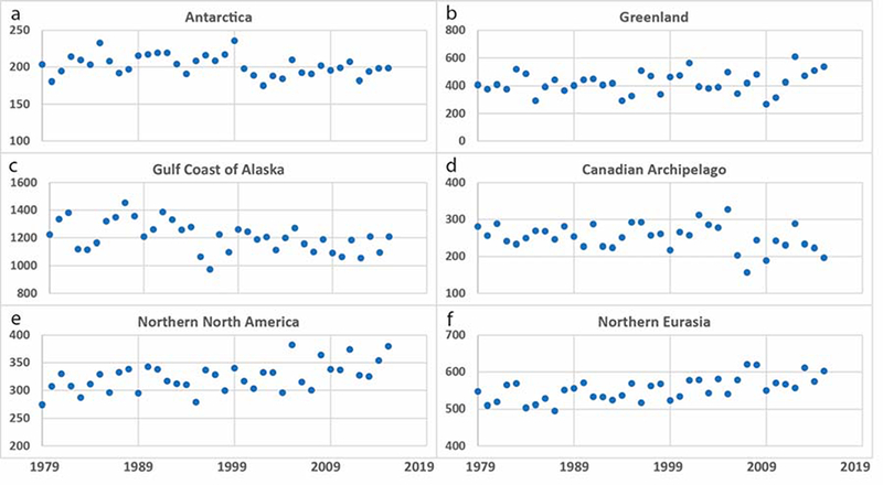
Freshwater availability is changing worldwide. Here we quantify 34 trends in terrestrial water storage observed by the Gravity Recovery and Climate Experiment (GRACE) satellites during 2002-2016 and categorize their drivers as natural interannual variability, unsustainable groundwater consumption, climate change or combinations thereof. Several of these trends had been lacking thorough investigation and attribution, including massive changes in northwestern China and the Okavango Delta. Others are consistent with climate model predictions. This observation-based assessment of how the world's water landscape is responding to human impacts and climate variations provides a blueprint for evaluating and predicting emerging threats to water and food security.


Conflict of interest statement

The authors claim no competing financial interests.

Figures

Figure ED1.
Figure ED1.. Non-seasonal TWS anomalies: global regions.
Time series of monthly TWS anomalies (departures from the period mean) from GRACE, after removing the mean seasonal cycle, averaged over each of study regions 1–6 (panels a-f), as equivalent heights of liquid water (cm). Note that the y-axes vary among panels.
Figure ED2.
Figure ED2.. Non-seasonal TWS anomalies: Eurasia
As in Figure ED1, for regions 7–18 (panels a-l).
Figure ED3.
Figure ED3.. Non-seasonal TWS anomalies: North and South America.
As in Figure ED1, for regions 19–26 (panels a-h).
Figure ED4.
Figure ED4.. Non-seasonal TWS anomalies: Africa and Australia.
As in Figure ED1, for regions 27–34 (panels a-h).
Figure ED5.
Figure ED5.. Annual precipitation totals: global regions.
Time series of annual precipitation totals (mm) averaged over each of study regions 1–6 (panels a-f), based on GPCP v.2.3. Note that the y-axes vary among panels.
Figure ED6.
Figure ED6.. Annual precipitation totals: Eurasia.
As in Figure ED5, for regions 7– 18 and the full drainage basins of the Aral and Caspian Seas (panels a-n).
Figure ED7.
Figure ED7.. Annual precipitation totals: North and South America.
As in Figure ED5, for regions 19–26 (panels a-h).
Figure ED8.
Figure ED8.. Annual precipitation totals: Africa and Australia.
As in Figure ED5, for regions 27–34 (panels a-h).
Figure ED9.
Figure ED9.. Comparison of TWS trends (cm/yr) over India (January 2003 - March 2016) from three GRACE mascon solutions.
JPL-M 3° (panel a), CSR-M 1° (b), GSFC-M 1° (c), and JPL-M smoothed with a 200 km radius Gaussian filter and plotted at 1° (d). Notice the similarity between the latter three trend maps, whose regional trend amplitudes have all been dampened by smoothing.
Figure ED10.
Figure ED10.. Comparison of normalized anomalies of Caspian Sea level changes and three primary drivers.
Normalized anomalies of (1) changes in annual mean Caspian Sea level, (2) Volga River discharge, (3) Russian total crop weight, and (4) Caspian Sea evaporation. Precipitation (Figure ED2) is the other primary driver. Sea level change is positively correlated with Volga River discharge is and negatively correlated with Russian crop weight and evaporation.
Figure 1.
Figure 1.. Annotated map of terrestrial water storage trends
. Trends in TWS (cm/yr) based on GRACE observations from April 2002 to March 2016. The cause of the trend in each outlined study region is briefly explained and color coded by category. The trend map was smoothed with a 150 km radius Gaussian filter for the purpose of visualization, however, all calculations were performed at the native 3° resolution of the data product.
Figure 2.
Figure 2.. Trends in terrestrial water storage and supporting data maps
. (Bottom to top) TWS trends (cm/yr); percentage of area equipped for irrigation23 (%); trend in precipitation; mean annual precipitation (2003–2015) as a percentage of the long term mean; IPCC predicted change in precipitation. Areas outside of the study regions are shaded.

References

    1. Changnon SA Detecting drought conditions in Illinois. Circular 169 (Illinois State Water Survey, 1987).
    1. Rodell M, & Famiglietti JS An analysis of terrestrial water storage variations in Illinois with implications for the Gravity Recovery and Climate Experiment (GRACE). Wat. Resour. Res 37, 1327–1340, doi:10.1029/2000WR900306 (2001). - DOI
    1. Getirana A, Kumar S, Girotto M, & Rodell M Rivers and floodplains as key components of global terrestrial water storage variability. Geophys. Res. Lett 44, 10359–10368, doi: 10.1002/2017GL074684 (2017). - DOI
    1. Luthcke SB et al. Antarctica, Greenland and Gulf of Alaska land ice evolution from an iterated GRACE global mascon solution. J. Glac 59, 613–631, doi:10.3189/2013JoG12J147 (2013). - DOI
    1. Velicogna I, Sutterley TC, & van den Broeke MR Regional acceleration in ice mass loss from Greenland and Antarctica using GRACE time-variable gravity data. Geophys. Res. Lett 41, 8130–8137, doi:10.1002/2014GL061052 (2014). - DOI

Publication types

LinkOut - more resources