

Use of mobile technology-based participatory mapping approaches to geolocate health facility attendees for disease surveillance in low resource settings
- PMID: 29914506
- PMCID: PMC6006992
- DOI: 10.1186/s12942-018-0141-0
Use of mobile technology-based participatory mapping approaches to geolocate health facility attendees for disease surveillance in low resource settings
Abstract
Background: Identifying fine-scale spatial patterns of disease is essential for effective disease control and elimination programmes. In low resource areas without formal addresses, novel strategies are needed to locate residences of individuals attending health facilities in order to efficiently map disease patterns. We aimed to assess the use of Android tablet-based applications containing high resolution maps to geolocate individual residences, whilst comparing the functionality, usability and cost of three software packages designed to collect spatial information.
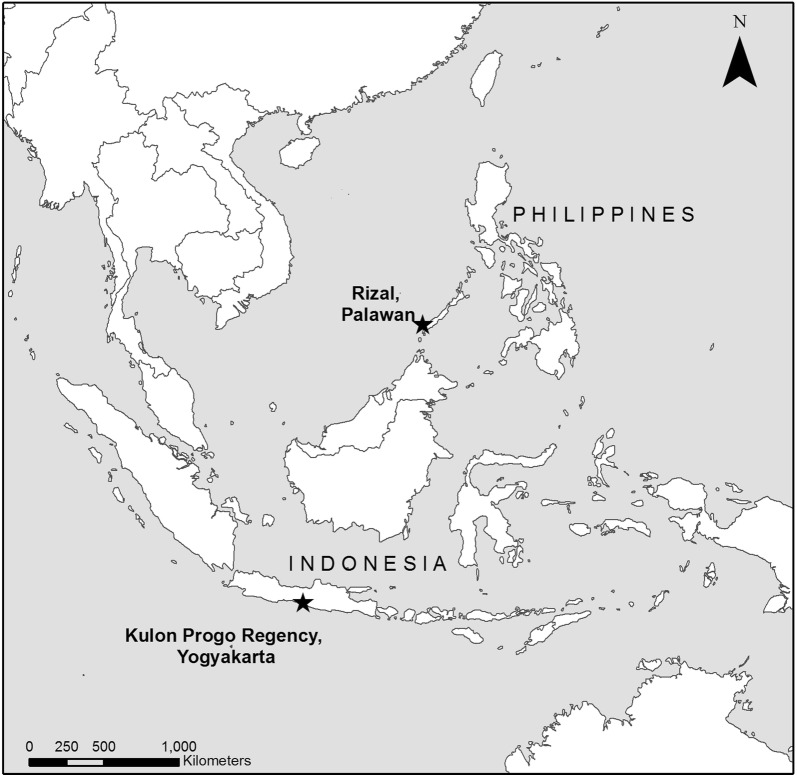
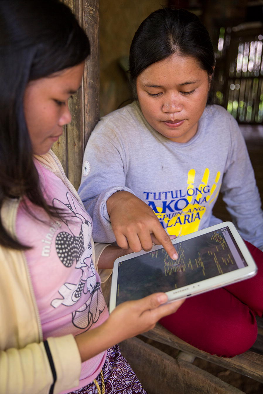
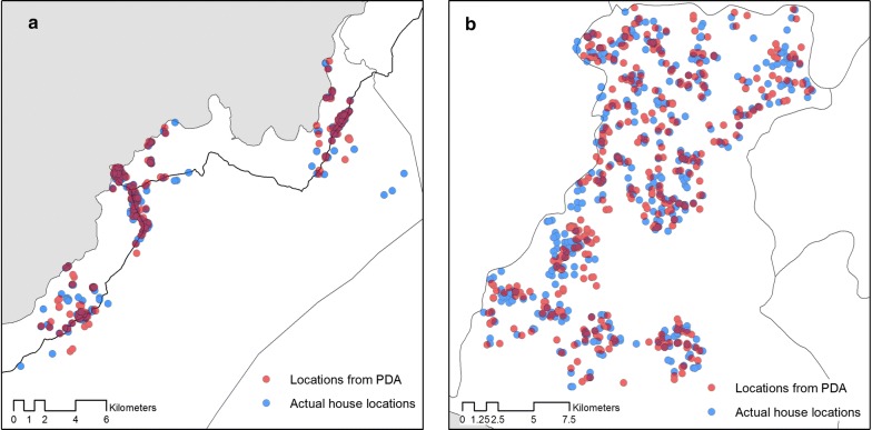
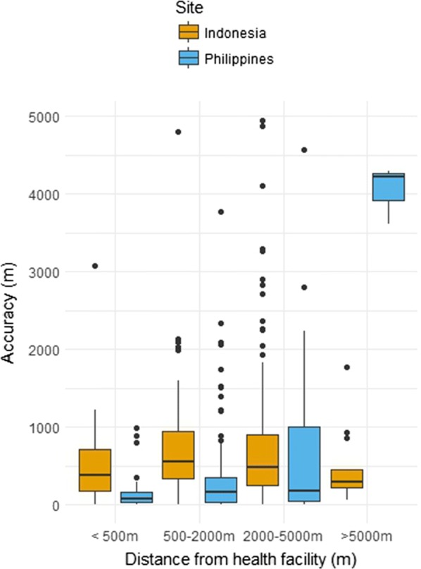
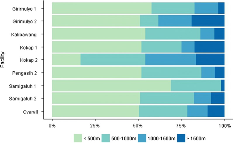
Results: Using Open Data Kit GeoODK, we designed and piloted an electronic questionnaire for rolling cross sectional surveys of health facility attendees as part of a malaria elimination campaign in two predominantly rural sites in the Rizal, Palawan, the Philippines and Kulon Progo Regency, Yogyakarta, Indonesia. The majority of health workers were able to use the tablets effectively, including locating participant households on electronic maps. For all households sampled (n = 603), health facility workers were able to retrospectively find the participant household using the Global Positioning System (GPS) coordinates and data collected by tablet computers. Median distance between actual house locations and points collected on the tablet was 116 m (IQR 42-368) in Rizal and 493 m (IQR 258-886) in Kulon Progo Regency. Accuracy varied between health facilities and decreased in less populated areas with fewer prominent landmarks.
Conclusions: Results demonstrate the utility of this approach to develop real-time high-resolution maps of disease in resource-poor environments. This method provides an attractive approach for quickly obtaining spatial information on individuals presenting at health facilities in resource poor areas where formal addresses are unavailable and internet connectivity is limited. Further research is needed on how to integrate these with other health data management systems and implement in a wider operational context.
Keywords: Electronic data collection; Geographical information systems; Mobile technology; Participatory mapping; Surveillance; mHealth.
Figures
References
Publication types
MeSH terms
Grants and funding
LinkOut - more resources
Full Text Sources
Other Literature Sources
Medical
