

Classifying ecosystems with metaproperties from terrestrial laser scanner data
- PMID: 30167104
- PMCID: PMC6108405
- DOI: 10.1111/2041-210X.12854
Classifying ecosystems with metaproperties from terrestrial laser scanner data
Abstract
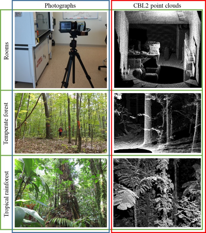
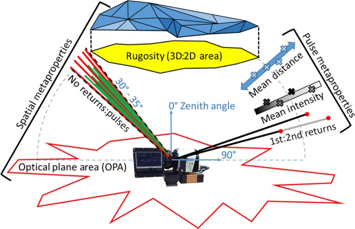
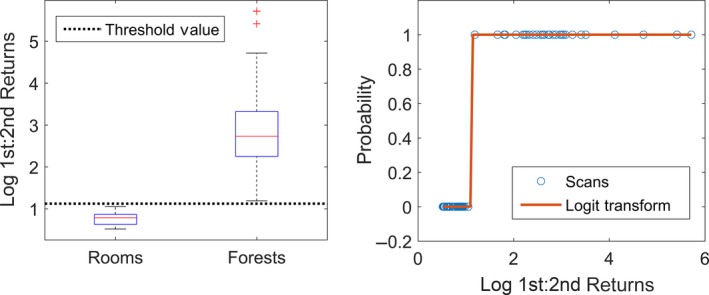
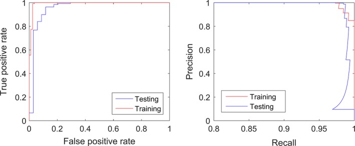
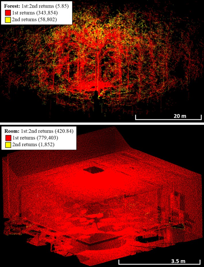
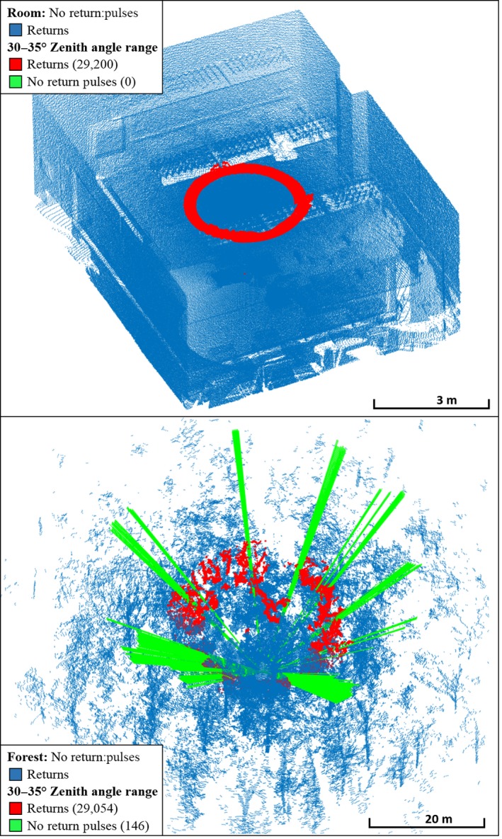
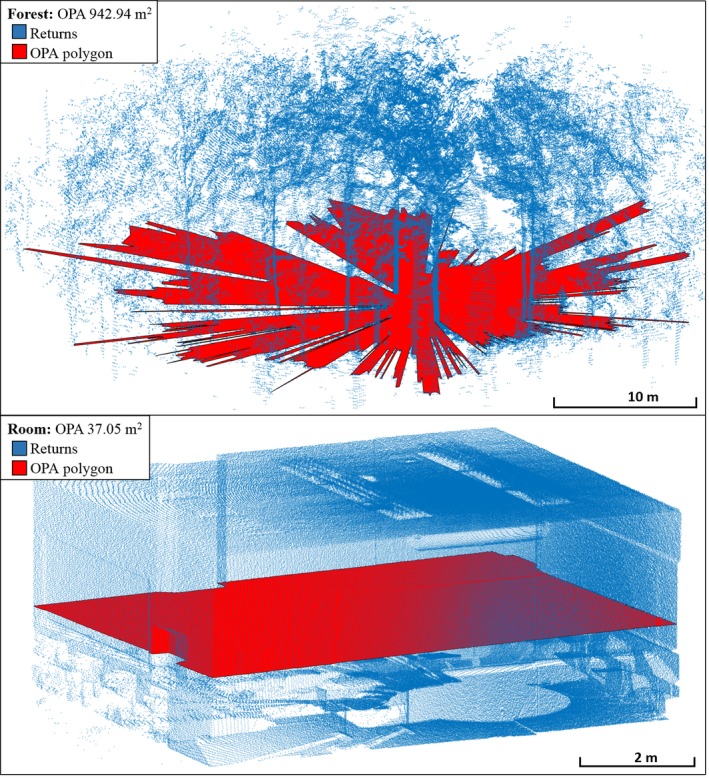
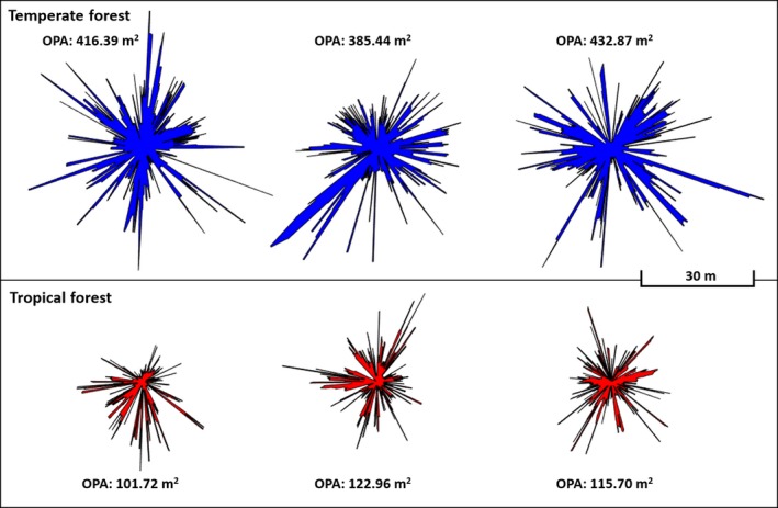
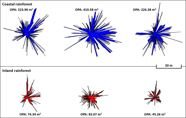
In this study, we introduce metaproperty analysis of terrestrial laser scanner (TLS) data, and demonstrate its application through several ecological classification problems. Metaproperty analysis considers pulse level and spatial metrics derived from the hundreds of thousands to millions of lidar pulses present in a single scan from a typical contemporary instrument. In such large aggregations, properties of the populations of lidar data reflect attributes of the underlying ecological conditions of the ecosystems.In this study, we provide the Metaproperty Classification Model to employ TLS metaproperty analysis for classification problems in ecology. We applied this to a proof-of-concept study, which classified 88 scans from rooms and forests with 100% accuracy, to serve as a template.We then applied the Metaproperty Classification Model in earnest, to separate scans from temperate and tropical forests with 97.09% accuracy (N = 224), and to classify scans from inland and coastal tropical rainforests with 84.07% accuracy (N = 270).The results demonstrate the potential for metaproperty analysis to identify subtle and important ecosystem conditions, including diseases and anthropogenic disturbances. Metaproperty analysis serves as an augmentation to contemporary object reconstruction applications of TLS in ecology, and can characterize regional heterogeneity.
Keywords: bioinformatics; conservation; habitats; software; statistics.
Figures
References
-
- Calders, K. , Newnham, G. , Burt, A. , Murphy, S. , Raumonen, P. , Herold, M. , … Kaasalainen, M. (2015). Nondestructive estimates of above‐ground biomass using terrestrial laser scanning. Methods in Ecology and Evolution, 6, 198–208.
-
- Douglas, E. S. , Strahler, A. H. , Martel, J. , Cook, T. , Mendillo, C. , Marshall, R. , … Lovell, J. . (2012). DWEL: A Dual‐Wavelength Echidna® Lidar for ground‐based forest scanning. In Proceedings IEEE international geoscience and remote sensing symposium 2012, Munich, Germany, July 22–27, 2012, 5.
-
- Gaulton, R. , Danson, F. M. , Pearson, G. , Lewis, P. E. , & Disney, M. (2010). The Salford Advanced Laser Canopy Analyser (SALCA): A multispectral full waveform LiDAR for improved vegetation characterisation. In proceedings of the remote sensing and photogrammetry society conference, remote sensing and the carbon cycle, London, UK (V. 5).
-
- Howe, G. A. , Hewawasam, K. , Douglas, E. S. , Martel, J. , Li, Z. , Strahler, A. , … Chakrabarti, S. (2015). Capabilities and performance of DWEL, the dual‐wavelength ECHIDNA® lidar. Journal of Applied Remote Sensing, 9, 13 10.1117/1.JRS.9.095979 - DOI
-
- Kaasalainen, S. , Krooks, A. , Liski, J. , Raumonen, P. , Kaartinen, H. , Kaasalainen, M. , … Mäkipää, R. (2014). Change detection of tree biomass with terrestrial laser scanning and quantitative structure modelling. Remote Sensing, 6, 3906–3922.
LinkOut - more resources
Full Text Sources
Other Literature Sources