

A System for Generating Customized Pleasant Pedestrian Routes Based on OpenStreetMap Data
- PMID: 30404175
- PMCID: PMC6263876
- DOI: 10.3390/s18113794
A System for Generating Customized Pleasant Pedestrian Routes Based on OpenStreetMap Data
Abstract
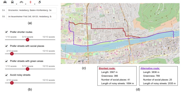
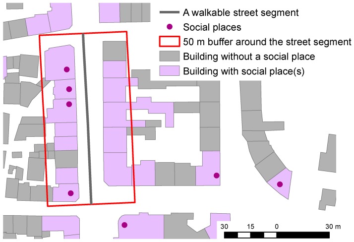
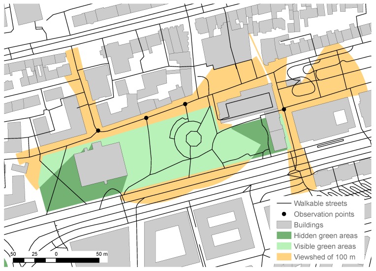
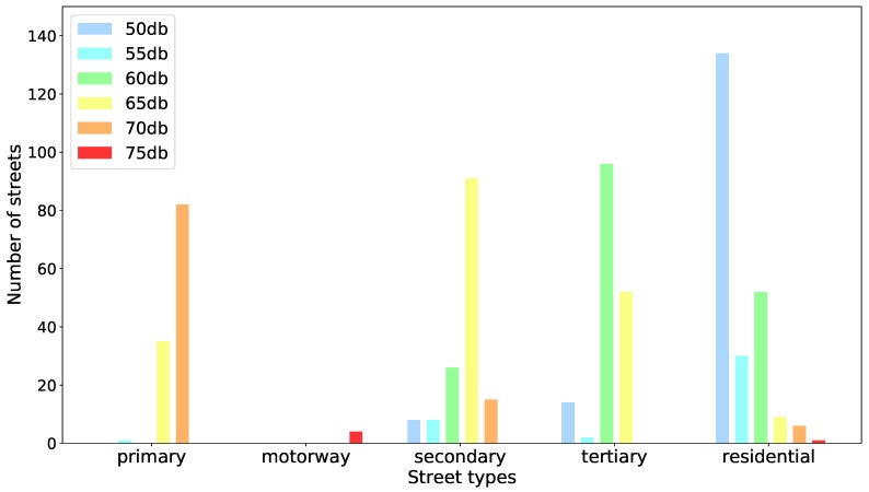
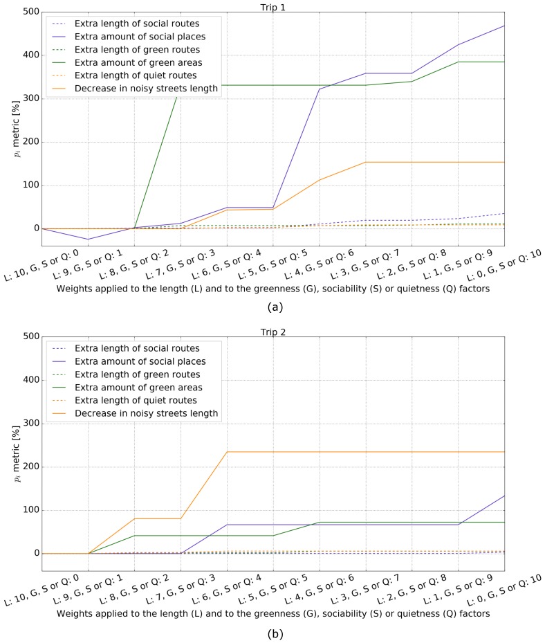
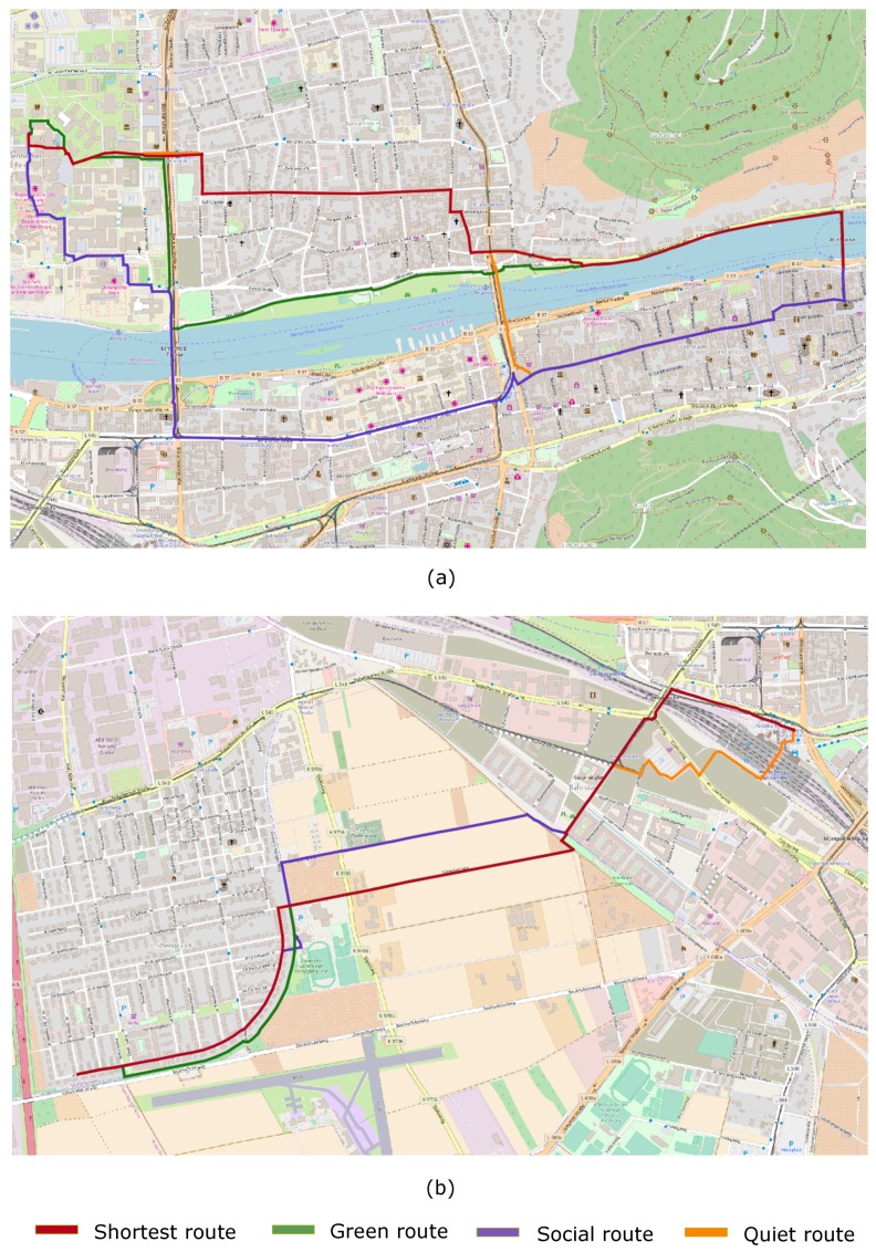
In this work, we present a system that generates customized pedestrian routes entirely based on data from OpenStreetMap (OSM). The system enables users to define to what extent they would like the route to have green areas (e.g., parks, squares, trees), social places (e.g., cafes, restaurants, shops) and quieter streets (i.e., with less road traffic). We present how the greenness, sociability, and quietness factors are defined and extracted from OSM as well as how they are integrated into a routing cost function. We intrinsically evaluate customized routes from one-thousand trips, i.e., origin⁻destination pairs, and observe that these are, in general, as we intended-slightly longer but significantly more social, greener, and quieter than the respective shortest routes. Based on a survey taken by 156 individuals, we also evaluate the system's usefulness, usability, controlability, and transparency. The majority of the survey participants agree that the system is useful and easy to use and that it gives them the feeling of being in control regarding the extraction of routes in accordance with their greenness, sociability, and quietness preferences. The survey also provides valuable insights into users requirements and wishes regarding a tool for interactively generating customized pedestrian routes.
Keywords: human–computer interaction; pedestrian routing; volunteered geographic information.
Conflict of interest statement
The authors declare no conflict of interest.
Figures
References
-
- Alfonzo M. To walk or not to walk? The hierarchy of walking needs. Environ. Behav. 2005;37:808–836. doi: 10.1177/0013916504274016. - DOI
-
- Agrawal A.W., Schlossberg M., Irvin K. How Far, by Which Route and Why? A Spatial Analysis of Pedestrian Preference. J. Urban Des. 2008;13:81–98. doi: 10.1080/13574800701804074. - DOI
-
- Borst H.C., de Vries S.I., Graham J.M., van Dongen J.E., Bakker I., Miedema H.M. Influence of environmental street characteristics on walking route choice of elderly people. J. Environ. Psychol. 2009;29:477–484. doi: 10.1016/j.jenvp.2009.08.002. - DOI
-
- Rodríguez D.A., Merlin L., Prato C.G., Conway T.L., Cohen D., Elder J.P., Evenson K.R., McKenzie T.L., Pickrel J.L., Veblen-Mortenson S. Influence of the Built Environment on Pedestrian Route Choices of Adolescent Girls. Environ. Behav. 2015;47:359–394. doi: 10.1177/0013916513520004. - DOI - PMC - PubMed
-
- Hahm Y., Yoon H., Jung D., Kwon H. Do built environments affect pedestrians’ choices of walking routes in retail districts? A study with GPS experiments in Hongdae retail district in Seoul, South Korea. Habitat Int. 2017;70:50–60. doi: 10.1016/j.habitatint.2017.10.002. - DOI
MeSH terms
Grants and funding
LinkOut - more resources
Full Text Sources
