

Building a Data Platform for Cross-Country Urban Health Studies: the SALURBAL Study
- PMID: 30465261
- PMCID: PMC6458229
- DOI: 10.1007/s11524-018-00326-0
Building a Data Platform for Cross-Country Urban Health Studies: the SALURBAL Study
Abstract
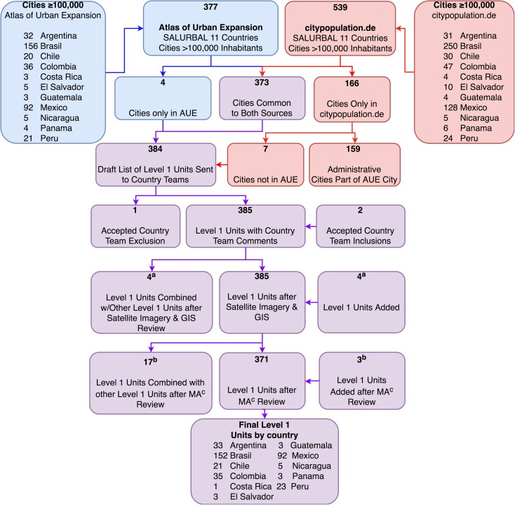
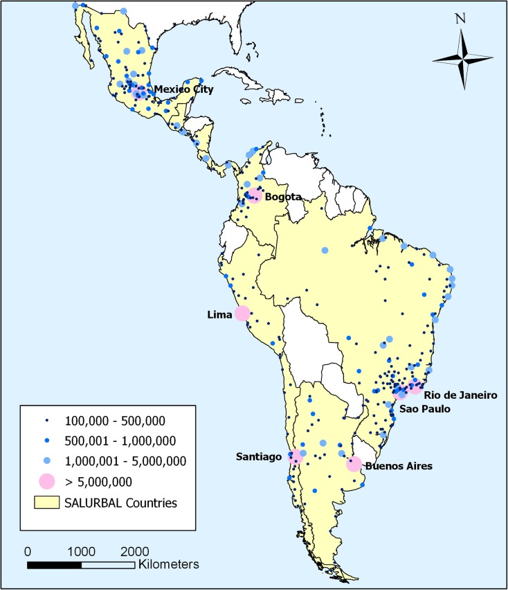
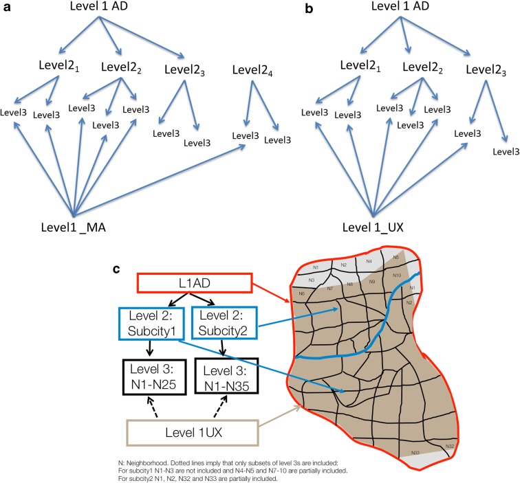
Studies examining urban health and the environment must ensure comparability of measures across cities and countries. We describe a data platform and process that integrates health outcomes together with physical and social environment data to examine multilevel aspects of health across cities in 11 Latin American countries. We used two complementary sources to identify cities with ≥ 100,000 inhabitants as of 2010 in Argentina, Brazil, Chile, Colombia, Costa Rica, El Salvador, Guatemala, Mexico, Nicaragua, Panama, and Peru. We defined cities in three ways: administratively, quantitatively from satellite imagery, and based on country-defined metropolitan areas. In addition to "cities," we identified sub-city units and smaller neighborhoods within them using census hierarchies. Selected physical environment (e.g., urban form, air pollution and transport) and social environment (e.g., income, education, safety) data were compiled for cities, sub-city units, and neighborhoods whenever possible using a range of sources. Harmonized mortality and health survey data were linked to city and sub-city units. Finer georeferencing is underway. We identified 371 cities and 1436 sub-city units in the 11 countries. The median city population was 234,553 inhabitants (IQR 141,942; 500,398). The systematic organization of cities, the initial task of this platform, was accomplished and further ongoing developments include the harmonization of mortality and survey measures using available sources for between country comparisons. A range of physical and social environment indicators can be created using available data. The flexible multilevel data structure accommodates heterogeneity in the data available and allows for varied multilevel research questions related to the associations of physical and social environment variables with variability in health outcomes within and across cities. The creation of such data platforms holds great promise to support researching with greater granularity the field of urban health in Latin America as well as serving as a resource for the evaluation of policies oriented to improve the health and environmental sustainability of cities.
Keywords: Built environment; Cities; Health Survey; Latin America; Mortality; Multilevel Models; Social Environment; Urban health.
Figures
References
-
- Population Division of the Department of Economic and Social Affairs. 2017 Revision of World Population Prospects: United Nations. New York, NY; 2017.
-
- United Nations Human Settlements Programme (UN-Habitat). Urbanization and Development: Emerging Futures - World Cities Report 2016: United Nations. Nairobi, Kenya; 2016. HS/038/16E.
Publication types
MeSH terms
Grants and funding
LinkOut - more resources
Full Text Sources
