

Estimating the global distribution of field size using crowdsourcing
- PMID: 30549201
- PMCID: PMC7379266
- DOI: 10.1111/gcb.14492
Estimating the global distribution of field size using crowdsourcing
Abstract
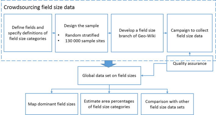
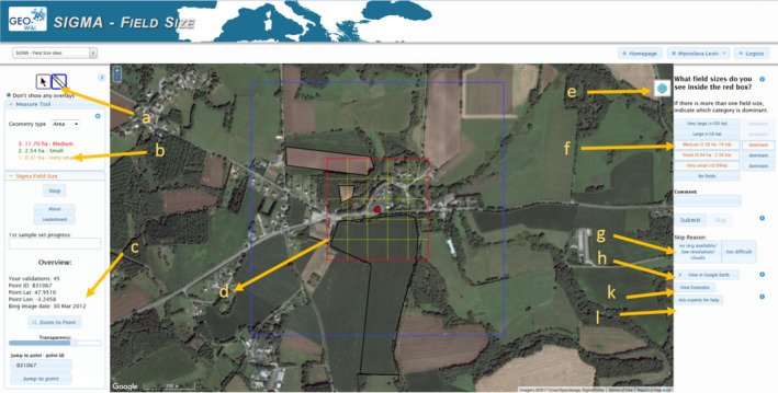
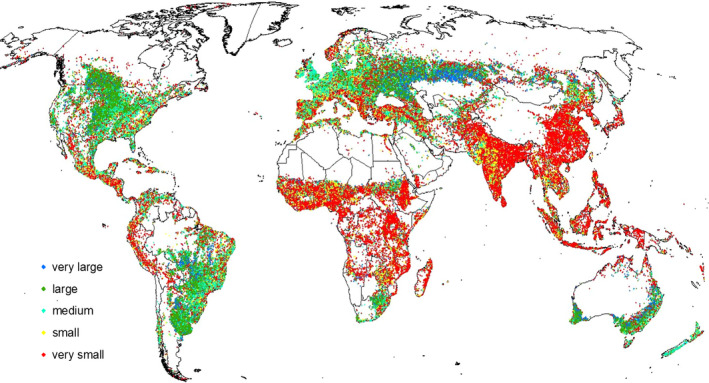
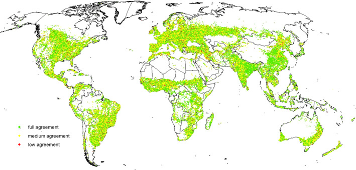
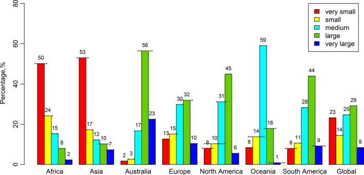
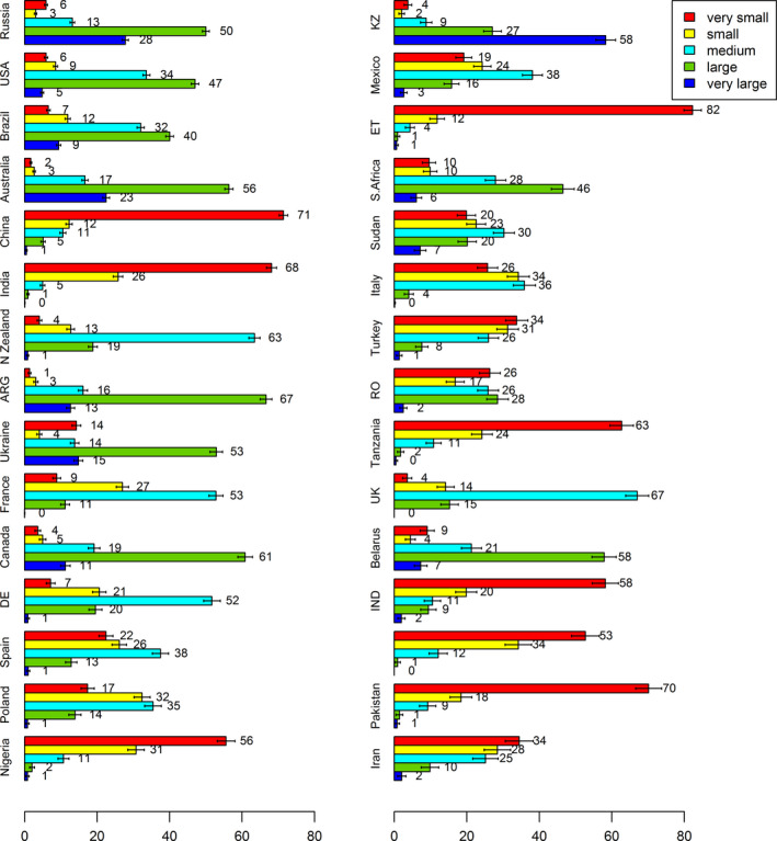
There is an increasing evidence that smallholder farms contribute substantially to food production globally, yet spatially explicit data on agricultural field sizes are currently lacking. Automated field size delineation using remote sensing or the estimation of average farm size at subnational level using census data are two approaches that have been used. However, both have limitations, for example, automatic field size delineation using remote sensing has not yet been implemented at a global scale while the spatial resolution is very coarse when using census data. This paper demonstrates a unique approach to quantifying and mapping agricultural field size globally using crowdsourcing. A campaign was run in June 2017, where participants were asked to visually interpret very high resolution satellite imagery from Google Maps and Bing using the Geo-Wiki application. During the campaign, participants collected field size data for 130 K unique locations around the globe. Using this sample, we have produced the most accurate global field size map to date and estimated the percentage of different field sizes, ranging from very small to very large, in agricultural areas at global, continental, and national levels. The results show that smallholder farms occupy up to 40% of agricultural areas globally, which means that, potentially, there are many more smallholder farms in comparison with the two different current global estimates of 12% and 24%. The global field size map and the crowdsourced data set are openly available and can be used for integrated assessment modeling, comparative studies of agricultural dynamics across different contexts, for training and validation of remote sensing field size delineation, and potential contributions to the Sustainable Development Goal of Ending hunger, achieve food security and improved nutrition and promote sustainable agriculture.
Keywords: crowdsourcing; environmental changes; field size; food security; visual interpretation.
© 2018 The Authors. Global Change Biology Published by John Wiley & Sons Ltd.
Figures
References
-
- Chen, J. , Ban, Y. , & Li, S. (2014). China: Open access to Earth land‐cover map. Nature, 514(7523), 434–434. - PubMed
-
- FAO, World Bank, & United Nations Statistical Commission (2012). Action plan of the global strategy to improve agricultural and rural statistics. Rome, Italy: FAO UN.
-
- Fonte, C. C. , Antoniou, V. , Bastin, L. , Estima, J. , Arsanjani, J. J. , Laso‐Bayas, J.‐C. , … Vatseva, R. (2017). Assessing VGI data quality In Foody G. M., See L., Fritz S., Fonte C. C., Mooney P., Olteanu‐Raimond A.‐M., & Antoniou V. (Eds.), Mapping and the citizen sensor (pp. 137–164). London, UK: Ubiquity Press.
Publication types
MeSH terms
LinkOut - more resources
Full Text Sources
