

Development of a Recognition System for Spraying Areas from Unmanned Aerial Vehicles Using a Machine Learning Approach
- PMID: 30646586
- PMCID: PMC6359728
- DOI: 10.3390/s19020313
Development of a Recognition System for Spraying Areas from Unmanned Aerial Vehicles Using a Machine Learning Approach
Abstract
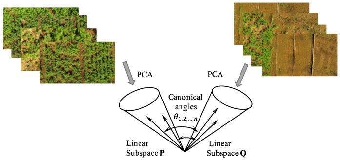
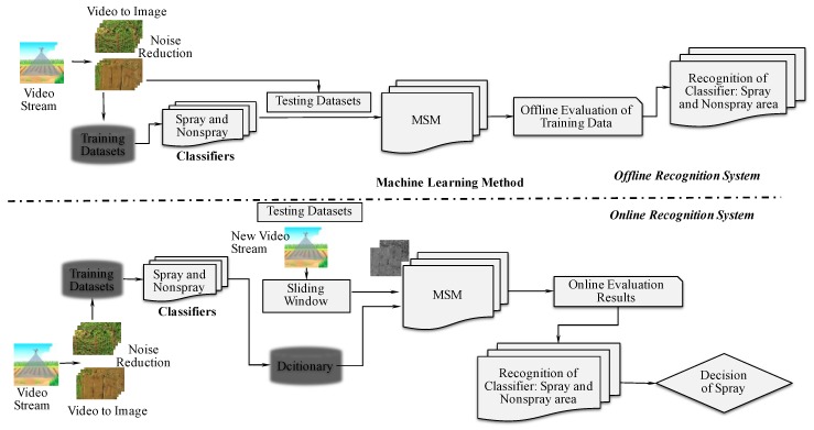
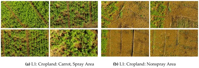
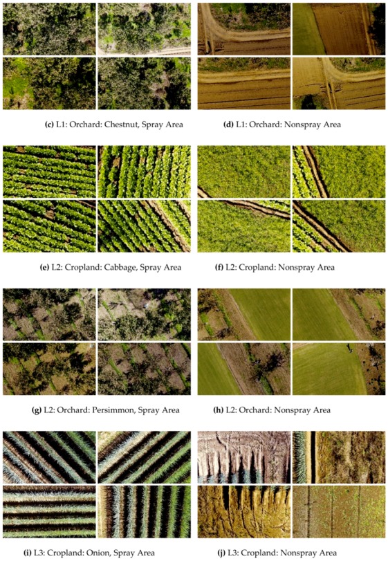
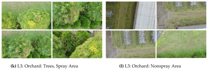
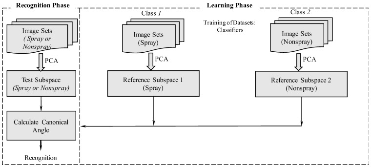
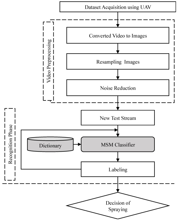
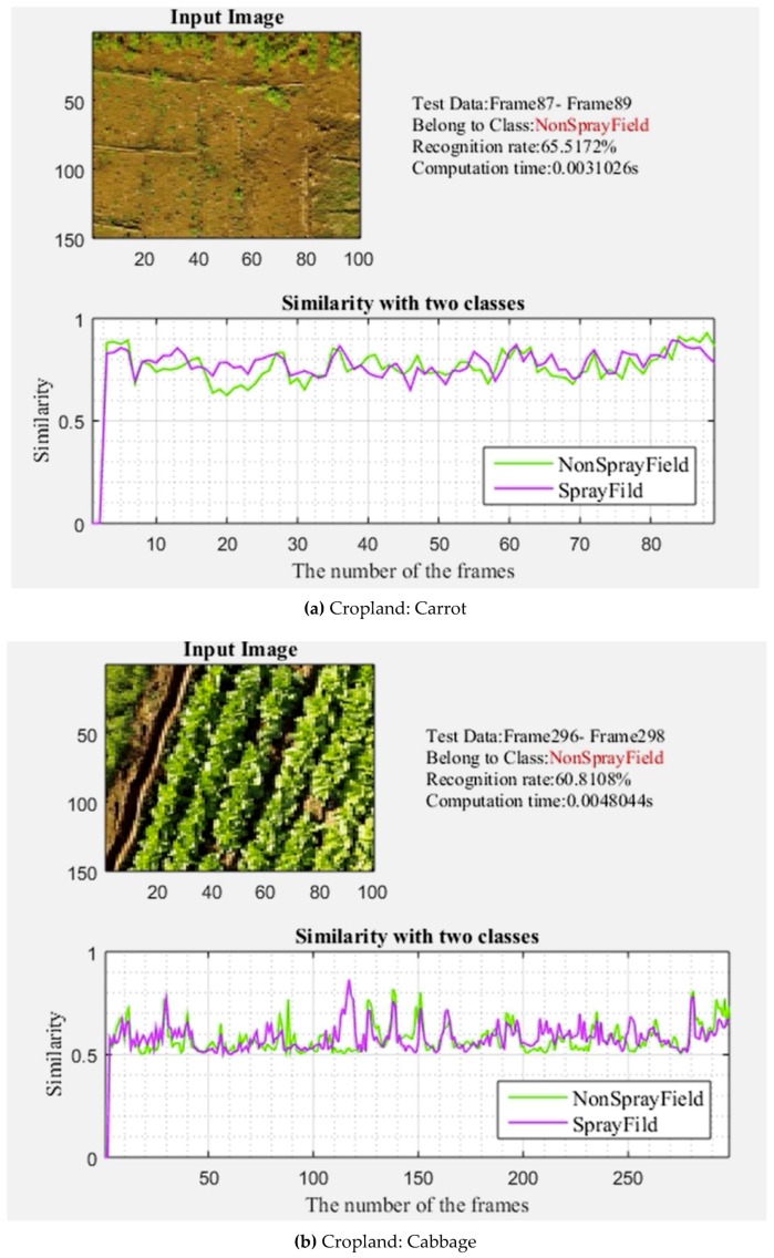
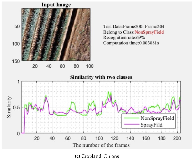
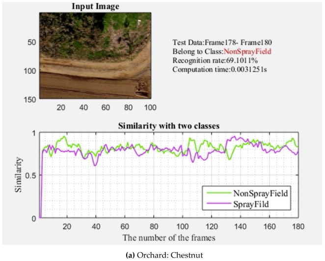
Unmanned aerial vehicle (UAV)-based spraying systems have recently become important for the precision application of pesticides, using machine learning approaches. Therefore, the objective of this research was to develop a machine learning system that has the advantages of high computational speed and good accuracy for recognizing spray and non-spray areas for UAV-based sprayers. A machine learning system was developed by using the mutual subspace method (MSM) for images collected from a UAV. Two target lands: agricultural croplands and orchard areas, were considered in building two classifiers for distinguishing spray and non-spray areas. The field experiments were conducted in target areas to train and test the system by using a commercial UAV (DJI Phantom 3 Pro) with an onboard 4K camera. The images were collected from low (5 m) and high (15 m) altitudes for croplands and orchards, respectively. The recognition system was divided into offline and online systems. In the offline recognition system, 74.4% accuracy was obtained for the classifiers in recognizing spray and non-spray areas for croplands. In the case of orchards, the average classifier recognition accuracy of spray and non-spray areas was 77%. On the other hand, the online recognition system performance had an average accuracy of 65.1% for croplands, and 75.1% for orchards. The computational time for the online recognition system was minimal, with an average of 0.0031 s for classifier recognition. The developed machine learning system had an average recognition accuracy of 70%, which can be implemented in an autonomous UAV spray system for recognizing spray and non-spray areas for real-time applications.
Keywords: image classifiers; machine learning system; mutual subspace method; precision agriculture; recognition system.
Conflict of interest statement
The authors declare no conflict of interest.
Figures
References
-
- Zhang Y., Chen D., Wang S., Tian L. A promising trend for field information collection: An air-ground multi-sensor monitoring system. Inf. Process. Agric. 2018;5:224–233. doi: 10.1016/j.inpa.2018.02.002. - DOI
-
- Peña Barragán J.M., Kelly M., Castro A.I.D., López Granados F. Object-based approach for crop row characterization in UAV images for site-specific weed management; Proceedings of the 4th Geographic Object-Based Image Analysis (GEOBIA); Rio de Janeiro, Brazil. 7–12 May 2012; p. 426.
-
- Salvatore M., Matthew F.M., Pauline E.M., Richard L., Victor P.M., Giorgos M., Eyal B.D., David H., Lyndon E., Giuseppe C., et al. On the use of unmanned aerial systems for environmental monitoring. Remote Sens. 2018;10:641.
-
- Bandini F., Jakobsen J., Olesen D., Reyna-Gutierrez J.A., Bauer-Gottwein P. Measuring water level in rivers and lakes from lightweight unmanned aerial vehicles. J. Hydrol. 2017;548:237–250. doi: 10.1016/j.jhydrol.2017.02.038. - DOI
-
- Zarco-Tejada P.J., González-Dugo V., Berni J.A. Fluorescence, temperature and narrow-band indices acquired from a UAV platform for water stress detection using a micro-hyperspectral imager and a thermal camera. Remote Sens. Environ. 2012;117:322–337. doi: 10.1016/j.rse.2011.10.007. - DOI
LinkOut - more resources
Full Text Sources
