

An Appearance-Based Tracking Algorithm for Aerial Search and Rescue Purposes
- PMID: 30764528
- PMCID: PMC6387277
- DOI: 10.3390/s19030652
An Appearance-Based Tracking Algorithm for Aerial Search and Rescue Purposes
Abstract
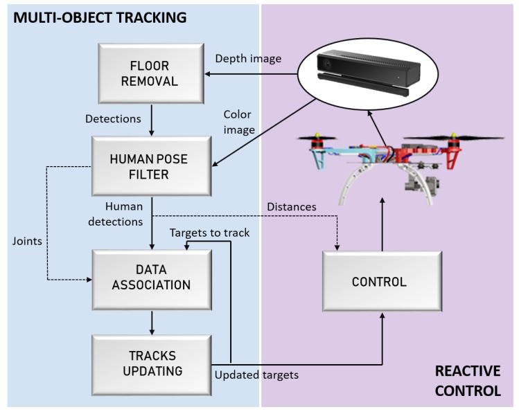
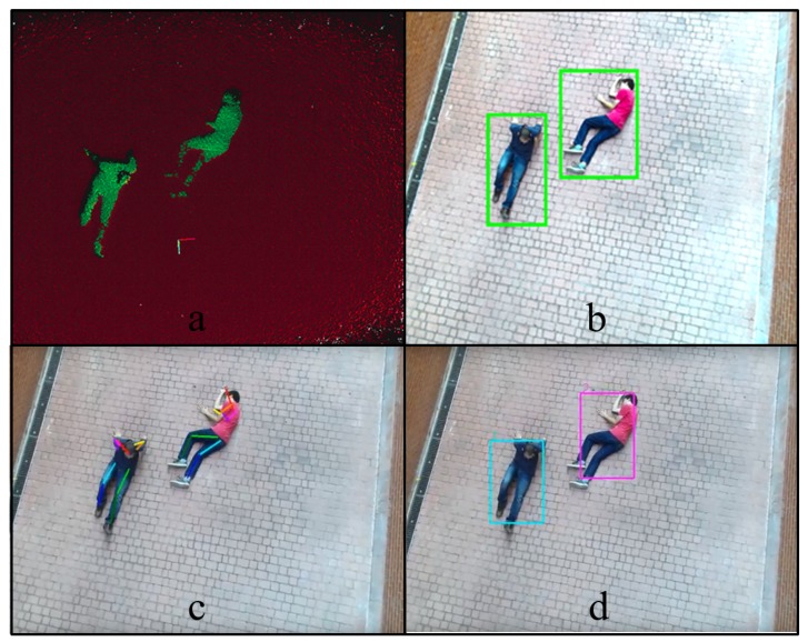
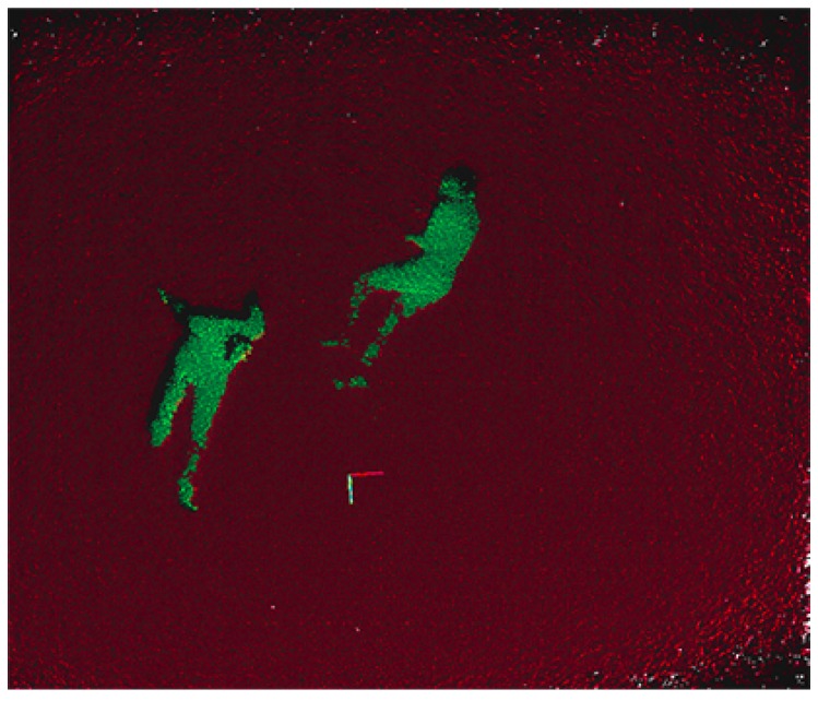
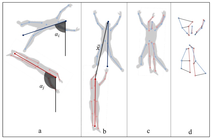
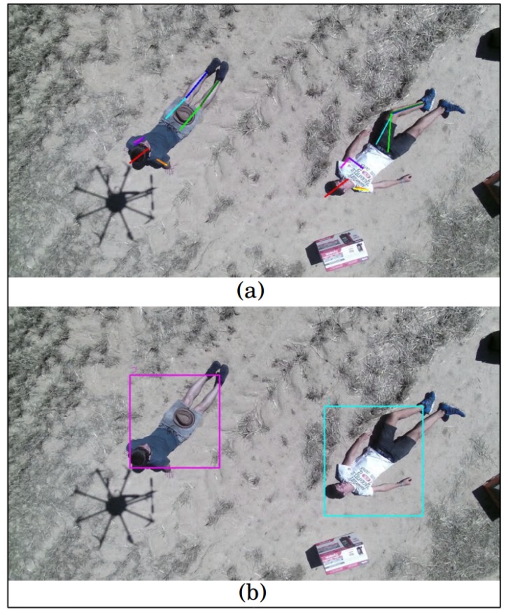
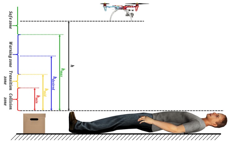
The automation of the Wilderness Search and Rescue (WiSAR) task aims for high levels of understanding of various scenery. In addition, working in unfriendly and complex environments may cause a time delay in the operation and consequently put human lives at stake. In order to address this problem, Unmanned Aerial Vehicles (UAVs), which provide potential support to the conventional methods, are used. These vehicles are provided with reliable human detection and tracking algorithms; in order to be able to find and track the bodies of the victims in complex environments, and a robust control system to maintain safe distances from the detected bodies. In this paper, a human detection based on the color and depth data captured from onboard sensors is proposed. Moreover, the proposal of computing data association from the skeleton pose and a visual appearance measurement allows the tracking of multiple people with invariance to the scale, translation and rotation of the point of view with respect to the target objects. The system has been validated with real and simulation experiments, and the obtained results show the ability to track multiple individuals even after long-term disappearances. Furthermore, the simulations present the robustness of the implemented reactive control system as a promising tool for assisting the pilot to perform approaching maneuvers in a safe and smooth manner.
Keywords: UAV; multi-object tracking; reactive control; rescue.
Conflict of interest statement
The authors declare no conflict of interest.
Figures
References
-
- Ahmad A., Tahar K.N., Udin W.S., Hashim K.A., Darwin N., Hafis M., Room M., Hamid N.F.A., Azhar N.A.M., Azmi S.M. Digital aerial imagery of unmanned aerial vehicle for various applications; Proceedings of the 2013 IEEE International Conference on Control System, Computing and Engineering (ICCSCE); Mindeb, Malaysia. 29 November–1 December 2013; pp. 535–540.
-
- Ma L., Li M., Tong L., Wang Y., Cheng L. Using unmanned aerial vehicle for remote sensing application; Proceedings of the 2013 21st International Conference on Geoinformatics (GEOINFORMATICS); Kaifeng, China. 20–22 June 2013; pp. 1–5.
-
- Tampubolon W., Reinhardt W. UAV Data Processing for Large Scale Topographical Mapping. ISPRS Int. Arch. Photogramm. Remote Sens. Spat. Inf. Sci. 2014;XL-5:565–572.
-
- Li Y.-C., Ye D.-M., Ding X.-B., Teng C.-S., Wang G.-H., Li T.-H. UAV Aerial Photography Technology in Island Topographic Mapping; Proceedings of the 2011 International Symposium on Image and Data Fusion (ISIDF); Tengchong, China. 9–11 August 2011; pp. 1–4.
-
- Rathinam S., Almeida P., Kim Z., Jackson S., Tinka A., Grossman W., Sengupta R. Autonomous searching and tracking of a river using an UAV; Proceedings of the American Control Conference; New York, NY, USA. 11–13 July 2007; pp. 359–364.
LinkOut - more resources
Full Text Sources
