

Tale of Two Storms: Impact of Extreme Rain Events on the Biogeochemistry of Lake Superior
- PMID: 30800557
- PMCID: PMC6381994
- DOI: 10.1029/2017JG004216
Tale of Two Storms: Impact of Extreme Rain Events on the Biogeochemistry of Lake Superior
Abstract
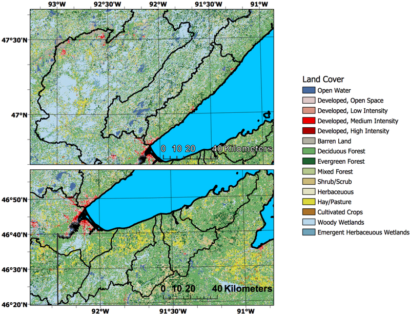
Climate change is expected to profoundly affect the Great Lakes region of North America. An increase in intensity and frequency of rain events is anticipated to deliver more runoff and to increase riverine inputs to Lake Superior's ecosystem. The effects of these changes on key biogeochemical parameters were analyzed by coupling satellite data, water column sensor profiles, and discrete surface-water sampling after two "500-year" flood events in the Lake Superior basin. This study provides both a spatial and a temporal sense of how plumes interacted within the ecosystem. We also determined the significant differences in water quality parameters for plume versus non-plume waters. These two plumes were important for delivery of nutrients, with variable transport of sediments and colored dissolved organic matter (CDOM). Data from the 2012 storm event showed a significant input of total nitrogen (TN), total phosphorous (TP) and CDOM to the system. In the 2016 storm event, carbon cycling parameters (acidity, total inorganic carbon (TIC), and dissolved organic carbon (DOC), and ammonia levels were elevated within the plume. In neither storm event was there a significant difference in chlorophyll a between plume and non-plume waters during our sampling cruises. These two plume events were similar in amount of precipitation, but their effect on the biogeochemistry of Lake Superior varied due to differences in the watersheds where the rain fell. The studied plume events were dynamic, changing with currents, winds and the settling of suspended sediments.
Figures


Similar articles
-
Humic substances-part 7: the biogeochemistry of dissolved organic carbon and its interactions with climate change.Environ Sci Pollut Res Int. 2009 Sep;16(6):714-26. doi: 10.1007/s11356-009-0176-7. Epub 2009 May 22. Environ Sci Pollut Res Int. 2009. PMID: 19462191 Review.
-
Variable responses of dissolved organic carbon to precipitation events in boreal drinking water lakes.Water Res. 2019 Jun 1;156:315-326. doi: 10.1016/j.watres.2019.03.036. Epub 2019 Mar 21. Water Res. 2019. PMID: 30927627
-
Mapping the pollutants in surface riverine flood plume waters in the Great Barrier Reef, Australia.Mar Pollut Bull. 2012;65(4-9):224-35. doi: 10.1016/j.marpolbul.2012.03.001. Epub 2012 Apr 1. Mar Pollut Bull. 2012. PMID: 22469152
-
Hurricane pulses: Small watershed exports of dissolved nutrients and organic matter during large storms in the Southeastern USA.Sci Total Environ. 2019 Nov 1;689:232-244. doi: 10.1016/j.scitotenv.2019.06.351. Epub 2019 Jun 24. Sci Total Environ. 2019. PMID: 31271989
-
Storm impacts on phytoplankton community dynamics in lakes.Glob Chang Biol. 2020 May;26(5):2756-2784. doi: 10.1111/gcb.15033. Epub 2020 Mar 5. Glob Chang Biol. 2020. PMID: 32133744 Free PMC article.
Cited by
-
The wind-driven formation of cross-shelf sediment plumes in a large lake.Limnol Oceanogr. 2019 May 1;64(3):1309-1322. doi: 10.1002/lno.11117. Limnol Oceanogr. 2019. PMID: 34012173 Free PMC article.
-
Impacts of a record-breaking storm on physical and biogeochemical regimes along a catchment-to-coast continuum.PLoS One. 2020 Jul 28;15(7):e0235963. doi: 10.1371/journal.pone.0235963. eCollection 2020. PLoS One. 2020. PMID: 32722700 Free PMC article.
-
Cell size explains shift in phytoplankton community structure following storm-induced changes in light and nutrients.Ecology. 2025 Mar;106(3):e70043. doi: 10.1002/ecy.70043. Ecology. 2025. PMID: 40065660 Free PMC article.
References
-
- APHA AWWA, WEF (1992), Standard Methods for the Examination of Water and Wastewater, 18th ed. American Public Health Association, Washington, D. C.
-
- Axler RC, and Owen CJ (1994) Measuring chlorophyll and phaeophytin: whom should you believe?, Lake Reservoir Manage, 8, 143–151.
-
- Baehr MM, and McManus J (2003), The measurement of phosphorus and its spatial and temporal variability in the western arm of Lake Superior, Journal of Great Lakes Research, 29(3), 479–487.
-
- Bahnick DA (1997), The contribution of red clay erosion to the orthophosphate loading into southwestern Lake Superior, J. Environ. Qual, 6, 217–222.
Grants and funding
LinkOut - more resources
Full Text Sources