

Determining spatial access to opioid use disorder treatment and emergency medical services in New Hampshire
- PMID: 31174714
- PMCID: PMC6557292
- DOI: 10.1016/j.jsat.2019.03.013
Determining spatial access to opioid use disorder treatment and emergency medical services in New Hampshire
Abstract
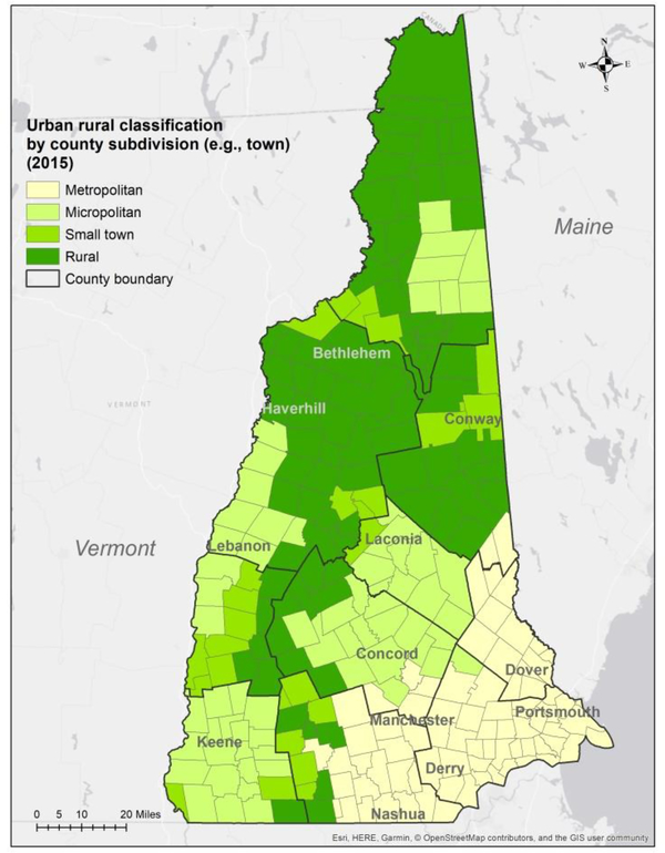
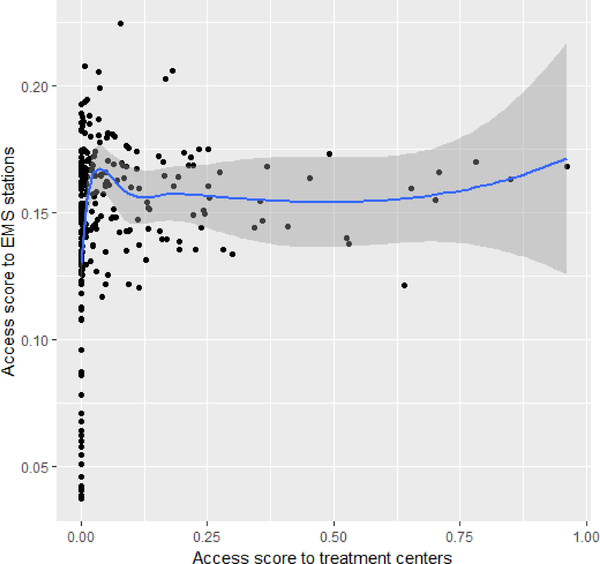
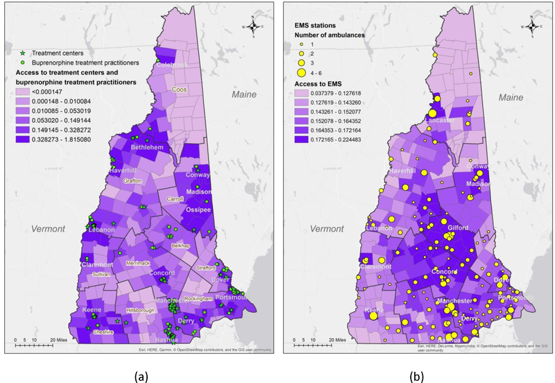
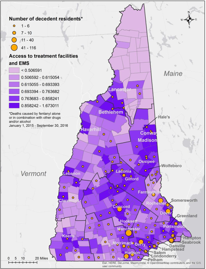
This research presents an analysis of spatial access to both opioid use disorder treatment facilities and emergency medical services in New Hampshire during 2015-2016, a period during which there was a steep increase in unintentional overdoses involving fentanyl. For this research, spatial access was computed using the enhanced two-step floating catchment area model combined with the Huff model to assess access across New Hampshire and gives attention to supply-side parameters that can impact spatial access. The model is designed to measure access to healthcare services for opioid use disorder patients offered at treatment centers or from buprenorphine treatment practitioners, as well as from emergency medical services across New Hampshire. A composite index of accessibility is proposed to represent overall access to these different treatment services for opioid use disorder patients. Geospatial determinants of spatial access included street network distances, driving times and distance decay relationships, while other key factors were services availability and population demand. Among the towns with the highest composite access scores, approximately 40% were metropolitan locations while 16% were rural towns. The insights from this research showed that for this period, while the opioid crisis was impacting many towns in New Hampshire, high levels of access to treatment services were not uniform across the state. When comparing the access results with data on the towns of residence for individuals who died from unintentional overdoses involving fentanyl during 2015 and 2016, estimates found that approximately 40% of the towns were not estimated to be in the highest class of access to treatment services at the time. This research provides information for local public health officials to support planning strategies to address opioid use disorder treatment access in high-risk regions.
Keywords: Emergency medical services; Floating catchment area; Opioid use disorder treatment services; Spatial accessibility; Substance use disorder.
Copyright © 2019 Elsevier Inc. All rights reserved.
Figures
References
-
- Abuzied S, Yuan M, Ibrahim S, Kaiser M, & Saleem T (2016). Geospatial risk assessment of flash floods in Nuweiba area, Egypt. Journal of Arid Environments, 133, 54–72. 10.1016/j.jaridenv.2016.06.004 - DOI
-
- Baldwin N, Gray R, Goel A, Wood E, Buxton JA, & Rieb LM (2018). Fentanyl and heroin contained in seized illicit drugs and overdose-related deaths in British Columbia, Canada: An observational analysis. Drug and Alcohol Dependence, 185(December 2017), 322–327. 10.1016/j.drugalcdep.2017.12.032 - DOI - PMC - PubMed
-
- Cao Y, Stewart K, & Kalil R (2016). Geographic patterns of end-stage renal disease and kidney transplants in the Midwestern United States. Applied Geography, 71, 133–143. 10.1016/j.apgeog.2016.05.001 - DOI
Publication types
MeSH terms
Grants and funding
LinkOut - more resources
Full Text Sources
Medical
